Table of Contents
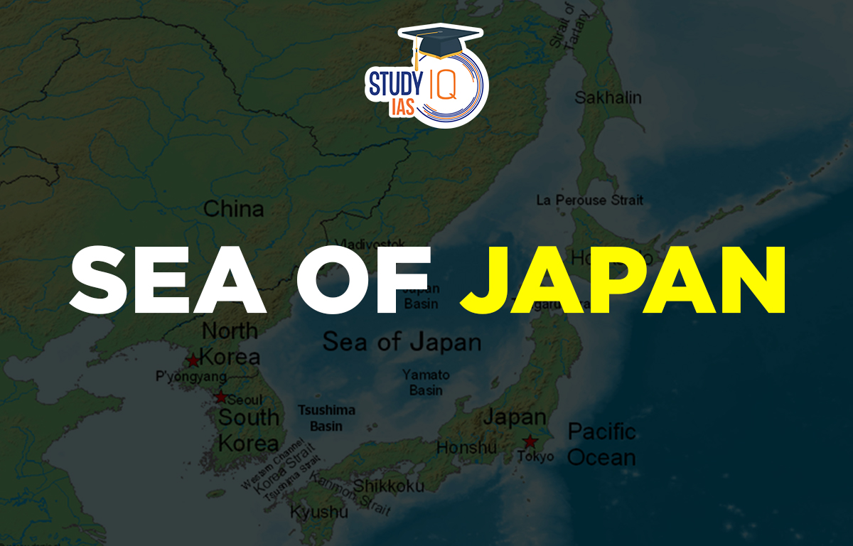
Context: China and Russia began a three-day joint naval drill, “Joint Sea-2025,” on the Sea of Japan.
Sea of Japan (also called East Sea)
The Sea of Japan, also known by various names, is a marginal sea that lies between the Korean Peninsula, Sakhalin, the Japanese archipelago, and the Russian Far Eastern mainland. The Pacific Ocean and the sea are divided by the Japanese archipelago. Due to its almost full isolation from the Pacific Ocean, it has essentially no tides, similar to the Mediterranean Sea.
The Sea of Japan has less variety of animals and lower salt levels than the open ocean, mainly because it is isolated. There are no large islands, bays, or capes in the sea. The amount of water coming in and going out through the straits that connect it to the Pacific Ocean and nearby seas mostly determines its water balance. Only a few rivers flow into the sea, contributing just 1% of the total water exchange.
The sea has a high level of dissolved oxygen, which supports a lot of marine life, making fishing the main economic activity in the area. Shipping traffic has been low due to political issues, but it is gradually increasing as East Asian economies grow.
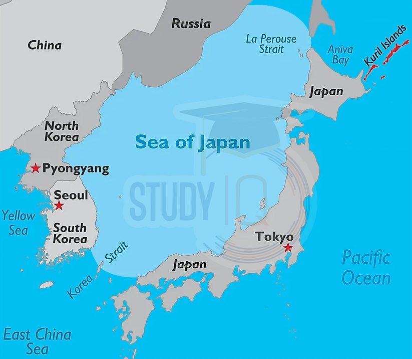
Sea of Japan Map
- A marginal sea of the western Pacific Ocean.
- Borders:
- East: Japan and Sakhalin (Russia)
- West: Mainland Russia, North Korea, South Korea
- Major Straits:
- South: East China Sea via Tsushima and Korea Straits
- North: Sea of Okhotsk via La Perouse and Tatar Straits
- East:
- Inland Sea of Japan via Kanmon Strait
- Pacific Ocean via Tsugaru Strait
Here is the Map of the Sea of Japan to understand the geographical location of the Sea of Japan region:
There are no large islands in the Sea of Japan. The only significant island is the South Korean island of Ulleungdo; all other small islands are found along the eastern coast of the sea. Major economic activities in the Sea of Japan include mining for minerals like magnetite, natural gas, and petroleum.
Important ports in the Sea of Japan include:
- Russia: Vladivostok, Sovetskaya Gavan, Nakhodka, Alexandrovsk-Sakhalinsky, and Kholmsk.
- North Korea: Hamhung, Chongjin, and Wonsan.
- Japan: Niigata, Tsuruta, and Maizuru.
Formation of Sea of Japan
- The Sea of Japan was formed during the Cenozoic era, about 20-30 million years ago, due to tectonic plate movements.
- It is bordered by Japan to the east, the Korean Peninsula to the west, and the Russian Far East to the north.
- Oki was once at the bottom of a large lake that formed between Japan and Eurasia.
- As the lake continued to separate, seawater started to enter it.
- This process led to the creation of the Sea of Japan, with Oki still at the bottom of the sea at that time.
Sea of Japan Geography
When the East Asian land bridge existed, the Sea of Japan was a landlocked area. The Japan Arc began to form during the Early Miocene. As the Sea of Japan started to open in this period, the northern and southern parts of the Japanese islands began to separate. The sea expanded throughout the Miocene.
The eastern edge of the sea may have a developing subduction zone, which is linked to major earthquakes in 1940, 1964, 1983, and 1993. Today, the Sea of Japan is bordered by the Korean Peninsula to the west, and the Japanese islands of Hokkaido, Honshu, and Kyushu to the east.
To the north, it is next to the Russian mainland and the island of Sakhalin. The sea connects to other bodies of water through five straits: the Korea Strait between the Korean Peninsula and Kyushu, the Tsugaru Strait between Hokkaido and Honshu, the La Pérouse Strait between Sakhalin and the Asian mainland, and the Strait of Tartary between the Asian mainland and Sakhalin.
Significance of Sea of Japan
- The Sea of Japan is part of the Western Pacific Ocean.
- It is located between Japan, Russia, and the Korean Peninsula.
- The sea covers about 378000 square kilometres.
- Its deepest point is about 3742 meters.
- The sea is known for its rich fishing resources.
- It serves as a key shipping route between Asia and the Pacific.
- The Sea of Japan has influenced the culture and history of nearby countries.
- It is home to many types of marine life, making it important for conservation.
- The sea is also valuable for scientific research, helping us understand ocean currents, climate, and tectonic movements.
| Related Articles | |
| Bay of Bengal | South China Sea |
| East China Sea | Atlantic Ocean |
 Astronomy in the Atacama Desert: Telesco...
 Why Below-Average Rains Don’t Rule Out...
 Mahanadi River: Location, Major Tributar...