Table of Contents
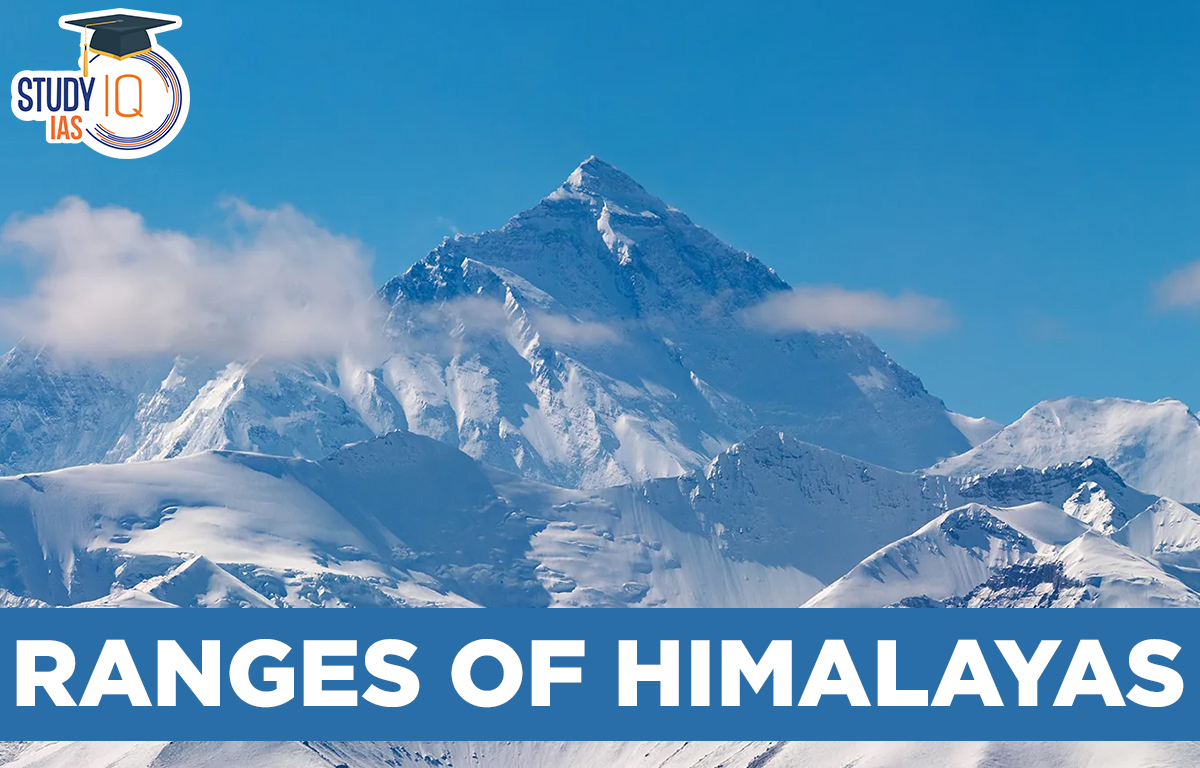
The Himalayan Ranges
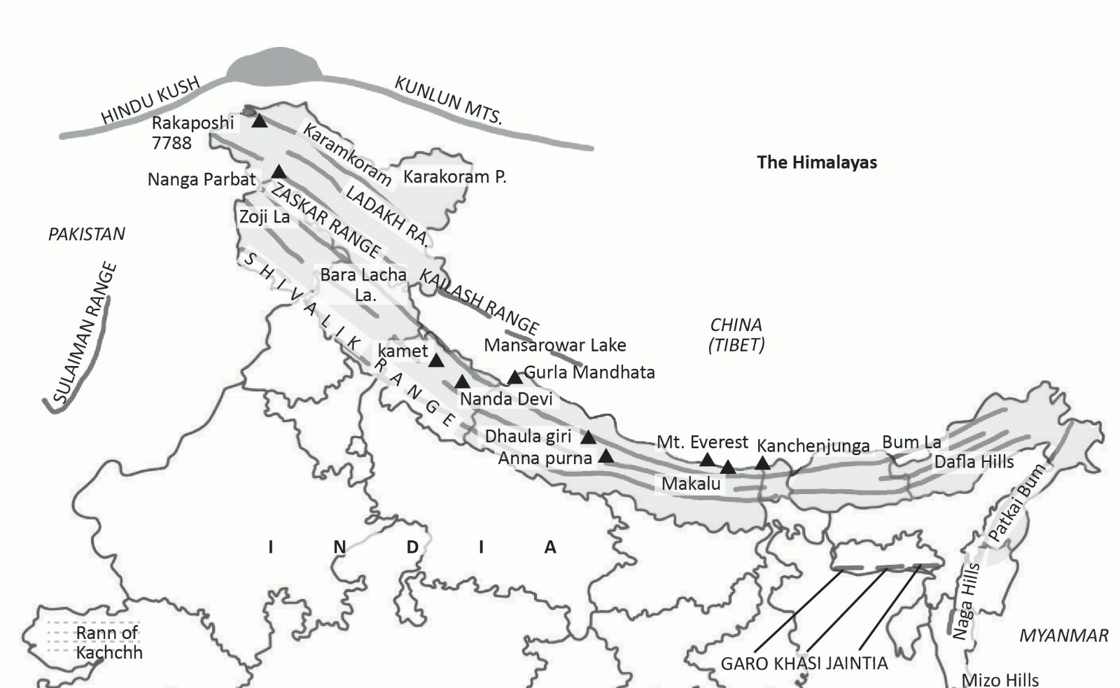
The Himalayas are a young mountain range that runs along the northern border of India. They were formed when the Indian Plate collided with the Eurasian Plate. The range stretches about 2500 kilometres from west to east, starting from the Indus Gorge and going to the Dihang Gorge. After the Dihang Gorge, the mountains curve sharply south and continue along India’s eastern edge. There is also an extended part of the Himalayas called the Arakan Yoma in Myanmar.
The Himalayan Mountain Range is the division between the Tibetan Plateau and the Indian subcontinent in Asia. The Himalayas are divided into three ranges: the Inner Himalayas, the Middle Himalayas, and the Outer Himalayas. Himadri, or the Greater Himalayas, is the name of the Himalayas’ northernmost range.
States in Himalayan Ranges of India
Here is the list of States in Indian Himalayas:
| Sl. No | State/region | % share of geographical area in the Indian Himalayan Region |
| 1 | Jammu & Kashmir | 41.65 |
| 2 | Himachal Pradesh | 10.43 |
| 3 | Uttarakhand | 10.02 |
| 4 | Sikkim | 1.33 |
| 5 | West Bengal hills | 0.59 |
| 6 | Meghalaya | 4.20 |
| 7 | Assam hills | 2.87 |
| 8 | Tripura | 1.97 |
| 9 | Mizoram | 3.95 |
| 10 | Manipur | 4.18 |
| 11 | Nagaland | 3.11 |
| 12 | Arunachal Pradesh | 15.69 |
Himalayan Ranges: Himalayan Mountain Ranges
The Himalayas are one of the three mountain ranges that make up the Himalayan mountain range system. The three sections are folded mountains that cross India’s northern boundaries. The Himalayan Ranges extend from the Indus River to the Brahmaputra River, running from west to east. The tectonic collision of the Indian Plate and the Eurasian Plate created the three components.
The Himalayas are the Highest mountain ranges in the world contain the highest peaks, glaciers, gorges, and deep valleys. They stretch 2400 km in length forming an arc over the Indian subcontinent and vary in width from 400 km in Kashmir to 150 km in Arunachal Pradesh.
The eastern Himalayas have more height differences compared to the western Himalayas. These mountains act as a barrier between India and the countries of East and Central Asia, blocking the cold winds from Central Asia. They also serve as barriers to climate, drainage, and culture. The northern mountain chain includes the Purvanchal Hills, Trans Himalayas, and the main Himalayan range.
Divions of Himalayan Ranges
The Himalayas are divided from south to north splitting them lengthwise. Another way is to divide them from east to west based on their height and regions. The Himalayan ranges are divided into three parallel sections:
- The Shivaliks (outer Himalayas)
- The Lesser Himalayas (middle Himalayas)
- The Greater Himalayas (innermost mountain ranges)
Himadri or Greater Himalayas
- Himadri, or Greater Himalayas, is the name of the Himalayas’ northernmost range.
- The Greater Himalayas stretch 2400 km from west to east and are between 120 and 190 km wide.
- The mountain’s average height is 6000 metres.
- The Greater Himalayas, also known as the Himadri, are the longest and most continuous mountain range in the world. Granite makes up the Greater Himalayas’ or Himadri’s core.
- This range is always covered with snow and consists of many glaciers
- The Greater Himalayas, which include Mount Everest (8850 m), Mt. Dhaulagiri (8172 m), Mt. Makalu (8481 m), and Mt. Kanchenjunga, are some of the other noteworthy peaks in this mountain range (8586 m.)
- Other ranges are Annapurna, Nanga Parbat, and Kamet.
- This Himalaya is the source of the Yamuna and Ganga rivers.
- Examples of folding mountains- the Himalayas, Andes, Alps, Appalachians and Ural etc.
Himachal or the Lesser Himalayas
- The Great Himalayas are separated from the Middle Himalayas by the main central thrust. They run parallel to the south of the Great Himalayas in an east-west direction. Their width is 60 to 80 kilometers, and their average height is 4500 meters.
- The Himachal, or Middle Himalayas stretches for 2400 kilometers along the northern edge of the Indian subcontinent, from northeast to southeast. This range covers areas like Ladakh, the Union Territories of Kashmir, Sikkim, Uttarakhand, Himachal Pradesh, Nepal, and Bhutan.
- The valleys in the Middle Himalayas are Kangra, Kashmir, and Kulu.
- The most well-known hill towns in the Middle Himalayas are Shimla, Ranikhet, Darjeeling, and Nainital.
- Prominent mountain ranges in this region include Pir Panjal, Dhauladhar, Naag Tibba, and Mahabharat. The Pir Panjal range, located in Kashmir, is the longest and most important range of the Lesser Himalayas. The highest peak in the Pir Panjal range is Indrasen. This part of the Himalayas is also rich in herbs.
The Outer Himalayas or Shivalik
- The Shivalik range is the outermost and southernmost part of the Himalayas. It is the youngest of the Himalayan mountain ranges, with widths of 10 to 50 kilometers and heights ranging from 600 to 1,200 meters.
- The Outer Himalayas stretch for over 2400 kilometers, from the Indus Gorge in the northwest to the Brahmaputra River in Assam.
- In Punjab and Himachal Pradesh, the southern Shivalik range does not have ice on it.
- Between the southern slopes of the Middle Himalayas and the Shivalik ranges, there are long valleys called dunes in the west and Dwaras in the east.
- The biggest doon in the Shivalik range is Dehradun.
- In Uttarakhand, the conical forests and small grasslands in these valleys are known as bughyals.
Himalayan Ranges Formation
The Himalayan mountain ranges were formed when the Indian Plate collided with the Eurasian Plate. This process started about 50 million years ago and is still happening today.
- Plate Tectonics: The Earth’s surface is made up of large and small plates. The Indian Plate moved north and hit the Eurasian Plate.
- Collision and Convergence: When the Indian Plate collided with the Eurasian Plate, the rocks at the bottom of the ancient Tethys Ocean were pushed up, forming the high peaks of the Himalayas.
- Ongoing Formation: The Himalayas are still growing because the Indian Plate keeps moving north, and the pressure from the collision continues to build the mountains.
- Geological Impact: This collision also created other mountain ranges and lifted the Tibetan Plateau.
Formation of Himalayas in Phases
- Phase 1: 100 million years ago
- Phase 2: 71 million years ago
- Phase 3: The Drass volcanic arc
- Phase 4: Greater Himalayas were raised
- Phase 5: Rise of lesser Himalayas
- Phase 6: Rise of the Shiwalik ranges
Himalayan Ranges Map
Himalayan Ranges Important Parts
- The Himalayan Ranges are a paradise for nature lovers because of the wide variety of plants and animals. This diversity is due to the changing temperatures as you go higher. Tropical plants and animals are found up to 1000 meters, temperate ones up to 3000 meters, and alpine species above that.
- From deodars to azaleas to pines and firs, to tigers and snow leopards, to sparrows and cormorants, to snow partridges, snow cocks, and snow pigeons, the flora and fauna fluctuate with height and temperature. The Climate of India is significantly influenced by the Himalayas. Because of their height, length, and direction, the Himalayas effectively block the summer monsoons coming from the Bay of Bengal and the Arabian Sea. This causes rain or snow to fall in the region.
- Almost all of India’s major rivers start in the Himalayas. These rivers are fed by large glaciers, snowfields, and heavy rainfall.
- The Himalayas have also protected India from invasions throughout history by acting as a natural barrier. With their stunning beauty and pleasant climate, the Himalayan Mountains are a popular tourist destination.
Himalayan Ranges Crops
The Himalayas are not good for farming because they are rocky and have steep slopes. Some hillsides are farmed using terraces. The main crop grown on these terraces is rice. Other crops include wheat, potatoes, and maize.
Tea can only be grown on the slopes of the Shiwalik hills. Growing fruit is also an important job. The Himalayan region grows many kinds of fruits, like apples, pears, grapes, mulberries, walnuts, cherries, peaches, and apricots.
Impact of Climate Change on Himalayan Ranges
The precipitation over the Himalayas, as well as the melting reaction of the glaciers or snow cover in the Himalayas, are all significantly impacted by climate change. This affects how rivers flow from the Himalayan glaciers. The ice and snow in the Himalayas play a big role in three major river systems and their many smaller rivers in India and Nepal, especially during the dry season.
These rivers support over 500 million people living in the Indo-Gangetic plains and also help many industries in the region. They are important for generating hydro and thermal electricity through dams and power plants in the Indo-Gangetic plains, which helps keep the country’s energy secure.
The Indo-Gangetic plains produce over one-third of the country’s electricity. Any change in the flow of the Himalayan rivers can greatly impact the country’s energy security.
Natural Disasters in Himalayan Ranges
- A rockfall or slope failure zone is a phenomenon in which a slope suddenly falls under the force of rainfall or an earthquake. Himachal Pradesh’s mountains are young and vulnerable, generating cracks and fractures in the rock that could develop in the future.
- Lahaul-Spiti and Kinnaur are both located in the Himalayan ranges, which are notorious for their geological and biological fragility. Environmentalists assert that the state’s promotion of mega hydropower projects is being carried out in a sensitive and fragile area without consideration for the cumulative effects of the individual projects.
- In the Sutlej basin, more than 140 hydroelectric projects have been assigned, and catastrophes similar to those in Chamoli and Kedarnath are imminent.
The Bane of Urbanization, Soil Infiltration Capacity Decreased
Floods are a result of a decline in soil infiltration capacity brought on by urbanization. This has increased the frequency of landslides and flash flooding, making the area more susceptible to natural disasters. Floods are more likely to occur if the landslide reaches the river stream.
Glacial Retreat due to Climate Change
The upper Himalayas used to be covered in numerous glaciers, but as a result of climate change and global warming, they have since receded. A glacier has a lot of loose rocks and soil because it is a moving mass of ice, rock, and dirt. Scientists say that as glaciers in the upper Himalayas melt and move back, they leave behind many layers of unstable rocks and soil.
Even a little rain can wash these rocks and dirt downstream. Because of this, the higher Himalayan region is not good for building dams and tunnels.
Since the early 2000s, snow cover has decreased in Asia’s high mountains, including the Himalayas. Glaciers have become thinner, moved back, and lost mass.
The Himalayan Ranges Important Peaks
1. Mount Everest
| Mount Everest |
|
2. Karakoram
| Karakoram |
|
3. Kanchenjunga
| Kanchenjunga |
|
4. Nanga Parbat
| Nanga Parbat |
|
5. Annapurna
| Annapurna |
|
6. Manaslu
| Manaslu |
|
7. Dhaulagiri Mountain
| Dhaulagiri Mountain |
|
8. Lhotse
| Lhotse |
|
 Astronomy in the Atacama Desert: Telesco...
 Why Below-Average Rains Don’t Rule Out...
 Mahanadi River: Location, Major Tributar...