Table of Contents
Cloud
A cloud is made up of tiny water droplets and ice crystals suspended in the air. They can be large and easily seen in different sizes, shapes, and colours. Clouds reflect sunlight, helping to cool the Earth. Clouds form when air is filled with water vapour. Cold air holds less water vapour than warm air, so when warm air cools, clouds form from the moisture.
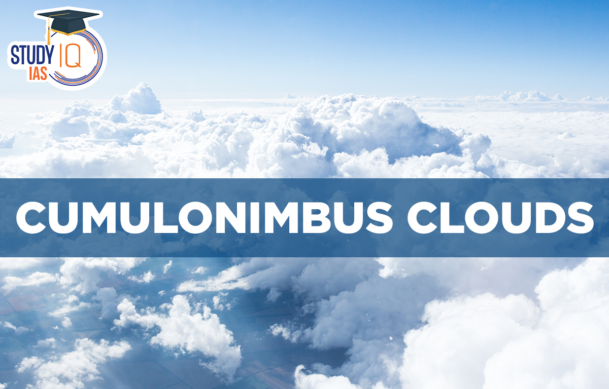
Cumulonimbus Clouds
Cumulonimbus clouds, also known as thunderstorm clouds, produce rain and lightning. They can bring heavy rain, strong winds, large hail, and tornadoes. Many areas rely on these clouds for most of their rainfall. Cumulonimbus clouds help move moisture and heat high into the atmosphere, affecting weather patterns and air quality.
Cumulonimbus Clouds Formation
- Cumulonimbus clouds are tall, dense clouds that form from water vapor in the lower atmosphere.
- They are created by strong upward air currents that lift moist air.
- Water vapour in these clouds can turn into ice crystals, leading to snow, graupel, and even hail.
- When they form during thunderstorms, they are called thunderheads.
- Cumulonimbus clouds can appear alone or in groups, sometimes along squall lines.
- They can cause severe weather, including lightning, tornadoes, high winds, and large hail.
- These clouds often develop from cumulus congestus clouds and may become part of a supercell.
Cumulonimbus Clouds Characteristics
Cumulonimbus clouds are tall and often have smaller cumulus clouds around them. Their bases can range from a few meters to several kilometers wide forming between 200 to 4000 meters high. These clouds can reach heights of 12000 meters or more, with some even reaching 21,000 meters (69,000 feet). A well-developed cumulonimbus cloud has a flat top, called an anvil dome, created by wind shear or temperature changes at high altitudes. This anvil can extend far and may have lightning. Sometimes, rising air pushes beyond this level, forming an “overshooting top.” Overall, cumulonimbus clouds are much larger than nearby clouds.
Difference between Cumulus Clouds and Cumulonimbus Clouds
| Cumulus Clouds | Cumulonimbus Clouds |
| Cumulus clouds appear huge and are dome-shaped. | Cumulonimbus clouds appear like huge mountains and have an anvil-shaped top portion. |
| Cumulus clouds form as a result of vertical airflow. | Cumulus clouds gradually transform into Cumulonimbus clouds as the vertical flow increases. |
| These clouds are grey in colour and are responsible for fair and pleasant weather. | These are dark-coloured clouds which cause thunder and lightning. |
| These clouds are also called ‘Fairweather clouds’. | These clouds are also known as ‘Thunderheads’ |
Cumulonimbus Clouds Effects
- Cumulonimbus storm clouds can cause heavy rain, flash flooding, and strong winds.
- Most storm cells last about 20 minutes because rain creates downdrafts that reduce their energy.
- Unstable and moist conditions can cause new storms to form from the outflow of one storm, leading to thunderstorms that can last for hours or days.
- Cumulonimbus clouds can also cause “thundersnow,” which involves heavy snowfall and strong winds, reducing visibility.
- These clouds are most common in tropical areas but also appear in warm seasons in other regions.
- A haboob is a dust storm created by a downburst from a cumulonimbus cloud.
Cumulonimbus Hazards are dangerous?
Cumulonimbus clouds are very dangerous for aviation because of strong winds, low visibility, lightning, and the risk of icing and hail. They create a lot of turbulence in thunderstorms. Sudden changes in wind speed, known as wind shear, can cause downbursts, which have led to accidents. Microbursts, a type of sudden wind, are especially risky and can result in crashes. While most downbursts show rain, dry microbursts are hard to see. There has also been at least one fatal airline accident caused by flying through a tornado.
Rain
Cumulonimbus clouds produce heavy rain, sometimes exceeding 2 inches per hour, which can lead to flooding and affect aircraft systems.
Updrafts and Downdrafts
These clouds have strong updrafts that lift moisture and downdrafts that bring rain, creating turbulence that can damage aircraft.
Icing Conditions
Moisture in the clouds can freeze, causing ice to build up on aircraft, which can block sensors and affect control, especially at the tops of clouds.
Hail
Strong updrafts can create hail, which can damage aircraft. Hail often forms high in the cloud and can be ejected far from the cloud.
Lightning
Cumulonimbus clouds produce lightning, which can cause disorientation for pilots and damage to aircraft systems, especially during night flights.
Tornadoes
These clouds can produce tornadoes, indicating severe weather conditions. Avoiding the area around such clouds is essential for safety.
Cumulonimbus Clouds UPSC
During the night, clouds reflect heat back to the earth, keeping it warm. Clouds help to keep it cooler outside by blocking the sun’s rays during the day. Understanding clouds aids in comprehending weather and climate.
As a UPSC aspirant, you should be well-versed with the types of clouds and their specifications.
Other Indian Geography Topics
Other Fundamental Geography Topics
 Lokmanya Tilak Jayanti 2026: Biography, ...
 Sex Ratio in India 2026: Latest Trends, ...
 Civil Disobedience Movement (CDM): Cause...