Table of Contents
Temperature Inversion Meaning
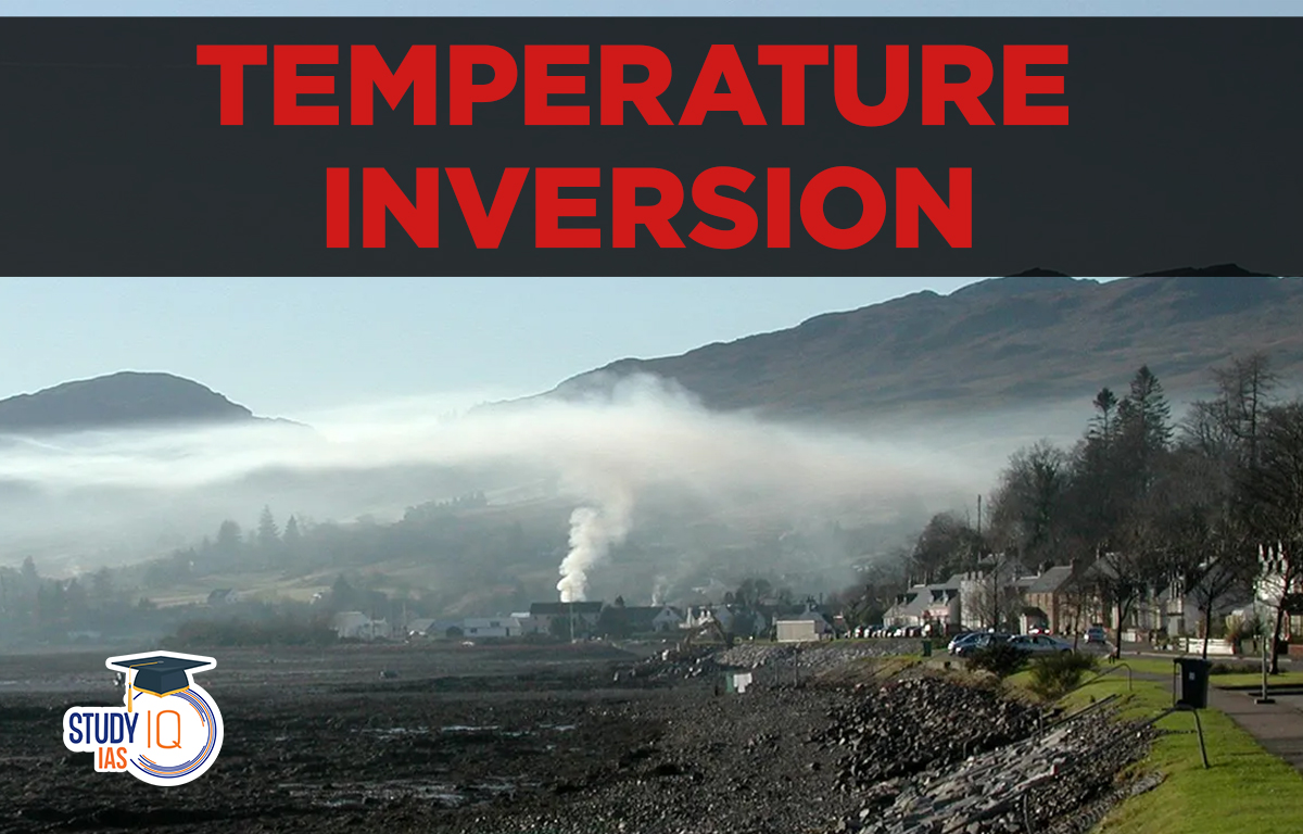
Temperature inversion is when warm air sits above a layer of cold air, which is the opposite of normal temperature behavior in the troposphere. This can happen due to calm weather or air movements and usually lasts for a short time but is quite common. Under normal conditions, temperature decreases as you go higher in the troposphere by about 1°C for every 165 meters. This is known as the normal lapse rate, sometimes the temperature increases with height instead, which is called temperature inversion.
The environmental lapse rate can change depending on the location and time but on average, the temperature drops about 6.5°C for every 1000 meters (or 3.6°F for every 1000 feet) in the troposphere. This means if you measure the temperature 1000 meters higher, it will be about 6.5°C cooler, and 1000 meters lower, it will be about 6.5°C warmer.
Read More: Heat Zones of Earth
Temperature Inversion Conditions
There are certain conditions under which Temperature Inversion occurs:
- Long Winter Nights: when the sky is clear during the long night in winter, the terrestrial radiation is faster. The reason is that the earth is cooling off faster. The lower layer of the earth-bound atmosphere is also cooled, and the upper layer remains warm.
- Clear, Cloudless Sky: Clouds block the earth’s terrestrial radiation. But this radiation pass unobstructed on cloudless days. So the soil is cooled faster and so is the air that comes into contact.
- Dry Air: Moist air absorbs the earth’s radiation, but dry air does not block radiation and allows radiation to escape into the atmosphere.
- Ice-covered Area: In ice-covered areas due to high albedo less sunlight is received. At night due to the earth’s radiation, most of the heat is lost in the atmosphere and the surface is cooled. The contact air is also cooled but the upper layer remains warm.
- Calm Atmosphere: the blowing of winds brings warm and cold air into contact. Under conditions of a calm atmosphere, the cold air stays put near the ground.
Read More: Heat Transfer
Temperature Inversion Types
There are mainly two types of Temperature Inversion namely Surface Inversion and Upper-air Inversion.
Surface Inversions
Surface temperature inversion occurs on clear nights when the ground cools quickly. If the air temperature drops below its dew point, fog can form. The most noticeable inversions occur at ground level and include the following types:
- Radiational Inversion: Radiational inversions can happen on long, cold winter nights when the ground quickly releases heat into a clear, calm sky. The cold ground cools the air above it, making the lowest part of the troposphere colder than the air above. This usually occurs in winter because there’s less sunlight to warm the ground during the short days, leading to more cooling at night. These inversions are more common in high-latitude areas.
- Advection Inversions: Advection inversions occur when cold air flows into an area, often when cool maritime air moves into a coastal region. These inversions are usually short-lived, lasting overnight, and are shallow. They can happen at any time of the year, depending on the location of the cold surface and wind direction.
- Drainage Inversion: Another type of surface inversion results when cooler air slides down a slope into a valley, thereby displacing slightly warmer air. During winter, this fairly common occurrence in some midlatitude regions is called a cold-air drainage inversion.
Read More: Isotherms
Upper-air Inversions
Temperature inversions in the upper air are usually caused by air sinking down from above, which is why they are called subsidence inversions. These inversions are often linked to high-pressure conditions, especially in subtropical areas year-round and in Northern Hemisphere continents during winter. A subsidence inversion can be quite deep, sometimes several thousand meters, with its base typically a few hundred meters above the ground. Low-level turbulence keeps the warmer air from sinking lower.
Read More: Insolation
Nighttime temperature inversions usually break up soon after sunrise when the sun warms the ground, causing the air in the inversion layer to warm and rise. These inversions are most common in valleys. In winter, mountain slopes cool quickly, causing the air above them to also become cold and dense. This cold air then flows down into the valleys, pushing the warmer air upwards and creating a temperature inversion. This is why apple orchards in the Himalayas and tea gardens in Darjeeling are located on the upper slopes of valleys.
Read More: Structure of the Atmosphere
Temperature Inversion Effects
- The temperature inversion helps in precipitation, forming clouds, and frost.
- The inversion of temperature leads to the floating of dust particles in the air, thus, checking dust particles and smoke from dispersing on the surface.
- Temperature inversion brings stability to the atmosphere by checking the downward and upward movement of the air.
- At times the temperature inversion can become a matter of concern. It checks the convection clouds from rising higher, thus, pouring less rainfall.
- Fog formed due to temperature inversion reduces visibility and is a concern for transportation.
- Intense thunderstorms and tornadoes are associated with temperature inversions.
Read More: Physiography of India
Temperature Anomaly
The temperature in a region can change along the same latitude line. It also varies because of differences between land and water, prevailing winds, and ocean currents. A temperature anomaly is the difference between the average temperature of a place and the average temperature for that latitude. This is also called a thermal anomaly.
- Temperature anomalies could be positive or negative. An anomaly is said to be a negative anomaly when the temperature of a place is less than the expected temperature of the latitude.
- The anomaly is a positive anomaly when the temperature of a place is more than the expected temperature of the latitude.
Due to the uneven distribution of land and water, the maximum temperature anomalies are found in the Northern Hemisphere and the minimum in the Southern Hemisphere.
Read More: Monsoon in India
Temperature Inversion UPSC
At times, the temperature at the valley bottom drops below freezing, while the air at higher altitudes remains relatively warm. As a result, the trees on the lower slopes are frost-bitten, whereas those on higher levels are not.
Because of the temperature inversion, air pollutants such as dust particles and smoke do not disperse in the valley bottoms. Because of these factors, houses and farms in intermountain valleys are typically located on the upper slopes, away from the cold and foggy valley bottoms. For example, coffee farmers in Brazil and apple farmers and hoteliers in India’s Himalayan mountain states avoid lower slopes.
This article will discuss an important phenomenon known as temperature inversion in the context of the UPSC IAS Exam.
 Sex Ratio in India 2026: Latest Trends, ...
 Civil Disobedience Movement (CDM): Cause...
 Role of Teachers in Educations, Student ...