Table of Contents
Aeolian Landforms
Wind shapes Aeolian landscapes, which are named after Aeolus, the Greek god of wind. Aeolian processes involve the wind carrying, depositing, and eroding sediment. These activities occur in various habitats, including coastal areas, cold and hot deserts, and farmlands. Common features of these ecosystems include little vegetation, fine sediments like clay and sand, and strong winds.
Aeolian processes create dust and form sand dunes. They also depend on other natural forces, such as rivers and glaciers, to move sediment. Wind acts as a powerful force in shaping land, especially in dry areas with few plants. Through erosion and deposition, aeolian processes create unique landforms, including:
- Mushroom Tables
- Yardangs
- Deflation Hollows
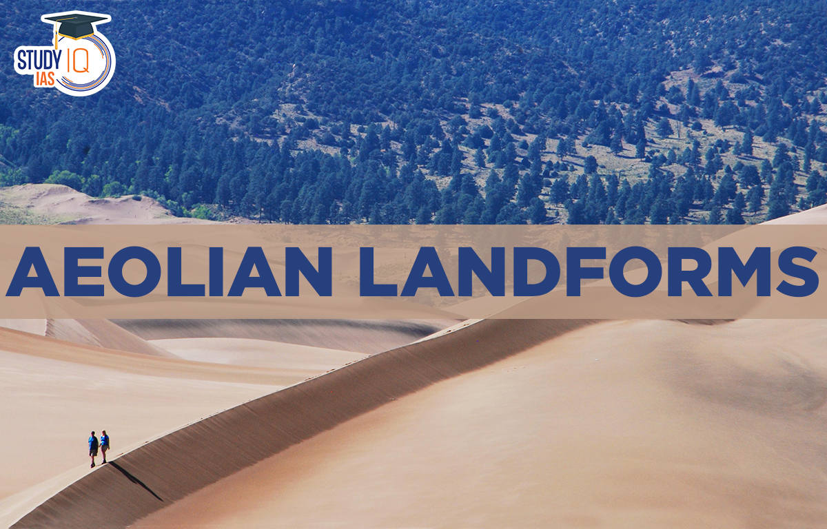
- Sand dunes
- Loess
- Ripples
Aeolian Landforms Wind Action
In scorching deserts, the wind is the primary geomorphic force. Winds blow more quickly in hot deserts, which leads to erosion and deposition in the desert. Aeolian Landforms are landforms produced by the wind’s erosional and depositional processes. This mechanism has been observed and researched on other worlds, including Mars, and is not specific to the Earth.
An erg is a wide, flat stretch of desert covered with wind-swept sand with little to no vegetation cover (also known as a sand sea, dune sea, or sand sheet if it lacks dunes). It is characterised as a desert region with more than 125 square kilometres of aeolian or wind-blown sand and more than 20% of the surface covered with sand. “Dune fields” are smaller regions. There are multiple ergs in the Sahara, the world’s largest scorching desert.
Deserts are arid regions of the landscape with minimal precipitation, making it difficult for plant and animal life to survive. The lack of vegetation exposes the exposed ground surface to denudation processes. The world’s land surface is roughly one-third arid or semi-arid. This comprises a large portion of the Polar Regions, which are called ‘’cold deserts” because they receive minimal precipitation. According to the amount of precipitation that occurs, the average temperature, the factors that contribute to desertification, or their geographic location, deserts can be categorized. Deserts make up about one-fifth of the earth’s surface. True deserts are those that are completely devoid of any vegetation.
Deserts are dry mainly due to low and unpredictable rainfall, high temperatures, and fast evaporation. Most deserts, known as trade wind or tropical deserts, are found between 15 and 30 degrees latitude near the equator. They are located along the western coasts of continents, where trade winds meet cold ocean currents, drying out the air and preventing moisture from forming rain.
Aeolian Landforms Erosional
Aeolian Erosional Landforms are explained below:
Mushroom Tables
Rocks that have been eroded, pitted, etched, grooved, or polished by ice crystals or sand carried by the wind are known as ventifacts. These landforms are commonly found in deserts, where there is little vegetation, strong winds, and a steady supply of sand. Mushroom tables and mushroom rocks are examples of ventifacts that look like mushrooms. In deserts, winds carry more sand and rock particles close to the ground, causing more erosion on the bottom of rocks than on the top. This creates tall rock pillars with wide tops that resemble mushrooms.
Pediplains
Pediplains are high-relief structures in deserts that have been eroded by the wind into low, featureless plains.
Deflation Hollows
Deflation is when the wind removes loose debris from the ground, creating shallow depressions called deflation hollows. These are also known as blowouts or deflation basins, and while they can be several kilometers wide, they are usually small.
Yardangs
Yardangs are ridge-separated parallel troughs carved into the softer rock that runs in the direction of the wind. The predominant wind’s direction can be determined from the yardangs.
Caves
Some blow-outs get deeper and wider over time, making them look like caverns as wind-blown sand hits the rocky walls.
Zeugen
A zeugen is a noticeable flat-topped rock formation found in the desert. It usually has layers of hard rock and soft rock stacked on top of each other.
Aeolian Landforms Depositional
Sand dunes
Sand dunes are mainly found in hot deserts. There are two main types of sand dunes based on their shapes:
- Barchans: These are crescent-shaped dunes and are the most common type.
- Seifs: These dunes have a long, narrow shape.
.The difference between a barchan and a seif:
| Barchans | Seif |
| These are crescent-shaped dunes. | These are linear in shape with two slip faces. |
| Barchan dunes may reach a height of more than 90 feet. | Seif dunes reach up to 300 feet in height. |
| These dunes occur all around the world where sand dunes occur. | Seif dunes mostly occur in the open desert. |
| They are formed in areas where the amount of sand is moderate and the wind blows only in one direction. | These are formed when the barchan dune moves in more than one direction. |
Loess
Wind-blown silt that has built up from dust storms over thousands of years covers large areas of the earth. This material is called loess.
Ripples
They are regular, wave-like undulations that are parallel to the direction of the dominant wind.
Aeolian Landforms UPSC
Deserts are areas with low levels of precipitation (below 25 cm yearly), making them unfavourable environments for both plant and animal life. Deserts can occur in plains or mountains, and they can be hot, arid, semiarid, coastal, or frigid. It is one of the main ecotypes on Earth and is home to a variety of unique plants and animals that have evolved to survive in harsh environments.
A UPSC aspirant should be well versed with the topic of the Evolution of various Landforms like Glacial, Fluvial, and Aeolian. This topic of geography holds immense importance from both Prelims and Mains’ point of View. The details in the article would help candidates prepare for UPSC 2023.
Other Indian Geography Topics
Other Fundamental Geography Topics
 Lokmanya Tilak Jayanti 2026: Biography, ...
 Sex Ratio in India 2026: Latest Trends, ...
 Civil Disobedience Movement (CDM): Cause...