Table of Contents
Fluvial Landforms
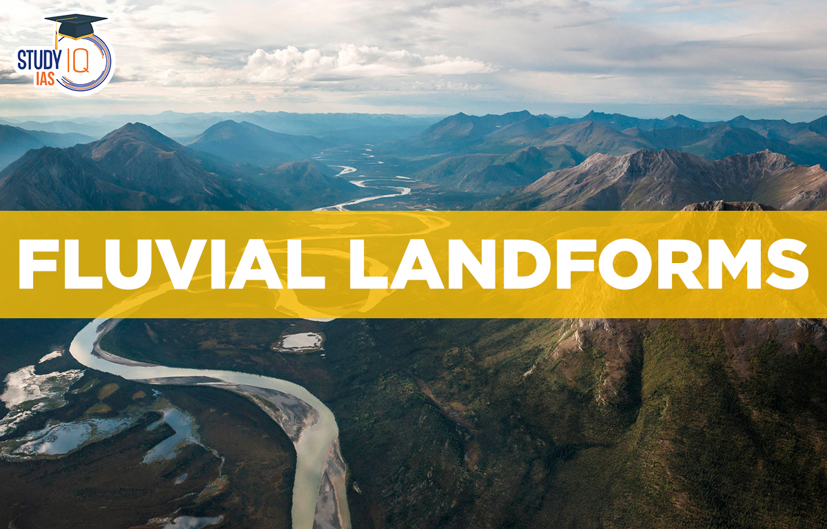
Fluvial Landforms: Fluvial topography refers to the landforms created by flowing water. Fluvial landforms include like waterfalls, oxbow lakes, valleys, and deltas. There are two main types:
- those formed by fluvial erosion and
- those formed by fluvial deposition.
Fluvial landforms range from small features like rills to large rivers and their drainage basins. About 68% of Earth’s land is drained by rivers that flow into the oceans. Rivers usually start in high, sloped areas called uplands, which act as catchment areas. The first stream forms from the slope, and as it flows, it collects tributaries from both sides. In fluvial geomorphology, the drainage basin or watershed is an important part of the landscape.
Running water is a major force of erosion, especially in humid areas with heavy rainfall. It has two forms: sheet flow across the ground and flowing in rivers. Most water-related landforms from erosion are found in young, active rivers that flow through steep terrain. Over time, as these streams erode their banks, they become smoother and slower, leading to more sediment deposition.
River Course
1. Youth
In this stage, there are few poorly connected streams flowing over old slopes. The valley is deep, narrow, and V-shaped, with little to no floodplains. Downcutting is more important than side erosion. Marshes, swamps, and lakes may form on the flat areas between streams. This stage also features gorges, canyons, waterfalls, rapids, and river captures.
2. Mature
At this stage, there are many well-connected streams. Lateral erosion becomes more important than vertical erosion. The valleys are still V-shaped but wider and deeper due to bank erosion. The main streams have wide floodplains where they meander. Young marshes and swamps disappear, and the streams may split suddenly. Rapids and waterfalls also disappear. Key features of this stage are meandering streams and sliding down slopes.
3. Old
As the river flows downstream across a flat plain, sediments weigh it down. While the banks still erode sideways, vertical erosion nearly stops. Older tributaries are rare and have gentle slopes. Streams meander freely across wide floodplains, with lakes, bogs, and marshes in the flat areas. The landscape is mostly at or just above sea level due to the buildup of materials. This stage features floodplains, oxbow lakes, natural levees, and deltas.
Fluvial Erosive Action Effects
- Rocks are eroded by the force of flowing water, which is hydration.
- Weathering is caused by a chemical reaction known as corrosion or solution.
- When materials are being carried, attrition refers to the wear and tear that occurs when they roll into one another and collide.
- Rocks are worn down by corrosion or abrasion caused by a heavy river load striking them.
- Vertical erosion known as downcutting: is the eroding of a stream’s base (downcutting leads to valley deepening).
- The eroding of a stream’s side walls is known as lateral erosion (leads to valley widening).
- Headward erosion is the erosion of a stream channel’s origin, which moves the origin back from the stream’s flow direction and lengthens the stream channel as a result.
- Gorges, canyons, waterfalls, rapids, and river capture are examples of fluvial eroded landforms.
- The mechanical loosening and sweeping away of materials by river water is known as hydraulic action. It mostly happens by rushing into rock crevices and cracks and eroding them.
- The primary waterway braiding into several, smaller channels A braided river or channel is made up of a network of river channels that are divided by tiny, frequently transient islands known as braid bars. Rivers with low slopes and/or high sediment loads frequently have braided streams.
Fluvial Landforms Types
There are two types of Fluvial Landforms:
- Fluvial Erosional Landforms
- Fluvial Depositional Landforms
Erosional Landforms Fluvial
1. River Valleys
A river valley is a low area where a stream flows. In its early stages, the valley is deep, narrow, and “V”-shaped with steep sides due to vertical erosion. As it matures, the valley floor becomes flatter, and lateral erosion makes it wider, giving it a “U” shape.
2. Georges
These valleys are known as “I-shaped valleys” because their sides are almost parallel, creating an “I” shape. A gorge is a deep, narrow valley with steep, straight sides. The width of a gorge is similar at the top and bottom, and they usually form in hard rocks.
Example: Indus Gorge in Kashmir.
3. Potholes
Potholes are small, cylindrical depressions found in rocky river valleys. They usually occur in coarse-grained rocks like sandstones and granites. When water swirls in eddies, rock fragments like boulders move in circles, grinding into the valley floor like a drilling machine. This process, called potholing or pothole-drilling, creates small holes that grow larger and deeper over time.
4. Gulleys/Rills
A gulley is a water-worn channel often found in semi-arid areas. It forms when excess rainwater flows down a slope, creating small rills that combine and grow into a larger channel.
Example: The ravines of Chambal Valley in Central India.
5. Ox-Bow Lake
The outer curve of a meander can erode so much that the ends of the loop get close to the main river and become separate water bodies. Over time, these can turn into swamps. In the Indo-Gangetic plains, the Ganga River’s movement south has created several oxbow lakes to the north of its current path.
6. Incised Meanders
Erosion mainly happens in fast-moving streams that flow over steep areas. In these streams, the sides of the valley erode less compared to streams on gentle slopes. Streams on mild slopes tend to twist and turn, creating winding paths. These meandering streams often flow across floodplains and delta plains. Even hard rocks can have deep and wide meanders, known as incised or entrenched meanders.
7. River Terraces
River terraces are flat areas that show where old floodplains or valley floors used to be. They can be made of stream deposits or bare bedrock. River terraces form mainly due to erosion, as a stream cuts down into its own floodplain. Such terraces may be numerous and vary in height, showing the levels of an earlier river bed. When the river terraces are found at the same elevation on both banks of the rivers, they are referred to as paired terraces.
8. Peneplain
This refers to a flat, smooth plain with small hills made of strong rocks. A peneplain forms during long periods of stability in the Earth’s crust, showing what the land looks like after a lot of river erosion.
Depositional Landforms
Stream speed and the amount of material a river carries affect how much sediment it deposits. Slower streams drop more sediment because they can not carry as much. Increased sediment downstream can come from:
- Faster erosion in deforested areas
- Materials from glaciers
- Extra sediment from tributary streams
- Erosion from rills and gullies.
1. Delta
A delta is an area of alluvium near the mouth of a river where more material is dumped there than can be taken away. A network of channels is created by splitting the river into two or more channels (distributaries), which may then split again and again.
2. Meanders
A meander is a curve or loop in a river channel. The outer bend, called the cliff-slope side, is steep and eroded. It has a concave slope. The inner side, known as the slip-off side, is gentler and has deposited materials. Meanders can take various shapes, including wavy, horseshoe, oxbow, or bracelet-like forms.
3. Alluvial Fans and Cones
As a stream flows from the mountains to the plains, its speed decreases due to a gentler slope. This causes the stream to drop a lot of the materials it carried from the mountains near the foothills. This material is deposited in a conical shape, resembling a series of continuous fans. They are referred to as alluvial fans. These fans can be seen all over the north Indian plains, at the foothills of the Himalayas.
4. Natural Levees, Floodplains, and Point Bars
A floodplain is created through deposition, much as valleys are created by erosion. A floodplain is a landform created by river deposits. When a river flows from a flat area to a slope, larger materials are dropped first. Slower-moving streams in plains carry fine particles like sand, silt, and clay, which are deposited on the riverbed during floods. The active floodplain is where these deposits occur, while the inactive floodplain is above the river banks.
There are two types of deposits in the inactive floodplain: flood deposits and channel deposits. Sometimes, river channels change direction, leaving behind cut-off areas that fill in over time. Coarse materials build up in these abandoned channels, while silt and clay come from flood deposits. Flood plains in a delta are known as delta plains.
5. Doab
A doab is a piece of land located between two rivers that meet. This term is commonly used in South Asia, especially in India and Pakistan.
Fluvial Landforms UPSC
- The highest waterfall in India is Kunchikal Falls, which is a cascade waterfall with numerous steps that are generated by the Varahi river in the Shimoga region of Karnataka (455 m).
- India’s tallest plunge waterfall is Nohkalikai Falls (340 m). It is located near Cherrapunji.
- The second-highest plunge waterfall in India is Jog or Gersoppa Falls, which is located in Karnataka on the Sharavati River (a tributary of the Cauvery).
- The highest waterfall in the world, Angel Falls in Venezuela, rises 979 metres and plunges 807 metres.
- The second-highest waterfall in the world is Tugela Falls (948 m), located in the Drakensberg mountains of South Africa.
A UPSC aspirant should be well versed with the topic of the Evolution of various Landforms like Glacial, Fluvial, and Aeolian. This topic of geography holds immense importance from both Prelims and Mains point of View. The details in the article would help candidates preparing for UPSC 2023.
Other Indian Geography Topics
Other Fundamental Geography Topics
 Sex Ratio in India 2026: Latest Trends, ...
 Civil Disobedience Movement (CDM): Cause...
 Role of Teachers in Educations, Student ...