Table of Contents
Sargasso Sea
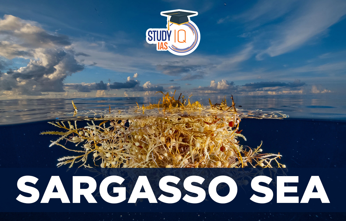
The Sargasso Sea is located in the Atlantic Ocean and it is named after the golden Sargassum seaweed that floats there which is a genus of brown macroalgae. The Sargasso Sea is a large ocean area of about two million square miles surrounded by the North Atlantic Gyre’s currents. This unique ecosystem supports ten special species and serves as a nursery for many fish and sea turtles. It’s also the only known breeding ground for two endangered eel species that move between the ocean and freshwater. Also, it is a migration route for sharks, rays, and whales.
Read More: Dead Sea
Sargasso Sea Boundaries
The North Atlantic Gyre also called the North Atlantic Ocean Current System, is a large, circular current. It is bounded by the Gulf Stream, North Atlantic Current, Canary Current, and North Atlantic Equatorial Current. The gyre is about 1100 km wide and 3200 km long, located between 20° and 35° north latitude and 40° and 70° west longitude. Bermuda is near its western edge.
The Sargasso Sea is not a sea in the traditional sense but is instead defined by ocean currents that form a gyre and trap the seaweed and other floating debris in its centre.
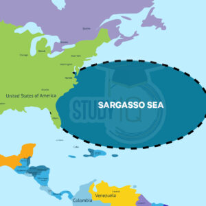
Sargasso Sea Map
It lies in the North Atlantic Ocean in between the Canary Islands, the east coast of the United States and the Caribbean Sea.
Read More: Sea of Okhotsk
Sargasso Sea Facts
The Sargasso Sea is a region of the North Atlantic Ocean that is elliptical in shape, calm, and covered in free-floating seaweed from the species Sargassum.
- Part of a clockwise ocean current system, with the Gulf Stream on its western edge
- Located between 20° N and 35° N latitude and 30° W and 70° W longitude
- Weak currents, low rainfall, high evaporation, light winds, warm, salty waters
- Depths range from 5000 to 23000 feet
- Few plankton, creating a “biological desert”
- Brown seaweed (gulfweed) floats on the surface, supporting unique marine life
- First described by Christopher Columbus in 1492
Sargasso Sea Significance
Shrimp, crabs, fish, and other marine species that have tailored their habitats to this floating algae can also depend on sargassum for vital habitat. White marlin, porbeagle sharks, dolphins, and threatened and endangered eels all reproduce in the Sargasso Sea. The Sargasso Sea is known for its unique ecosystem and is home to a variety of endemic species, such as the Sargassum fish and the juvenile eels known as “leptocephali”.
Read More: Arabian Sea
 Lokmanya Tilak Jayanti 2026: Biography, ...
 Sex Ratio in India 2026: Latest Trends, ...
 Civil Disobedience Movement (CDM): Cause...