Table of Contents
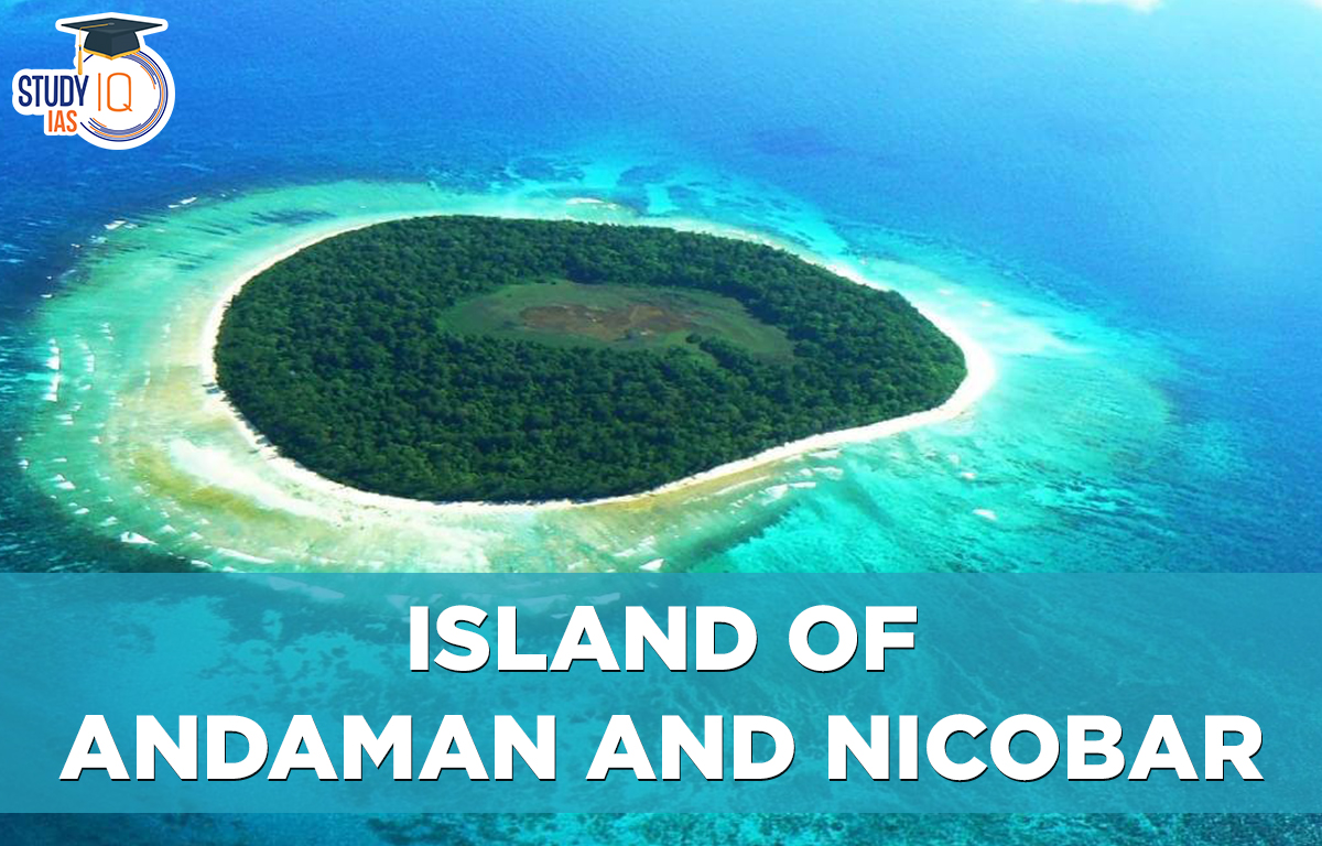
Andaman and Nicobar Islands
The Andaman and Nicobar Islands are a union territory of India with 836 islands from which approximately 30 are inhabitated. The Andaman Islands are one of the two main groups of islands in the union territory with the Nicobar Islands to the south. Together, they form a chain of islands that separates the southeastern Bay of Bengal on the west from the Andaman Sea on the east. The territory shares sea borders with Indonesia (165 km south), Myanmar (280 km northeast), and Thailand (650 km southeast). The islands are divided into three districts: Nicobar, South Andaman, and North and Middle Andaman, with capitals in Car Nicobar, Port Blair, and Mayabunder.
Andaman and Nicobar Islands: Brief Information
| Andaman and Nicobar Island |
|
Islands of Andaman and Nicobar History
- The name “Andaman” is believed to come from Lord Hanuman, who stopped in the region on his way to Lanka.
- Famous islands like Neil and Ross are named after British engineers from the East India Company era.
- The Jarawa tribe, living in parts of South and Middle Andaman Islands is protected and has a population of 250-400. Contact with them is illegal as they avoid outsiders.
- During World War II, Japan controlled the Andaman Islands until 1945 when the British took over again. The Museum of the Japanese Occupation in Port Blair shows this history.
- Hermit crabs, also known as coconut crabs, are the largest land-dwelling arthropods.
- The 2004 Indian Ocean earthquake caused a huge damage to the Andaman Islands, including loss of life and land. The tsunami that followed took away 4.25 meters of land from Indira Point, the southernmost tip.
- The leatherback sea turtle, the largest living turtle, nests in the Andaman Islands. Adults are 1 to 1.75 meters long and weigh 250 to 700 kilograms.
| Restricted Island in Andaman |
Andaman and Nicobar Islands (Protection of Aboriginal Tribes) Regulation, 1956 (ANPATR)
|
Climate of Andaman and Nicobar Island
The sea breeze helps make the tropical climate of the Andaman and Nicobar Islands more pleasant. Temperatures basically stay between 70 and 80 degrees Fahrenheit throughout the year. The islands receive a lot of rain, about 3000 mm each year. Most of this rain comes from tropical cyclones, which occur from October to November, and the southwest monsoon, which lasts from May to September. Greater Nicobar gets the most rainfall compared to the other islands.
Important Points related to Andaman and Nicobar Islands
- The Andaman Islands are part of a submerged mountain range from Myanmar, and the Nicobar Islands continue from the Mentawai Islands near Sumatra.
- The main rocks on these islands are sandstone, limestone, and shale.
- These islands are located in the Bay of Bengal, stretching from 6°45′ N to 13°41′ N and 92°12′ E to 93°57′ E.
- Great Nicobar Island is 145 km southeast of Sumatra, and Landfall Island is 280 km south of Myanmar.
- The Andaman and Nicobar Islands have hilly terrain, with Saddle Peak (732 m) being the highest in the Andamans and Mt. Thuillier (568 m) in the Nicobars.
- The Andaman Islands have one of the world’s largest mangrove ecosystems and a high diversity of unique plants and animals.
- 90% of the Andamans’ land area is protected, including tribal reserves, wildlife sanctuaries, national parks, and a biosphere reserve.
- The islands have fragile ecosystems with diverse landscapes, from coral reefs and beaches to forests and streams.
- Little Andaman Island has unique ecosystems, including fresh and saline water marshes.
- The islands are home to many species, including the Nicobar crab-eating macaque and over 250 bird species, with high levels of endemism due to their isolation.
- Andaman has four national parks: Mahatma Gandhi Marine, Mount Harriet, Rani Jhansi Marine, and Saddle Peak.
- Nicobar has two national parks and the Great Nicobar Biosphere Reserve, including Galathea National Park and Campbell Bay National Park.
- Barren Island in the Andamans has an active volcano. Two volcanic islands, Barren and Narcondam, are located 80 km east of the Andaman Islands.
- Rice is the main crop grown in both the Andaman and Nicobar Islands.
- Coconut and arecanut are important cash crops in Nicobar.
- The islands were known as ‘Kalapani’ during British rule as a penal settlement.
- The British established this settlement in 1858 after the first Indian War of Independence in 1857.
- The 10 Degree Channel separates the Andaman Islands from the Nicobar Islands and is about 150 km wide.
- The Andaman Islands have hilly landscapes with the highest point being Saddle Peak at 732 meters.
- The original inhabitants include the Great Andamanese, Onge, Jarawa, and Sentinelese in the Andaman Islands, and Nicobarese and Shompens in the Nicobars.
- Around 50% of the population consists of settlers from mainland India.
- Many areas are protected by tribal reserves, national parks, and wildlife sanctuaries. Significant biodiversity exists, with unique flora and fauna due to isolation.
- Chatham Island has the largest sawmill in Asia.
- Ross Island was the seat of the British administration and is now deserted.
- Cellular Jail is a historical site significant to freedom fighters.
- Havelock Island is famous for its coral reefs.
- Neil Island is known for timbering operations.
- Chiriya Tapu, also called Bird Island, is another attraction.
Andaman and Nicobar Islands Flora and Fauna
The Andaman and Nicobar Islands are mostly covered by tropical rainforests. These forests have plants from Malaysia, India, and Myanmar. There are over 2,200 plant species on the islands, with about 200 of them being unique. Common plants include orchids, ferns, and Andaman redwood (narra). The Middle Andaman Islands have some deciduous forests, while the North Andaman Islands are filled with evergreen trees. The Nicobar Islands are the only ones that have grasslands.
Even though the islands are separated from the mainland, they have a wide variety of animals. There are 50 types of mammals, including local species like the Andaman wild boar. The islands also have 14 species of bats and 26 species of rodents. Other mammals found here include elephants, dugongs, spotted deer, shrews, and wild boars. There are about 270 species of birds, 14 of which are only found on these islands.
Islands of Andaman and Nicobar Economy
The economies of the Andaman and Nicobar Islands are centred on agriculture and tourism, with agriculture serving as the primary source of income for the majority of households. A total area of 487 square kilometres is used for agriculture. On the islands, paddy is the primary crop, along with legumes and vegetables. In mountainous locations, a large variety of fruits, including oranges, mango, and pineapple, are grown.
The islands’ pristine beaches have made them popular tourist destinations. Water sports such as sea walking and snorkelling are becoming increasingly popular on the islands. Some islands are being developed into luxury resorts. Smith, Avis, and Long Islands are among the islands slated for development under the National Institute for Transforming India (NITI). Recent estimates show that 430,000 tourists visited the islands in 2016-2017, up from 130,000 a decade ago.
Andaman and Nicobar Islands Demography
Although the Andaman and Nicobar Islands have over 836 islands, only 31 of them are inhabited. The Union Territory has a population of 380,000 people, 53% of whom are men. The Andaman Islands are home to roughly 90% of the total population, with the remainder living in the Nicobar Islands. Port Blair, the territory’s largest and capital city, has a population of 141,000 people.
In the Andamans, there are approximately 450 native Andamanese people, while the Nicobarese make up the majority in the Nicobar Islands. Sentinelese and Jarawa are indigenous Andamanese. The majority of islanders speak Bengali or Hindi, with Malayalam, Telugu, and Tamil also being widely spoken. The territory’s official language is Hindi. English is also used for official correspondence. The primary religion is Hinduism (69.5%), followed by Christianity 21.7%.
Andaman and Nicobar Islands Administration
The British combined the Nicobar and Andaman Islands into one administrative unit in 1874. Nicobar, South Andaman, and North and Middle Andaman are the three districts that comprise the territory. Subdivisions and townships are formed from the districts (taluks). South Andaman is divided into three sub-divisions and four taluks, one of which is Port Blair. Lieutenant Governor is in charge of the Union Territory. It has one Lok Sabha member who represents it in the House of the People (Lok Sabha).
Islands of Andaman and Nicobar Tourism
Port Blair, the capital and largest city of the Andaman and Nicobar Islands, serves as the Union Territory’s entry point. It can be reached by sea or air from mainland India. The primary airport serving the islands is Port Blair Airport, also known as Veer Savarkar International Airport. It is located about 2 kilometres south of the capital. The flight from mainland India to the airport takes about 2-3 hours. Travelling from Port Blair to Visakhapatnam, Chennai, or Kolkata takes 3-4 days.
| Related Articles | |
| Important Mountain Passes in India | Biodiversity in India |
| Natural Vegetation in India | Earthquakes in India |
| Tributaries of Ganga | Major Ports in India |
 Sex Ratio in India 2026: Latest Trends, ...
 Civil Disobedience Movement (CDM): Cause...
 Role of Teachers in Educations, Student ...