Table of Contents
Landforms are natural or human-made features on the Earth’s surface that shape the landscape. They can be big, like continents and oceans, or small, like hills and rivers. Some landforms are even found underwater, such as mid-ocean ridges and ocean basins. You can learn more about the types and benefits of landforms in this article.
What are Landforms
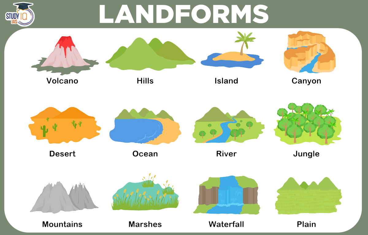
A landform is the land feature on the Earth’s surface, like mountains, hills, plateaus, and plains. Smaller landforms include buttes, canyons, valleys, and basins. Landforms are created by two main processes:
- Tectonic plate movements: Push the ground up.
- Erosion from water and wind: Wear the ground down.
These changes take a long time, sometimes millions of years. For example, the Colorado River took six million years to carve the Grand Canyon in Arizona, which is 446 kilometers (277 miles) long. The tallest landform on Earth is Mount Everest in Nepal, rising 8,850 meters (29,035 feet) high. It is part of the Himalayas range. There are also landforms underwater, like mountain ranges and basins. The Mariana Trench in the South Pacific is the deepest landform on Earth.
Read about: Coastal Landforms
Landforms Definition
Landforms are natural features on the Earth’s surface with unique shapes. They are created by processes like erosion, sedimentation, volcanic activity, and tectonic movements. Landforms can be small, like hills and valleys, or large, like mountain ranges and plateaus. Here are some common examples of landforms:
- Mountains: Elevated areas with significant height and steep slopes, often formed by tectonic forces or volcanic activity.
- Valleys: Low areas between hills or mountains, typically formed by river erosion.
- Plateaus: Flat, elevated areas that have been uplifted by tectonic activity.
- Hills: Raised areas of land with rounded tops, smaller and less steep than mountains.
- Plains: Large, flat, or gently rolling areas of land, often formed by sediment deposition.
- Deserts: Arid regions with sparse vegetation, characterized by sand dunes, rocky plateaus, or barren plains.
- Rivers: Flowing bodies of water that move across the land, carving out valleys and shaping the landscape.
- Lakes: Bodies of water surrounded by land, formed by tectonic activity, glacial processes, or volcanic activity.
- Canyons: Deep, narrow valleys with steep sides, often carved by river erosion.
- Deltas: Landforms created at the mouths of rivers, where sediment is deposited as the river flows into a larger body of water.
Types of Landforms of Earth
The surface of the ground is uneven; certain parts can be rough, while others might be smooth. There is limitless diversity of landforms on the planet.
- Internal Process: The Internal Process causes the earth’s surface to rise and fall.
- External Process: The land surface is always changing because of two processes: erosion and deposition. Landforms can be grouped into different categories based on their slope and height.
- Mountains
- Plains
- Plateaus
Mountains Landforms
A mountain is a raised part of the Earth’s surface with steep sides and exposed rock. Mountains are taller than hills and usually rise at least 300 meters (1,000 feet) above the land around them. They often have smaller peak areas and are mostly found in groups called mountain ranges, though some stand alone.
Fold Mountains: These are formed when two tectonic plates push together. The rocks bend and create cliffs, hills, and peaks. Examples include the Himalayas and the Alps.
Block Mountains: These are made when a block of land rises between two faults. The raised area is called a horst. Block mountains have steep sides but a flat top. Examples include the Rhine Valley and the Vosges in Europe.
Volcanic Mountains: Volcanic mountains occur as a result of volcanic Eruption on the Earth’s surface.
Through the fractures on the Earth’s surface, the magma inside the planet emerges as lava. This repeatedly cools down to create volcanic mountains. Example: Mount Kilimanjaro (Africa), Mount Fujiyama (Japan).
Mountain Landforms Benefits
Many rivers start in glaciers in the mountains, which hold water. Reservoirs collect and store this water for people to use. Water from the mountains is important for making electricity and for farming. Mountains are home to many plants and animals. They provide food, shelter, fuel, and resources like raisins and gum. Mountains also offer peace and quiet for visitors.
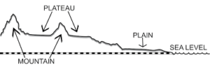
Plains Landforms
Plains are one of the most important landforms on Earth’s surface. A plain is flat land that is low-lying and has gentle slopes with little change in height. Plains cover about 55% of the Earth’s land area. Most plains were formed by sediments left by rivers. Other factors like wind, moving glaciers, and tectonic activity have also helped create some plains.
Examples: Asia and North America are where you can find the greatest plains created by rivers.
The Ganga and Brahmaputra rivers in India and the Yangtze in China create broad plains throughout Asia.
Plains Landforms Benefits
Plains are important for farming because they support grasslands for cattle and have rich, fertile soil for crops. The Indo-Gangetic plains in India have the highest population density.
Plateau Landforms
A plateau is a flat area of high land that rises sharply above the surrounding land on at least one side. In geology, it’s often called a tableland or high plain. Plateaus usually have steep hills on one or more sides.
Examples: One of the oldest plateaus is in India’s Deccan region. Australia’s Western Plateau, Kenya’s East African Plateau, Tibet’s Tibetan Plateau, the world’s tallest plateau, etc.
Plateau Landforms Benefits
Plateaus are valuable because they have many minerals used by different industries. They provide food and essential resources for businesses. Lava plateaus often have rich black soil that is very fertile. Many plateaus also attract tourists.
Formation of Landforms
- Plate Tectonics: Moving plates create mountains, valleys, and plateaus.
- Volcanic Activity: Rising magma forms volcanoes, islands, and lava plateaus.
- Erosion: Water, wind, and ice wear away rocks, forming canyons, valleys, and beaches.
- Deposition: Sediment builds up to create deltas and sand dunes.
- Glaciation: Moving glaciers carve out valleys and moraines.
- Weathering: Natural forces break down rocks, forming caves and arches.
Top 10 Landforms Around the World
| Top 10 Landforms: |
|
Landforms UPSC
Landforms are features on the Earth’s surface that make up the terrain, such as mountains, valleys, plains or plateaux. They also include coastal features, such as peninsulas or bays, and underwater features, such as ocean basins and mid-ocean ridges.
 Sex Ratio in India 2026: Latest Trends, ...
 Civil Disobedience Movement (CDM): Cause...
 Role of Teachers in Educations, Student ...