Table of Contents
Tibetan Plateau
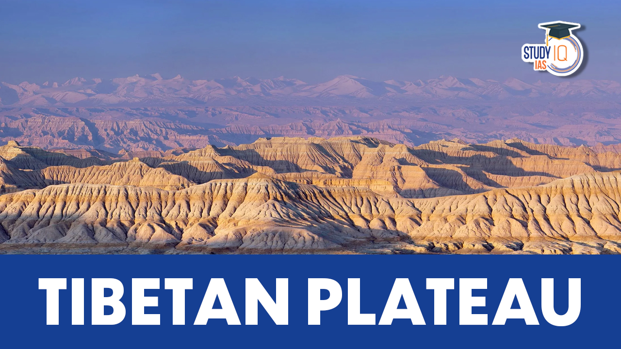
The vast highland region of the Tibetan Plateau, also known as the “Roof of the World,” is situated in Central Asia. Due to its distinctive geographical characteristics, cultural significance, and environmental significance, it is a topic of great interest. In this article will examine the Tibetan Plateau, highlighting its geological features, ecological importance, and current difficulties. Tibetan Plateau is an important part of Geography which an important subject in UPSC Syllabus. Students can also go for UPSC Mock Test to get more accuracy in their preparations.
Tibetan Plateau Geographical Features
The Tibetan Plateau spans an area of approximately 2.5 million square kilometers and is surrounded by towering mountain ranges, including the Himalayas and Kunlun Mountains. With an average elevation of over 4,500 metres (14,800 feet), it is the highest and largest plateau on Earth. The plateau is home to multiple rivers, notably the Yangtze, Yellow, and Brahmaputra, which spring from its glaciers and give water resources to billions of people throughout Asia.
Tibetan Plateau Geopolitical Significance
With a number of nations, including China, India, Nepal, Bhutan, and Myanmar, the Tibetan Plateau shares borders. Due to its location, there have been and still are territorial disputes, which have shaped regional politics and impacted international relations.
Downstream nations rely on the vast network of glaciers and rivers on the plateau, which includes the Indus, Ganges, and Brahmaputra. The management and utilization of these water resources have implications for regional stability and cooperation.
he Tibetan Plateau plays a significant part in China’s grandiose BRI, which intends to connect Asia, Europe, and Africa through infrastructural projects. Due to the plateau’s advantageous location, trade routes and connectivity can pass through it, increasing China’s economic influence in the region.
Also Read: Western Ghats
Tibetan Plateau Physiographic Features
An area’s physiography results from its structure, processes, and developmental stage. The Tibetan Plateau is usually considered the largest and highest area ever to exist in the history of Earth. The plateau averages more than 5,000 metres (16,400 feet) above sea level and covers an area roughly half the size of the contiguous United States.
Due to its massive quantity of glaciers, the Tibetan Plateau is very significant to the global water cycle. Outside of the poles, these glaciers hold the most ice. Massive mountain ranges in High-mountain Asia encircle the Tibetan Plateau. The plateau is bounded to the south by the inner Himalayan range, to the north by the Kunlun Mountains that divide it from the Tarim Basin, and to the northeast by the Qilian Mountains that divide it from the Hexi Corridor and the Gobi Desert.
The headwaters of the upper Indus and Brahmaputra rivers are located in the southern portion of the plateau’s southern region, which is known as Qiangtang. The plateau gives way to the forested gorge and ridge geography of the Salween, Mekong, and Yangtze rivers’ mountainous headwaters in northwest Yunnan and western Sichuan (the Hengduan Mountains) to the east and southeast. The plateau is embraced in the west by the sweeping curve of the rocky Karakoram Range in northern Kashmir. Around Lake Manasarovar on the western Tibetan Plateau, the Indus River is born.
The Yangtze River (Chang Jiang), the Huang He (Yellow River), the Mekong, the Salween, and the Tarim are further rivers that originate in the highlands. Grasslands are utilised for pasturage, and barley is farmed on the plateau; trees grow on the slopes of valleys, particularly in the south. The most extensive farming in Tibet takes place on the fertile plains of the Brahmaputra River and its tributaries. Tibet’s capital Lhasa serves as the main population, economic, cultural, and transportation hub for the plateau.
Tibetan plateaus Effect on Weather Pattern
The differing seasonal amplitudes of surface temperature cycles on land and in the oceans are what create monsoons. This differential warming happens because heating rates differ between land and ocean. The Tibetan Plateau is a significant atmospheric heating surface. Approximately 2,400,000 square kilometres (930,000 sq mi) ice sheet blanketed the plateau. The Himalayan hydrodynamic effect promotes the start of the summer monsoon in early June, not the thermally produced low-pressure centre over northwest India.
At least four times as much radiation energy is reflected into space per unit area by the ice in Tibet as opposed to ice at higher latitudes due to its much lower latitude. In late spring, the Indian subcontinent is heated by solar radiation, making it warmer than the Indian Ocean. The Tibetan plateau, which serves as a high source of heat, is also warmed by it. Consequently, the Indian landmass receives the brunt of the southwest monsoon winds.
By changing this temperature differential, the snow-monsoon teleconnection operates. Because of the snow’s albedo, or reflectivity, the Himalaya and Tibetan plateau have a significant impact on the monsoon. Over the Himalaya and Tibetan plateau, increased snow cover reflects more solar radiation, resulting in less warming of the land surface there than would otherwise occur. As a result, the monsoon winds weaken and the temperature gradient narrows. Due of their reduced moisture content, they don’t get as far north into India.
In the summer, the Tibetan plateau is a major source of heat. A thermal anticyclone that forms above Tibet during the southwest monsoon leads to the development of a dynamic anticyclogenesis. The tropical jet stream originates on the anticyclone’s southern flank. Because of this, there is a sensible heat transfer from Tibet and the Himalayas’ elevated surfaces to the sky. In addition, the monsoon rains over India release a significant quantity of latent heat, which is also added to the upper troposphere anticyclone. The presence of Tibet Highland is crucial for the onset of the monsoon and for shielding India from the chilly winds from the north.
Tibetan Plateau Environmental Significance
In both local and global climate systems, the Tibetan Plateau is essential. The distribution of rainfall across Asia is a result of its high altitude and distinctive topography’s influence on monsoon patterns. Climate shifts on the plateau could have a significant impact on nearby agriculture, water availability, and ecosystems.
The Tibetan Plateau is a hotspot for biodiversity, supporting a large number of endemic species. Famous animals that live there include the snow leopard, Tibetan antelope, and black-necked crane. However, these species and their habitats are threatened by human activity and climate change, making conservation efforts crucial.
Major rivers that support agriculture and habitations downstream are fed by the glaciers and snowfields of the plateau, which serve as a massive water storage. For the livelihoods and ecosystems of millions of people throughout Asia, the sustainability of these water supplies is essential.
Tibetan Plateau Environmental Challenges
The effects of climate change are being felt more quickly on the Tibetan Plateau. Climate change is causing ecosystem changes, altered precipitation patterns, and glacier retreat. For both human communities and wildlife, these changes present serious difficulties.
Rapid economic development has led to expanded infrastructure developments, like as dams, highways, and mining operations, on the Tibetan Plateau. Although these developments may have economic advantages, they also pose risks to the region’s delicate ecosystems, wildlife migration routes, and overall ecological balance.
The future of the Tibetan Plateau depends on striking a balance between conservation efforts and sustainable development. Governments, local communities, and international organizations must work together to safeguard the region’s unique biodiversity, lessen the effects of climate change, and ensure the sustainable use of its resources.
 Sex Ratio in India 2026: Latest Trends, ...
 Civil Disobedience Movement (CDM): Cause...
 Role of Teachers in Educations, Student ...