Table of Contents
Seismic Zones of India
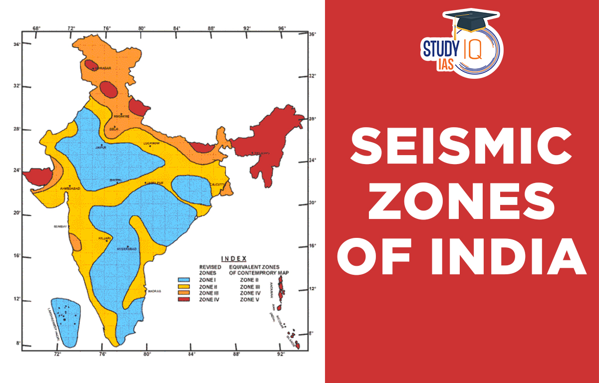
The geology of different areas in the country means that the chances of earthquakes vary by location. To identify these areas, we use a seismic zone map. In 1970, India was divided into five zones (I, II, III, IV, and V) based on past earthquake intensities. Zone V, the highest risk, includes parts of the Himalayas and Kachchh. Seismic zones in India are classified by the Bureau of Indian Standards (BIS). Other agencies like the European Mediterranean Seismological Centre (EMSC) and the United States Geological Survey (USGS) also help set design and construction standards for buildings in different parts of the country.
Seismic zone maps are updated as we learn more about the country’s geology and seismic activity. The first map was made in 1962 and revised in 1967, 1970, and 2002. The 2002 map has four zones (II, III, IV, and V), merging the old Zone I with Zone II. Changes were also made in the peninsular region, with Madras moving from Zone II to Zone III. This map is not final, and we must stay vigilant about seismic hazards.
In high-risk earthquake zones, building codes might need stronger and more flexible materials like steel and concrete. Buildings should be designed to better handle earthquakes. Seismic zones can change over time with new data, so it’s important to use the latest information and follow the right standards for the area.
Read about: Earthquakes in India
Seismic Zones of India Origin
Seismic zones form because of the movement of tectonic plates in the Earth’s crust. These plates move and interact at boundaries. When plates move apart, it is called a divergent boundary. When they move towards each other, it is a convergent boundary. At convergent boundaries, one plate goes under another into the Earth’s mantle a process called subduction. Most of the world’s biggest and most destructive earthquakes happen at these subduction zones.
Read More: Plate Tectonics Theory
Seismic zones are areas where earthquakes are most likely to happen. These zones are found at plate boundaries and places where the Earth’s crust is changing a lot. They can also form near active faults, where two blocks of the Earth’s crust move each other. In India, seismic zones are mainly due to the collision of the Indian Plate with the Eurasian Plate. The Indian Plate started moving north from the Southern Hemisphere about 50 million years ago and collided with the Eurasian Plate around 40 million years ago. This collision continues today. This collision has resulted in the uplift of the Himalayan Mountain range and the formation of the world’s highest peaks, including Mount Everest.
The collision of the Indian and Eurasian plates has also resulted in the formation of several active faults and fault zones that run through the Himalayas, the Indo-Gangetic plain, and other parts of the country. These faults are capable of producing large earthquakes, and the surrounding areas are considered to be seismically active.
Read about: Volcanic Eruption
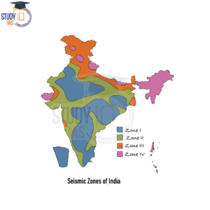
Seismic Zones in India Map
India is divided into four seismic zones based on the level of seismic hazard, with Zone 5 being the most seismically active and Zone 2 being the least.
Some institutes who monitors earthquake
National Centre for Seismology (NCS): Part of the Ministry of Earth Sciences (MoES), NCS monitors earthquakes and conducts seismological research. It runs the National Seismological Network (NSN) with 160 stations across India and provides earthquake data to various agencies.
Institute of Seismological Research (ISR): Conduct seismic surveys for petroleum exploration and mapping of basement structures. ISR also studies deep crustal and lithospheric structures using seismic soundings, tomography, and other surveys.
Earthquake Zones of India
The following is a summary of the four Seismic Zones of India:
| Zone | Description |
| Zone 5 | This zone covers areas that are very prone to earthquakes. Buildings here must be designed and built to handle the strongest earthquakes, covering parts of Jammu and Kashmir, Himachal Pradesh, Uttarakhand, and northeastern India, as well as the Andaman and Nicobar Islands. |
| Zone 4 | This zone covers areas that have a moderate risk of earthquakes. It includes parts of the Himalayan region, the western and eastern coasts, and some central and southern areas of the country. covering the remaining parts of Jammu and Kashmir, Himachal Pradesh, and Uttarakhand, as well as parts of Haryana, Punjab, Delhi, Sikkim, and more. |
| Zone 3 | This zone has a moderate risk of earthquakes and includes Kerala, Goa, the Lakshadweep Islands, and parts of Uttar Pradesh, Haryana, Gujarat, Punjab, West Bengal, and more. |
| Zone 2 | This zone includes areas that have a very low level of seismic hazard and includes parts of the northeastern region of the country. |
Read about: Sea Floor Spreading Theory
Seismic Zones of India UPSC
The seismic zones of India are an important topic in UPSC exams, especially for disaster management and environmental geography. These exams often test knowledge of India’s geography, geology, and seismology, making the seismic zones an important part of the syllabus. The seismic zone map of India is regularly updated with new data on seismic activity. UPSC candidates need to understand these zones and the factors that affect seismic hazards in different areas.
Read about: Aeolian Landforms
 Sex Ratio in India 2026: Latest Trends, ...
 Civil Disobedience Movement (CDM): Cause...
 Role of Teachers in Educations, Student ...