Table of Contents
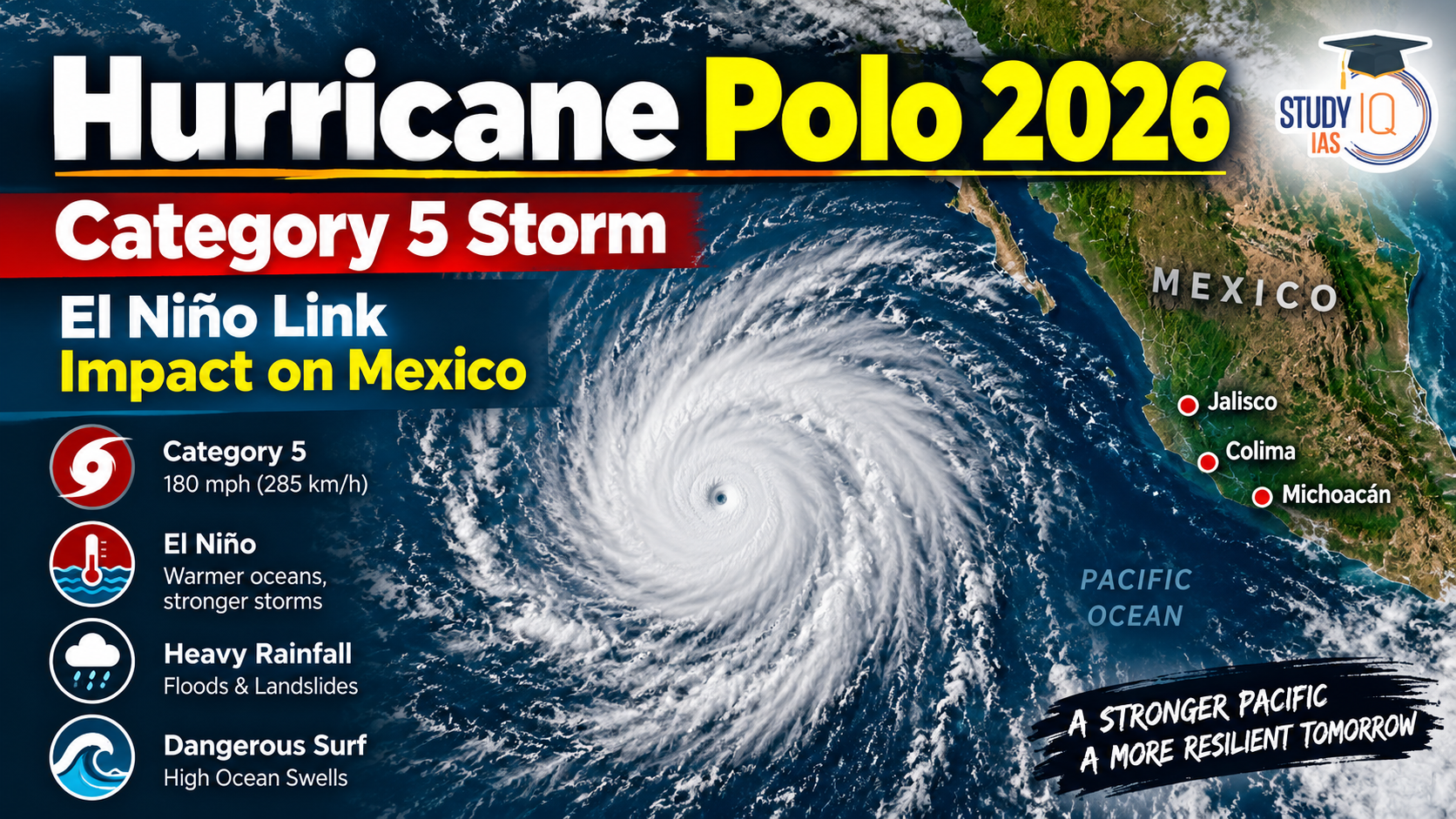
Hurricane Polo 2026 has rapidly intensified in the Eastern Pacific Ocean off the southwestern coast of Mexico, becoming a powerful Category 5 hurricane. The storm has attracted international attention because of its exceptionally rapid strengthening and the extremely warm ocean conditions supporting it.
According to the US National Hurricane Center (NHC), Polo reached maximum sustained winds of approximately 180 mph (285 km/h), while its central pressure fell to around 892 mb. A NOAA Hurricane Hunter aircraft flew into the storm and collected observations confirming its exceptional intensity.
The hurricane was forecast to remain offshore rather than make a direct landfall, but authorities warned of dangerous rainfall, flooding, landslides, large swells and life-threatening surf along parts of Mexico’s Pacific coast.
Read Also: UPSC Daily Current Affairs 2026
Why Did Hurricane Polo Intensify So Rapidly?
The rapid intensification of Polo is closely associated with a highly favourable ocean-atmosphere environment.
Tropical cyclones derive much of their energy from warm ocean waters. High sea-surface temperatures increase evaporation, transferring heat and moisture from the ocean into the atmosphere.
The basic mechanism is:
Warm ocean → increased evaporation → moisture-rich air → condensation → release of latent heat → falling central pressure → stronger winds
As a tropical cyclone strengthens, the pressure difference between its centre and surrounding atmosphere increases. This strengthens the pressure-gradient force and accelerates winds around the storm.
The NHC reported that Polo strengthened by approximately 90 knots in 24 hours, an extraordinary example of rapid intensification.
What Is Rapid Intensification?
Rapid intensification generally refers to an increase of at least 30 knots in maximum sustained winds within 24 hours.
Polo’s reported strengthening was therefore substantially greater than this commonly used threshold.
El Niño Connection
One of the important climate factors associated with the broader Pacific environment in 2026 is El Niño.
El Niño is the warm phase of the El Niño–Southern Oscillation (ENSO), a major coupled ocean-atmosphere phenomenon in the tropical Pacific.
Under normal conditions, trade winds generally push warm surface water towards the western Pacific. During El Niño, these trade winds weaken, allowing warmer surface waters to shift towards the central and eastern Pacific.
This produces:
- Higher sea-surface temperatures in parts of the eastern and central Pacific
- Changes in atmospheric circulation
- Changes in rainfall patterns
- Alterations in tropical convection
- Changes in conditions affecting tropical cyclones
The exceptionally warm Pacific waters provided a favourable energy source for Polo.
However, El Niño alone does not create or determine the intensity of a particular hurricane. Tropical cyclone development also depends on ocean heat content, atmospheric moisture, vertical wind shear, upper-level outflow, atmospheric stability and the storm’s internal structure.
Therefore, Polo’s exceptional intensity should be understood as the result of a combination of favourable conditions.
Impact of Hurricane Polo on Mexico
Although Polo was forecast to remain offshore, a major hurricane can produce severe impacts without making direct landfall.
Heavy Rainfall
Polo was expected to produce substantial rainfall along parts of southwestern Mexico. Prolonged rainfall can overwhelm drainage systems and cause flash flooding.
Flooding and Landslides
Mountainous areas are particularly vulnerable to landslides and mudslides when intense rainfall saturates the soil. Rivers and streams can also rise rapidly.
Dangerous Surf and Ocean Swells
Large hurricanes generate powerful ocean swells. These can reach coastal areas far from the storm’s centre and create dangerous conditions for swimmers, fishermen and coastal communities.
Mexican authorities urged residents in vulnerable Pacific coastal states, including Jalisco, Colima and Michoacán, to remain vigilant.
Category 5 Hurricane: Saffir–Simpson Scale
The Saffir–Simpson Hurricane Wind Scale classifies hurricanes according to maximum sustained wind speed.
| Category | Sustained Wind Speed |
|---|---|
| Category 1 | 119–153 km/h |
| Category 2 | 154–177 km/h |
| Category 3 | 178–208 km/h |
| Category 4 | 209–251 km/h |
| Category 5 | 252 km/h or higher |
With winds of around 285 km/h, Hurricane Polo falls within the Category 5 classification.
Key Takeaways
- Hurricane Polo developed in the Eastern Pacific Ocean.
- It intensified into a Category 5 hurricane.
- Maximum reported sustained winds reached around 285 km/h.
- Its central pressure fell to approximately 892 mb.
- Exceptionally warm ocean waters provided favourable conditions for strengthening.
- The storm underwent rapid intensification.
- The broader Pacific environment was influenced by a strong El Niño.
- Polo was forecast to remain offshore but posed risks from heavy rainfall, flooding, landslides and dangerous surf.
- The event highlights the importance of cyclone forecasting, early warnings and disaster preparedness.

 East Sea (Sea of Japan): Location, Count...
 WMO State of Global Water Resources 2025...
 FCRA Amendment Bill 2026: Key Provisions...














 WhatsApp