Table of Contents
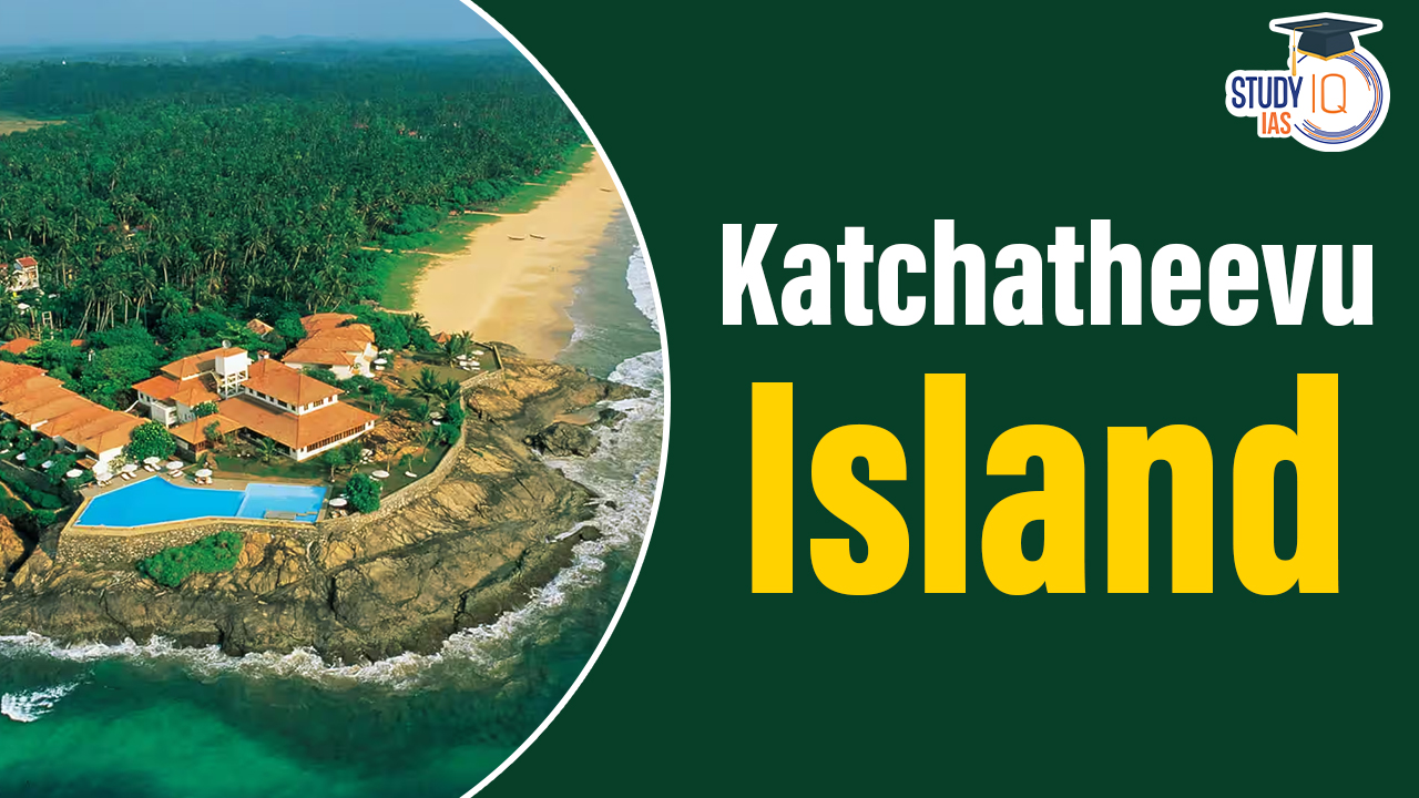
Context: The Sri Lankan president recently visited Katchatheevu Island. Prime Minister Modi criticised the ceding of Katchatheevu to Sri Lanka in 1974 by the then Indira Gandhi Government.
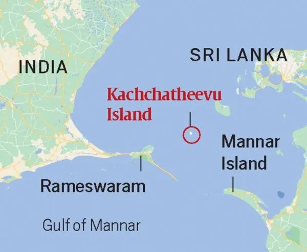
About Katchatheevu Island
- Katchatheevu is an uninhabited offshore island in the Palk Strait.
- It has been used by fishermen from both countries for centuries as a resting point during fishing expeditions in the Palk Strait.
- The island lacks fresh water sources, making it unsuitable for permanent habitation.
- Geographical Location: Katchatheevu is a small, uninhabited island in the Palk Strait, positioned northeast of Rameswaram (India) and southwest of Jaffna (Sri Lanka).
Physical Characteristics of Katchatheevu Island
- Size and Shape: The island spans 285 acres, measures about 1.6 km in length, and is over 300 m wide at its widest point.
- Accessibility: It is situated approximately 33 km from the Indian coast and 24 km from Delft Island, Sri Lanka.
- Natural Features: The island lacks fresh water sources, making it unsuitable for permanent habitation.
Key Landmark
St Anthony’s Church: The sole structure on the island, dating back to the early 20th century, where annual religious festivals attract pilgrims from both India and Sri Lanka.
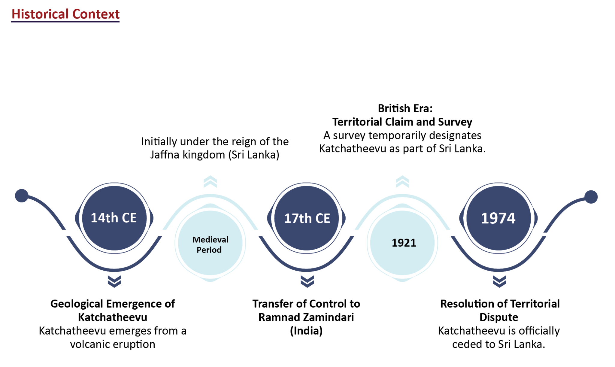
Historical Context of Katchatheevu Island
- Geological Origin: Katchatheevu emerged from a volcanic eruption in the 14th century, making it a geologically recent formation.
- Early Control: Initially under the reign of the Jaffna kingdom (Sri Lanka) in the medieval period, it later came under the control of the Ramnad Zamindari (India) in the 17th century.
- British Era: Incorporated into the Madras Presidency during British rule, the island was subject to a territorial claim by both India and Sri Lanka in 1921, aiming to define fishing boundaries. A survey temporarily designated it as part of Sri Lanka, a decision contested by a British delegation from India, citing historical ownership by the Ramnad kingdom.
- Resolution: The territorial dispute remained unresolved until 1974, when it was officially ceded to Sri Lanka by India.
Indo-Sri Lankan Maritime Agreement of 1974
- Settlement Objective: Aimed to definitively resolve the maritime boundary between India and Sri Lanka.
- Cession of Katchatheevu: Indira Gandhi ceded Katchatheevu to Sri Lanka, deeming it of minimal strategic value, to strengthen ties with Sri Lanka.
- Fishing Rights: The agreement allowed Indian fishermen access to Katchatheevu for rest, drying nets, and shrine visits without a visa, though it left some issues regarding fishing rights.
Subsequent Developments
- 1976 Agreement: The fishing vessels and fishermen of India shall not engage in fishing in the historic waters, the territorial sea and the Exclusive Economic Zone of Sri Lanka, creating ambiguity over fishing rights near Katchatheevu.
- Impact of Sri Lankan Civil War (1983-2009): The conflict put border disputes on hold, with Indian fishermen often encroaching into Sri Lankan waters, leading to tensions over fishing practices and resources.
Post-Civil War Period
- Maritime Defence Enhancement: Post-2009, with the civil war’s end, Sri Lanka intensified its maritime security, focusing on protecting its waters from foreign fishermen.
- Increased Enforcement: The Sri Lankan navy began strictly enforcing maritime boundaries, leading to the arrest and, in some cases, allegations of mistreatment of Indian fishermen.
- Renewed Demands for Katchatheevu: Incidents involving the Sri Lankan navy and Indian fishermen have reignited calls for India to reclaim Katchatheevu.
Tamil Nadu’s Stance on Katchatheevu Island
- Historical Claims: References the historical governance of the island by the Ramnad zamindari and the traditional fishing rights of Indian Tamil fishermen.
- Lack of Consultation: Highlights that Katchatheevu was ceded to Sri Lanka without the consent of the Tamil Nadu State Legislative Assembly.
- Resolution for Retrieval: In 1991, the Tamil Nadu Assembly passed a resolution calling for the island’s return.
Legal Actions
- 2008: Tamil Nadu argued in court that ceding Katchatheevu required a constitutional amendment.
- 2012: Approached the Supreme Court to address the issue promptly, citing increased arrests of Indian fishermen by Sri Lankan authorities.
 World Bear Day 2026: Date, Theme, Histor...
 Shaheed Diwas 2026: History, Significanc...
 Mahad Satyagraha 1927, History and Signi...