Table of Contents
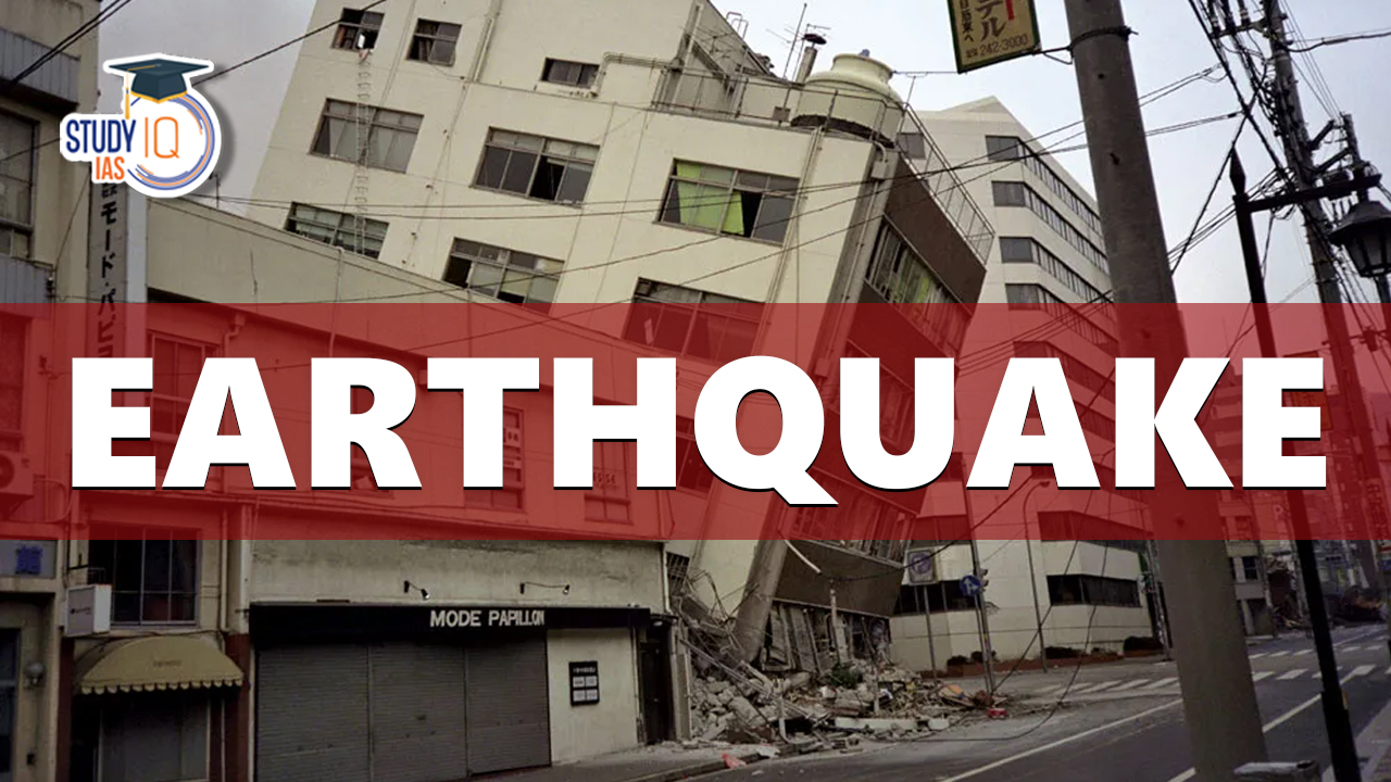
On August 8, 2024, a powerful earthquake with a magnitude of 7.1 struck the southern island of Kyushu, Japan, causing significant concern across the region. The earthquake, which was recorded at a depth of approximately 30 kilometers off Kyushu’s eastern coast, has triggered a tsunami advisory, urging residents and visitors in the affected areas to take immediate precautions.
Earthquake in Japan
The earthquake occurred on Thursday afternoon, shaking Kyushu and surrounding regions. According to the Japan Meteorological Agency (JMA), the quake was centered off the eastern coast of Kyushu, one of Japan’s four main islands. The seismic event is part of Japan’s ongoing exposure to frequent earthquakes due to its location along the Pacific Ring of Fire, a tectonic belt known for its seismic activity.
Magnitude and Location of Japan Earthquake
The earthquake, measuring 7.1 on the Richter scale, hit the southern part of Japan, particularly affecting the island of Kyushu. The Japan Meteorological Agency (JMA) reported that the epicenter was located off the eastern coast of Kyushu, a region known for its seismic activity due to its position along the Pacific Ring of Fire.
Casualties and Immediate Response
As of the latest reports, there have been no confirmed casualties resulting from the earthquake. However, the situation remains fluid, with authorities closely monitoring affected areas for any developments. The lack of immediate casualties is a testament to Japan’s stringent building codes and comprehensive disaster preparedness measures, which have been developed over decades to minimize the impact of such natural disasters.
In response to the earthquake, the Japanese government quickly established an emergency task force to oversee the situation. Local authorities in the affected regions have been instructed to conduct thorough inspections of infrastructure, including buildings, roads, and bridges, to ensure their safety and integrity. Emergency services have been deployed to assist with evacuations and provide aid to those in need.
Impacts on the Region
- Tsunami Advisory:
- The JMA issued a tsunami advisory for several regions along Kyushu’s southern coast and the nearby island of Shikoku. The advisory specifically targets the Miyazaki, Oita, Kagoshima, Kochi, and Ehime prefectures.
- The tsunami advisory predicts waves of up to 1 meter in height, prompting authorities to urge residents to evacuate coastal areas and move to higher ground.
- Infrastructure and Property Damage:
- While no major damage has been reported immediately following the earthquake, the potential for structural damage to buildings and infrastructure exists, especially in regions closer to the epicenter. Authorities are conducting detailed assessments to determine the full extent of any damage.
- Power outages and disruptions to transportation services have been reported in some areas, though efforts are underway to restore services as quickly as possible.
- Public Safety Measures:
- Residents in the affected areas have been advised to remain indoors, avoid coastal regions, and follow official guidance regarding evacuations and safety precautions.
- The JMA continues to monitor the situation closely, providing regular updates on aftershocks and the status of the tsunami advisory.
Japan’s Preparedness and Seismic Vulnerability
Japan’s location along the Pacific Ring of Fire makes it one of the most seismically active countries in the world. The constant interaction of tectonic plates in this region leads to frequent earthquakes, ranging from mild to severe. Japan’s experience with such natural disasters has led to the development of advanced early warning systems, strict building codes, and a culture of disaster preparedness that prioritizes public safety.
Potential Aftershocks and Ongoing Monitoring
As is common after a major earthquake, there is a likelihood of aftershocks in the coming days. The JMA and other relevant authorities are closely monitoring seismic activity in the region to provide timely warnings and updates to the public.
About Earthquakes
- An earthquake is a sudden release of energy in the Earth’s crust that creates seismic waves.
- Key terms related to earthquakes:
- Focus: The focus, also known as the hypocentre, is the point within the Earth where an earthquake originates.
- Epicentre: The point on the Earth’s surface directly above the focus or source of an earthquake.
- Aftershocks: Smaller earthquakes that occur after a larger earthquake, as the Earth adjusts to the sudden movement.
- Seismic waves: The waves of energy that travel through the Earth’s crust and cause ground shaking during an earthquake.

Causes of Earthquakes
- Plate tectonics: The movement of the Earth’s tectonic plates can cause earthquakes when the plates interact along plate boundaries.
- Volcanic activity: Earthquakes can occur when magma moves beneath a volcano, causing the ground to shake.
- Human activity: Human activities, such as the injection of fluid into the ground for waste disposal, or the extraction of oil and gas from underground reservoirs, can induce earthquakes.
- Reservoir-induced earthquakes: The filling or emptying of large reservoirs, such as lakes or dams, can cause earthquakes as the weight of the water changes and affects the Earth’s crust.
- Glacial rebound: The movement of glaciers can cause earthquakes as they advance or retreat and cause changes in the Earth’s crust.
Measurement of earthquakes
The magnitude and intensity of an earthquake are two ways to measure its size and impact.
- Magnitude: The magnitude of an earthquake is a measure of its energy release, and is determined from measurements of the seismic waves generated by the earthquake.
- The most commonly used scale for measuring earthquake magnitude is the Richter scale, which was developed in the 1930s.
- The Richter scale ranges from 0 to 9, with each increase in magnitude representing a tenfold increase in energy release.
- Intensity: The intensity of an earthquake is a measure of its impact at a specific location, and is determined by the effects of the seismic waves on the ground, buildings, and people.
- The most commonly used scale for measuring earthquake intensity is the Modified Mercalli Intensity (MMI) scale, which ranges from I to XII.
- The MMI scale takes into account factors such as the type of building construction, the height of the building, and the distance from the earthquake’s epicenter.
Seismic waves: Seismic waves are waves of energy that travel through the Earth’s crust and cause the ground to shake during an earthquake.

Read More: Earthquake in India
India’s Earthquake Propensity
India’s large and increasing population coupled with unsustainable construction and planning that include multi-storeyed buildings and skyscrapers, keep India at high earthquake risk.
- Over the past 2 decades, the country has experienced 10 major earthquakes that have resulted in over 20,000 deaths.
- As per the current seismic zone map of the country, over 59% of India’s land area is under threat of moderate to severe seismic hazard.
- The entire Himalayan belt is considered prone to hazardous earthquakes of magnitude exceeding 8.0.
- Example: 1897 Shillong Earthquake (M8.7); 1905 Kangra (M8.0); 1950 Assam-Tibet earthquake etc (M8.6).
- Himalayas is the region of convergence of Indian and Eurasian plates.
- The Indian plate is moving at a speed of one centimetre per year towards the north and northeastern direction.
- The entire Himalayan belt is considered prone to hazardous earthquakes of magnitude exceeding 8.0.
- In the recent past, the inter-plate boundary areas have also been experiencing devastating earthquakes, although the magnitude is lesser than the Himalayan earthquakes.
- The Andaman and Nicobar Islands are situated on an inter-plate boundary and frequently experience damaging earthquakes.
- The North-Eastern part of the country continues to experience moderate to large earthquakes at frequent intervals.
- On average, the region experiences an earthquake with a magnitude greater than 6.0 every year.

Earthquake Zones of India
India is divided into four earthquake zones (Zone II-Zone V).
- There was a change in the earthquake map of India where the Very low-risk zone and Low-risk zone were merged into a single ‘low-risk zone’.
- Zone IV and Zone V have experienced some of the most devastating earthquakes in India.
- These include North-east states, areas to the north of Darbhanga and Araria along the Indo-Nepal border in Bihar, Uttaranchal, Western Himachal Pradesh (around Dharamshala) and Kashmir Valley in the Himalayan region and the Kuchchh region of Gujarat.
- Most of the areas that are safe are from the stable landmass covered under the Deccan plateau.

Impact of Earthquakes
- Damage to life and property: Earthquakes of high magnitude cause total collapse of the entire structure/building. This is accompanied by the disruption of underground pipelines and railway lines and the collapse of dams which cause sudden floods that endanger life and livelihood.
- Changes in river courses: Sometimes river channels are blocked or their courses are changed due to the impact of earthquakes.
- Tsunami and other associated disasters: Earthquakes cause Tsunamis which disrupt living in settlements of coastal areas. It sinks large ships. Example: Tsunami in Indonesia The Tsunami near the Sumatra coast cost properties worth billions of rupees.
- Landslides and avalanches are also caused by Earthquakes.
Earthquake Hazard Mitigation
- Establishing earthquake monitoring centres (seismological centres) for regular monitoring and fast dissemination of information among the people in vulnerable areas.
- Preparing a vulnerability map of the country disseminating vulnerability risk information among the people and educating them about how and means to minimise the adverse impacts of disasters.
- Community preparedness: Community preparedness is like the ‘DROP, COVER and HOLD’ technique in case of earthquakes.
- Planning: The Bureau of Indian Standards has published building codes and guidelines for safe construction of buildings against earthquakes. All infrastructure both the already existing ones and the upcoming ones needs to be upgraded by retrofitting techniques.
- Public education is educating the public on the causes and characteristics of an earthquake and preparedness measures that can be created through sensitization and training programmes for the community, architects, engineers, builders, masons, teachers, government functionaries teachers and students.
- Engineered structures: Buildings need to be designed and constructed as per the soil strength and building structures on soft soil should be avoided as they are more likely to get damaged even if the magnitude of the earthquake is not strong.
- Similar problems persist in the buildings constructed on the river banks which have alluvial soil.
- Strengthening the Preparedness Phase Urban Planning and Zoning -There is a need to enhance the efforts for integrating disaster risk reduction elements in settlement planning and land use zoning to mitigate flood and earthquake risks. Planned urban settlements and housing are the need of the day for disaster risk management that leads to sustainable development, particularly in ecologically sensitive regions, high-risk locations and high population density pockets.
Initiatives taken by the Government for Earthquake Risk Reduction and Mitigation
- National Earthquake Risk Mitigation Project (NERMP): The proposed project aims at strengthening the structural and non-structural earthquake mitigation efforts and reducing the vulnerability in high-risk districts prone to earthquakes. The proposed components of the project include a techno-legal regime, institutional strengthening, capacity building public awareness etc.
- National Building Code (NBC): The National Building Code of India (NBC), a comprehensive building code, is a national instrument providing guidelines for regulating building construction activities across the country. The salient features of the revised NBC include meeting the challenges posed by natural calamities and reflecting the state-of-the-art and contemporary applicable international practices.
- Efforts by Building Materials & Technology Promotion Council (BMTPC): The BMTPC has undertaken projects for retrofitting of life-line structures to generate awareness among the people as well as various government agencies about the need and techniques of retrofitting. The Council has initiated retrofitting of MCD school buildings in Delhi.
- Initiative by Ministry of Panchayati Raj: It releases funds under the Backward Regions Grant Fund (BRGF) for meeting critical infrastructural gaps and other developmental requirements. The ministry has financed several district plans under the BRGF for the construction of panchayat buildings, Anganwadi centres, school buildings, classrooms, roads, bridges, culverts etc.
- Disaster Management Support (DMS) of ISRO: This program provides timely support and services from aerospace systems, both imaging and communications, towards efficiently managing disasters in the country. The DMS programme addresses disasters such as floods, cyclones, droughts, forest fires, landslides and earthquakes. These include:
-
- creation of a digital database for facilitating hazard zonation, damage assessment etc.,
- monitoring of major natural disasters using satellite and aerial data
- development of appropriate techniques and tools for decision support
- establishing a satellite-based reliable communication network.
- deployment of emergency communication equipment and
- R&D towards early warning of disasters.
- Indian National Centre for Oceanic Information System (INCOIS): It gives information to all responders about the origin, time, location of the epicentre, magnitude and depth of an earthquake inside the ocean and accordingly issues bulletins.
- Tsunami Early Warning System (TEWS) at INCOIS is capable of detecting all earthquake events of more than 6 Magnitude occurring in the Indian Ocean in less than 20 minutes of occurrence and the first report on the occurrence of an earthquake in India and the Indian Ocean region is sent to MHA within 25-30 minutes indicating the location and magnitude of the earthquake.
 Nicobarese Tribal Governance Debate 2026...
 Global Peace Index 2026: Top 10 Safest C...
 NITI Aayog Governing Council Meeting 202...