Table of Contents
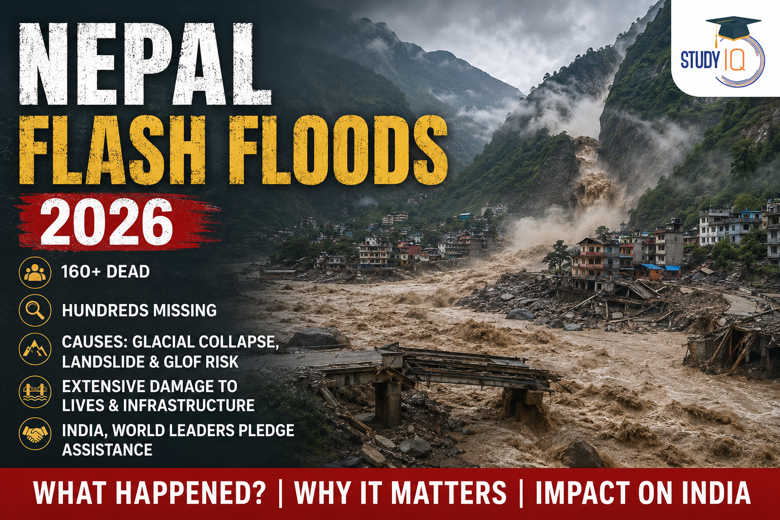
A devastating flash flood and mudslide struck the Nepal-Tibet border on August 26, 2026, causing widespread destruction across Nepal’s Rasuwa region and parts of Tibet. The disaster swept away homes, roads and bridges, damaged hydropower infrastructure and left hundreds of people missing.
The death toll in Nepal has crossed 160, while hundreds of tourists and local residents remain unaccounted for. The affected region is particularly important because it is a major route for trekkers and pilgrims travelling towards Mount Kailash and Lake Manasarovar.
The disaster has also raised concerns about the growing vulnerability of the Himalayan region to glacial hazards, landslides and sudden floods.
What Caused the Nepal Flash Flood?
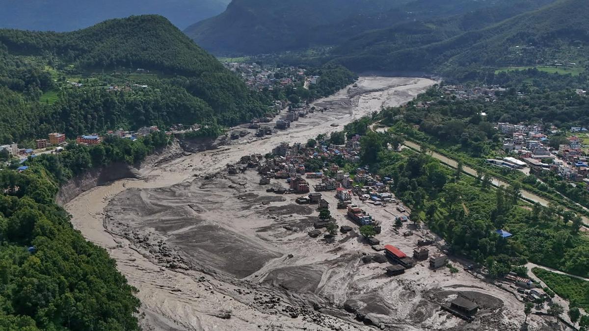
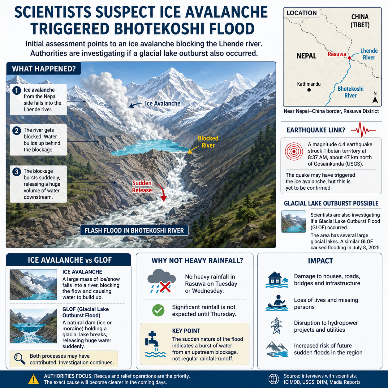
The precise sequence of events is still being investigated. Initial reports suggested that an earthquake may have triggered a landslide, which subsequently blocked a river and caused a sudden release of water.
However, the U.S. Geological Survey (USGS) later indicated that the seismic signal initially interpreted as an earthquake was actually generated by a landslide and debris flow.
Scientists are also investigating whether a glacial collapse or ice avalanche initiated the landslide and whether a glacial lake outburst flood (GLOF) contributed to the disaster.
A possible sequence is:
Glacial/Ice Collapse → Landslide & Debris Flow → River Blockage → Sudden Water Release → Flash Flood
The exact mechanism will become clearer after satellite imagery, hydrological data and field investigations are analysed.
Bhotekoshi River and Rasuwa Region
The Bhotekoshi River became one of the major channels through which the floodwaters and debris moved downstream.
The worst-affected area includes Rasuwa district, located along Nepal’s northern border with China’s Tibet Autonomous Region.
The region is characterised by:
- Steep Himalayan terrain
- Glaciers and glacial lakes
- Narrow river valleys
- Landslide-prone slopes
- Major trekking and pilgrimage routes
- Hydropower projects
These geographical characteristics can amplify the impact of sudden high-altitude disasters.
Read Also: UPSC Daily Current Affairs 2026
Glacial Collapse: What Does It Mean?
A glacial collapse occurs when a large mass of ice breaks away from a glacier or mountain ice mass. The falling ice can pick up enormous quantities of rock, soil and sediment.
This can create a powerful debris flow capable of:
- Blocking a river
- Creating a temporary natural dam
- Displacing huge volumes of water
- Destroying bridges and roads
- Triggering downstream flash floods
This is different from a conventional flood caused by prolonged rainfall.
Could It Be a Glacial Lake Outburst Flood?
Another possibility being investigated is a Glacial Lake Outburst Flood (GLOF).
Glacial lakes form when meltwater accumulates near glaciers. They may be contained by natural dams made of ice, rock or glacial debris.
If such a natural dam fails, enormous quantities of water can suddenly rush downstream.
GLOF Process
Glacier Melt → Glacial Lake Formation → Natural Dam Weakening → Sudden Breach → Catastrophic Downstream Flood
The Himalayan region contains thousands of glacial lakes, some of which are considered potentially hazardous.
However, it is important to distinguish between a confirmed GLOF and a suspected GLOF. In the Nepal disaster, investigators are still determining whether a glacial lake outburst occurred.
Why Was the Flood So Destructive?
The Himalayan landscape can significantly increase the destructive power of flash floods.
- Sudden onset: A rapid ice-rock avalanche and debris flow generated a powerful flood wave with little warning.
- Steep Himalayan terrain: Narrow valleys accelerated and concentrated the floodwaters and debris.
- Huge debris load: Ice, rocks, mud and boulders greatly increased the destructive force of the flow.
- Rapid water rise: River levels reportedly rose by up to 9 metres within 30 minutes downstream.
- Infrastructure in vulnerable corridors: Roads, bridges, settlements and hydropower projects located along river valleys were directly exposed.
- Cross-border impact: The flood affected both Nepal and Tibet, complicating rescue and relief operations.
Impact on Tourists and Pilgrims
The disaster occurred in an area that attracts large numbers of international visitors.
The route is particularly important for people travelling towards:
- Mount Kailash
- Lake Manasarovar
- Gosaikunda
- Himalayan trekking destinations
At the time of the disaster, many tourists were travelling through the region. Hundreds were subsequently reported missing or out of contact, including significant numbers of Indian, American, Australian and British nationals.
The incident has therefore become not only a natural-disaster emergency but also a major international search-and-rescue operation.
Impact on Hydropower Projects
Nepal’s rivers have enormous hydropower potential, and the Bhotekoshi and Trishuli corridors contain several hydropower facilities.
The flash flood caused extensive damage to infrastructure, highlighting a major challenge for Himalayan hydropower development:
High hydropower potential also means high exposure to mountain hazards.
Floods carrying boulders, mud, ice and debris can damage powerhouses, transmission infrastructure, access roads and bridges.
Is Climate Change Responsible?
Climate change is an important factor in understanding the changing risk environment of the Himalayas, but it would be premature to attribute this particular disaster directly to climate change.
Rising temperatures are contributing to glacier retreat and changes in the stability of high-altitude environments. In some locations, this can increase the formation or expansion of glacial lakes and potentially increase GLOF risk.
However, individual disasters can have multiple triggers, including:
- Glacier instability
- Landslides
- Ice avalanches
- Extreme rainfall
- River blockages
- Glacial lake breaches
- Seismic activity
Therefore, scientists need event-specific evidence before establishing a direct causal relationship with climate change.
Nepal Flash Floods and India
The disaster also has implications for India because Nepal’s rivers eventually flow into the Ganga river system.
Sudden floods originating in the Himalayan region can affect downstream areas and raise concerns for states such as Bihar and Uttar Pradesh, particularly when water levels rise rapidly.
India’s geographical proximity to Nepal also means that disasters involving Indian tourists require rapid coordination between:
- Indian diplomatic missions
- Nepalese authorities
- State governments
- Disaster-response agencies
- Tour operators
- Local rescue teams
India has offered humanitarian assistance to Nepal and has also been coordinating efforts concerning Indian nationals affected by the disaster.
What Does the Disaster Tell Us About Himalayan Risk?
The Nepal flash flood demonstrates that Himalayan disasters are increasingly multi-hazard events.
A single event may involve several processes:
Glacier instability + Landslide + Debris Flow + River Blockage + Flash Flood
This makes disaster prediction particularly difficult.
Traditional flood forecasting based primarily on rainfall may not be sufficient in high-altitude regions. Greater emphasis is needed on:
- Satellite monitoring
- Glacier and glacial-lake surveillance
- Seismic monitoring
- Early-warning systems
- Hazard mapping
- Cross-border data sharing
- Climate-resilient infrastructure
- Community preparedness

UPSC IAS Live GS P2I Foundation 2027 Pratigya August Evening Batch 2 (Basic)
Conclusion
The Nepal flash floods of 2026 have exposed the extreme vulnerability of Himalayan communities, infrastructure and tourism corridors to sudden mountain hazards.
While the initial theory focused on an earthquake, subsequent analysis indicates that the seismic signal was associated with a landslide and debris flow. Scientists are still investigating whether an ice avalanche, glacial collapse or GLOF played a role in initiating the chain of events.
The disaster is a reminder that the Himalayas are not simply a source of water and hydropower—they are also a highly dynamic geological and climatic system where glacial, geological and hydrological hazards can interact within minutes.
Understanding these interactions will be crucial for improving early-warning systems, protecting Himalayan infrastructure and reducing the human cost of future disasters.
 Child Marriage in India: Causes, Impacts...
 World Development Report 2026: The Promi...
 US Suspension of PERM Filings by Major I...














 WhatsApp