Table of Contents
Context: The tragic incident of a landslip/landslide recently occurred in the hamlet of Irshalwadi in Raigad district, located 65 km from Mumbai, Maharashtra.
More on the News
- The incident cost several lives.
- The lack of a proper motorable road to the village made it difficult for heavy machinery like earth movers and excavators to reach the site.
- Consequently, rescue operations were delayed, and teams from the National Disaster Response Force, State Disaster Response Force, NGOs, and trekkers’ outfits had to perform operations manually.
- Poor visibility, gusty winds, intense downpour, and thick mud further hindered the rescue efforts, and the risk of more mud slips added to the dangers faced by the rescue teams.
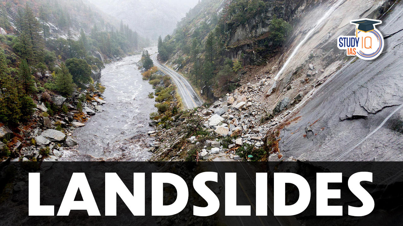
What are Landslides?
- Landslide is the rapid sliding of large mass of bedrocks.
- It is defined as the movement of a mass of rock, debris, or earth down a slope.
- They are a type of mass wasting, which denotes any downward movement of soil and rock under the direct influence of gravity.
- As per the United Nations International Strategy for Disaster Reduction (UN/ISDR), landslide ranked 3rd in terms of number of deaths among the top ten natural disasters.

- Landslide classification: The term landslide encompasses five modes of slope movement i.e., falls, topples, slides, spreads, and flows.
- Falls: Falls are rapid movements of rocks and boulders detached from steep slopes or cliffs along fractures, joints, and bedding planes.
- Topple: It is the forward rotation of a mass of debris or rock out of a slope. The slope failure generally occurs at point near the base of the block of rock.
- Slides: A slide is a downslope movement of material that occurs along a slip surface.
- Lateral Spreads: It is the lateral movement usually occur on very gentle slopes or flat terrain. The failure is caused by liquefaction due to earthquake.
- Flow: It refers to the movement of soil, rock, or other debris down a slope in a fluid-like manner.

Causes of Landslides
| Natural Causes | Anthropogenic Causes |
|
|
Key Highlights from the ‘Land Slide Atlas of India 2023’
- India’s vulnerability to landslides: India is among the top four countries with highest landslide risk, where for every year the estimated loss of life per 100 km2 is greater than one.
- Approximately 0.42 million sq. km or 12.6% of land area of India, excluding snow covered area, is prone to landslide hazard.
- In India, landslides mostly occur in the monsoon season. Himalayas and Western Ghats are highly susceptible to mass movements due to hilly topography and heavy rainfall.
- Most vulnerable districts: Rudraprayag and Tehri Garhwal in Uttarakhand are the most landslide-prone districts in the country.
- Rajouri, Thrissur, Pulwama, Palakkad, Malappuram, South Sikkim, East Sikkim and Kozhikode in Kerala, Jammu Kashmir and Sikkim are other high-risk districts, found the Atlas.
- Maximum landslides: Between 1988 and 2022, the maximum number of landslides — 12,385 — were recorded in Mizoram.
- Uttarakhand followed it at 11,219, Tripura at 8,070, Arunachal Pradesh at 7,689, Jammu and Kashmir at 7,280.
- Causes of landslides:
- Rainfall variability: The majority of landslides are triggered by variability in rainfall patterns.
- Climate change: Sudden heavy rains due to climate change are also increasing landslides, said the report.
- Himalayan region: Around 73 per cent of landslides in the Himalayan region are attributed to heavy rains and reduced water-absorbing capacity of the soil.
- Vulnerability of the Himalayas and the Western Ghats
| The Himalayas | The Western Ghats |
|
|
Landslide Vulnerability Zones in India
- Very High Vulnerability Zone:
- Highly unstable, relatively young mountainous areas in the Himalayas and Andaman and Nicobar, high rainfall regions with steep slopes in the Western Ghats and Nilgiris, the north-eastern regions, along with areas that experience frequent ground-shaking due to earthquakes, etc. and areas of intense human activities, particularly those related to construction of roads, dams, etc. are included in this zone.
- High Vulnerability Zone:
- Areas that have almost similar conditions to those included in the very high vulnerability zone are also included in this category.
- The only difference between these two is the combination, intensity and frequency of the controlling factors.
- All the Himalayan states and the states from the north-eastern regions except the plains of Assam are included in the high vulnerability zones.
- Moderate to Low Vulnerability Zone:
- Areas that receive less precipitation such as Trans Himalayan areas of Ladakh and Spiti (Himachal Pradesh), undulated yet stable relief and low precipitation areas in the Aravali, rain shadow areas in the Western and Eastern Ghats and Deccan plateau also experience occasional landslides.
- Landslides due to mining and subsidence are most common in states like Jharkhand, Odisha, Chhattisgarh, Madhya Pradesh, Maharashtra, Andhra Pradesh, Karnataka, Tamil Nadu, Goa and Kerala.
- Other Areas:
- The remaining parts of India, particularly states like Rajasthan, Haryana, Uttar Pradesh, Bihar, West Bengal (except district Darjeeling), Assam (except district Karbi Anglong) and Coastal regions of the southern States are safe as far as landslides are concerned.

Consequences of Landslides
- Disruption to infrastructure: Landslides have relatively small and localised area of direct influence, but roadblock, destruction of railway lines and channel blocking due to rock-falls have far-reaching consequences.
- Diversion of River Channel: Diversion of river courses due to landslides can also lead to flood and loss of life and property.
- Difficult Spatial Interaction: It also makes spatial interaction difficult, risky as well as a costly affair, which, in turn, adversely affects the developmental activities in these areas.
Mitigation of Landslides
Structural Measures:
- Retaining Walls: Constructing retaining walls can provide support and stabilize slopes by preventing soil movement.
- Slope Reinforcement: Techniques such as soil nailing, ground anchors, and geosynthetics (e.g., geotextiles, geogrids) can be used to reinforce the slope and increase its resistance to sliding.
- Drainage Systems: Proper drainage systems are crucial in managing water flow and reducing excess pore water pressure in slopes.
- Terracing: In hilly or mountainous regions, terracing involves creating a series of level platforms or steps on slopes. This technique helps break the slope into smaller segments, reducing the potential for large-scale landslides and promoting soil conservation.
Non-Structural Measures
- Early Warning Systems: Implementing early warning systems can provide timely alerts to communities at risk of landslides.
- Land-Use Planning and Zoning: Proper land-use planning can help prevent or minimize the construction of critical infrastructure or settlements in landslide-prone areas.
- Vegetation Management: Maintaining healthy vegetation on slopes is crucial for slope stability as plant roots bind the soil and increase its resistance to erosion.
- Public Awareness and Education: Educating communities about landslide risks, safe practices, and preparedness can help minimize the impact of landslides.
- Slope Monitoring and Assessment: Regular monitoring and assessment of slopes in landslide-prone areas can help detect early signs of instability.
NDMA Guidelines on Landslide Hazard Management
Landslide hazard management involves measures taken to avoid or mitigate the risk posed by landslide hazards.
- Landslide Hazard, Vulnerability and Risk Assessment: This includes delineating areas susceptible to landslide hazards and status of landslide hazards in different areas and to assess the resources at risk due to these hazards 2
- Landslide Remediation Practice: Encouraging implementation of successful landslide remediation and mitigation technologies.
- Research and Development; Monitoring and Early Warning
- Knowledge Network and Management: Establishing an effective system for gathering information on landslides, loss assessment resulting from landslides, and the effective dissemination of technical information and maps is an essential component of the disaster management process.
- Capacity Building and Training: Developing institutional capacity and training for geoscientists engineers, and planners is necessary for effective management of the landslide hazard.
- Public Awareness and Education: The Public should have general awareness about the cause, consequences and mitigation measures in case of landslides.
- Emergency Preparedness and Response: Development of coordinated landslide rapid response capability.
- Regulation and Enforcement: Establishment of a techno-legal mechanism of landslide hazard assessment and mitigation.

 Why is English Important for UPSC IAS Ex...
 Current Affairs 13th May 2024 for UPSC P...
 List of Finance Ministers of India 1947 ...