Table of Contents
5.3-Magnitude Earthquake in Telangana
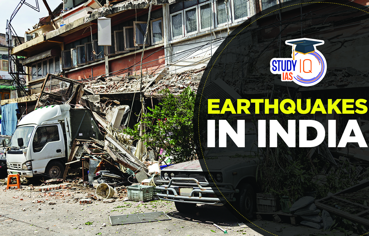
According to the National Centre for Seismology, A 5.3-magnitude earthquake struck Telangana’s Mulugu district, originating 40 km below the ground in the Eturnagaram forest area. The earthquake occurred at 7:27 AM, prompting panic among residents. Read this article below to know all about Earthquakes in India.
- It is the 2nd-largest earthquake in the region in the last 55 years.
- Seismological Analysis: The epicentre of the earthquake lies within the Godavari Fault System.
- It is a major fault line in the Krishna-Godavari basin in Andhra Pradesh.
- This basin contains major hydrocarbon fields.
- It was formed by rifting along the eastern margin of the Indian Craton in the early Mesozoic period.
About Earthquakes
An earthquake is the shaking of the earth. It happens naturally when energy is released, creating waves that travel in all directions. When an earthquake occurs the Earth vibrates and seismographs detect these vibrations. Moderate earthquakes happen every day, but big, damaging earthquakes are rare. Earthquakes are more common around the edges of tectonic plates. In India, more earthquakes occur where the Indian Plate meets the Eurasian Plate.
| Some terminologies related to Earthquakes are: |
|
Earthquakes in India
Earthquakes in India mainly occur when the Indian tectonic plate collides with the Eurasian plate. The peninsular region of India is usually stable, but sometimes earthquakes occur on the edges of smaller plates. For example, the 1967 Koyna earthquake and the 1993 Latur earthquake happened in these areas.
India is divided into four seismic zones (II, III, IV, V) based on the level of seismicity:
- Zone II: Low seismicity
- Zone III: Moderate seismicity
- Zone IV: High seismicity
- Zone V: Very high seismicity (includes areas like the Himalayan region, northeastern states, Kutch, and Andaman & Nicobar Islands)
Zones V and IV cover the entire Himalayan region, North-East India, Western and Northern Punjab, Haryana, Uttar Pradesh, Delhi, and parts of Gujarat.
Most of the peninsular region is in a low-risk zone,
while the northern lowlands and western coastal areas are in a moderate-hazard zone.
Types of Indian Earthquakes
In India, earthquakes can be categorized based on their origins and the tectonic settings. Here are the main types:
| Type of Earthquake | Description | Example/Region |
|---|---|---|
| Tectonic Earthquakes | Caused by the movement of Earth’s tectonic plates. | |
| – Interplate Earthquakes | Occur at the boundaries between two tectonic plates. | Himalayan region |
| – Intraplate Earthquakes | Occur within a tectonic plate. | Latur earthquake (1993), Maharashtra |
| Volcanic Earthquakes | Associated with volcanic activity due to the movement of magma beneath the Earth’s surface. | Andaman and Nicobar Islands |
| Induced Earthquakes | It is caused by human activities such as mining, reservoir filling, geothermal energy extraction, and oil extraction. | |
| – Reservoir-Induced | Earthquakes are induced by the filling of large dams. | Koyna earthquake (1967), Maharashtra |
| Collapse Earthquakes | Caused by the collapse of underground caverns or mines. Usually localized and of low magnitude. | Mining areas |
| Explosion Earthquakes | Caused by explosions, such as nuclear tests or large chemical explosions. | Nuclear tests in Pokhran, Rajasthan |
1. Tectonic Earthquakes
These are the most common types of earthquakes in India, caused by the movement of the Earth’s tectonic plates. They can be divided into:
Interplate Earthquakes: Happen at the boundaries between two tectonic plates. For example, the Himalayan region has interplate earthquakes because the Indian and Eurasian plates collide there.
Intraplate Earthquakes: Happen within a tectonic plate not at its boundary. The 1993 Latur earthquake in Maharashtra is an example.
2. Volcanic Earthquakes
A special type of earthquake called a volcanic earthquake happens only in areas with active volcanoes. These earthquakes occur when molten rock (magma) is injected into or withdrawn from solid rock causing stress changes. This can make the ground sink or crack. These earthquakes can also happen when rock moves to fill spaces left by magma. Volcanic earthquakes do not mean the volcano will erupt they can happen at any time.
3. Induced Earthquakes
These are caused by human activities such as mining, reservoir-induced seismicity (due to the filling of large dams), geothermal energy extraction, and oil extraction. Examples include:
- Reservoir-Induced Seismicity: The Koyna earthquake (1967) in Maharashtra is believed to have been induced by the filling of the Koyna dam reservoir.
4. Collapse Earthquakes
These happen when underground caves or mines collapse. They are usually small and only affect a local area.
5. Explosion Earthquakes
These are caused by explosions, such as nuclear tests or large chemical explosions. For example, nuclear tests conducted in Pokhran, Rajasthan, generated minor seismic activity.
Earthquake Zones in India
Complete List of All Zones of Earthquakes in India:
The zones are identified using the Modified Mercalli (MM) intensity, which measures how earthquakes affect areas. After the Killari earthquake in Maharashtra in 1993 the seismic map was updated. The low danger zone called Seismic Zone I was combined with Seismic Zone II. So Zone I is no longer shown on the map.
Zone II
It is a low-intensity area, covering 40.93% of the country’s land. This includes the Karnataka Plateau and the peninsula region.
Zone III
This region has moderate intensity and covers 30.79% of the country’s area. It includes Kerala, Goa, and the Lakshadweep Islands, along with parts of Punjab, Rajasthan, Madhya Pradesh, Bihar, Jharkhand, Chhattisgarh, Maharashtra, Odisha, and Tamil Nadu.
Zone IV
This is called a high-intensity zone. It covers 17.49% of the country’s land. It includes the rest of Jammu & Kashmir, Himachal Pradesh, Delhi, Sikkim, northern parts of Uttar Pradesh, Bihar, West Bengal, the western coast of Maharashtra, and Rajasthan.
Zone V
This is an extremely severe zone. It covers 10.79% of the country’s land. It includes North Bihar, Himachal Pradesh, Uttarakhand, the Rann of Kutch in Gujarat, and the Andaman and Nicobar Islands.
Major Earthquakes in India List
Some of the devastating earthquakes have affected India. More than 58.6% of Indian Territory is vulnerable to earthquakes of moderate to very high intensity.
| India’s most significant earthquakes include: |
|
Key Regions Prone to Different Types of Earthquakes
| Region | Type of Earthquake | Description |
|---|---|---|
| Himalayan Region | Tectonic (Interplate) | Frequent earthquakes due to the collision of the Indian and Eurasian plates. |
| Northeastern India | Tectonic (Interplate) | Complex tectonic interactions cause frequent earthquakes. |
| Western India (Kutch) | Tectonic (Intraplate) | Earthquake (2001). |
| Peninsular India | Tectonic (Intraplate) | Generally stable but can experience intraplate earthquakes like Latur (1993). |
| Andaman & Nicobar Islands | Tectonic & Volcanic | Prone to both tectonic and volcanic earthquakes. |
List of Major Earthquakes in India Year-wise for UPSC
| Year-wise Major Earthquakes |
|
Causes of Earthquakes in India
Avalanches and Landslides
Tremors can make slopes unstable and collapse causing debris to fall and create landslides mainly in hilly areas. Earthquakes can also trigger avalanches, making large amounts of ice fall from snowy peaks. For example, the 2015 Nepal earthquake caused several avalanches on and near Mount Everest.
The 2011 Sikkim earthquake caused landslides and significant property damage, especially at the Singik and Upper Teesta hydroelectric projects.
Floods
Earthquakes can cause flash floods and make dams and reservoirs fail. Avalanches and landslides can block rivers, leading to flooding. For example, the 1950 Assam earthquake created a barrier in the Dihang River with huge debris, causing flash floods upstream.
Tsunami
Tsunamis are waves created when an ocean basin is disturbed displacing a large amount of water. Earthquakes can move the seafloor, causing these big waves. On December 26, 2004, an earthquake off Sumatra’s coast caused the Indian Ocean Tsunami.
This happened because the Indian plate moved under the Burmese plate. Over 240000 people died in the Indian Ocean region and nearby countries. In 2011 a massive undersea earthquake in Japan caused 10-meter tsunami waves during the Tohoku earthquake. This led to a nuclear meltdown at Fukushima Daiichi, causing major global concerns due to radioactive fallout.
Impact of Earthquakes in India
Loss of Human Life and Property
Human towns and buildings suffer severe damage when the ground moves up, down, or sideways. For example, the 2015 Nepal earthquake caused massive urban destruction. This 7.8-magnitude earthquake was 8.2 kilometers deep. Many lives were lost due to uncontrolled urban growth, poorly built structures, and unscientific designs. Kathmandu’s urban areas were badly hit causing 8000 deaths and $10 billion in economic loss
Alterations to the River’s Course
One major effect of an earthquake is that it can change the course of a river. This happens when debris from the earthquake blocks the river’s flow forcing the water to find a new path. This alteration can lead to flooding and other significant changes in the landscape.
Fountains of Mud
Earthquakes can force mud and boiling water to the surface. After the 1934 Bihar earthquake, fields were covered in knee-deep mud.
Fire Risks
Earthquakes damage gas pipelines and electric systems. This makes it much harder to put out fires caused by the earthquake.
Mitigation Measures for Earthquakes in India
The National Center for Seismology
Governmental organisations receive earthquake monitoring and hazard reports from a department of the Ministry of Earth Sciences. There are three divisions in it: Geophysical Observation System, Earthquake Hazard and Risk Assessment, and Earthquake Monitoring and services.
National Earthquake Risk Mitigation Project (NERMP)
Improving both the non-structural and structural parts of earthquake safety programs helps reduce risks in high-danger areas. In places with strong earthquakes, important safety measures are implemented. The NDMA which is in charge of the project, has made a detailed project report (DPR).
National Building Code (NBC)
It is a detailed building code and national regulation that sets rules for construction across the country. The Planning Commission first published it in 1970, and it was updated in 1983. There were three major changes: two in 1987 and one in 1997. The National Building Code of India 2005 (NBC 2005) replaced the old version. It focuses on addressing natural disaster challenges and using the best international practices.
Building Materials & Technology Promotion Council (BMTPC)
It works on projects to strengthen important buildings and raise awareness among people and government organizations. The goal is to help the public and policymakers reduce the risk to many existing public and private buildings
NDMA Guidelines for Earthquakes
In 2007, the NDMA released detailed earthquake guidelines. These rules tell State Governments, Central Ministries, and Departments what to do to make disaster management plans focused on earthquake risk. The guidelines are based on six main principles
- The building of new structures that is earthquake-resistant.
- Retrofitting and selective seismic strengthening of existing structures.
- Enforcement and regulation.
- Preparation and awareness.
- Building capacity;
- Emergency reaction.
Biggest Earthquakes in India
The devastating Bhuj earthquake happened on 26 January 2001 near the Pakistani border in Gujarat India. The largest earthquake in India with a magnitude of 8.6, occurred in the India-China region on 15 August 1950. It caused the death of 1530 people due to tectonic plates shifting 30 km deep.
Earthquake in the Indian Ocean
The 2004 Indian Ocean earthquake and tsunami important points
- Magnitude: Between 9.1 and 9.3 on the Richter scale, making it one of the largest earthquakes ever recorded.
- Duration: Faulting lasted between 8.3 and 10 minutes, unusually long for an earthquake of this magnitude.
- Aftershocks: Numerous aftershocks continued for 3 to 4 months after the initial earthquake.
- Energy Release: The earthquake released a massive amount of energy, causing significant geological effects.
- Earth’s Axis Shift: It is believed that the earthquake caused a slight shift in the Earth’s axis due to the redistribution of mass.
- Tsunami Generation: The seismic activity caused vertical movement of the seafloor, displacing a large volume of water and triggering a tsunami.
- Impact: Indonesia was the first and hardest-hit country due to its proximity to the epicenter.
- Casualties: Approximately 170000 people lost their lives, making it one of the deadliest natural disasters in recorded history.
 Astronomy in the Atacama Desert: Telesco...
 Why Below-Average Rains Don’t Rule Out...
 Mahanadi River: Location, Major Tributar...