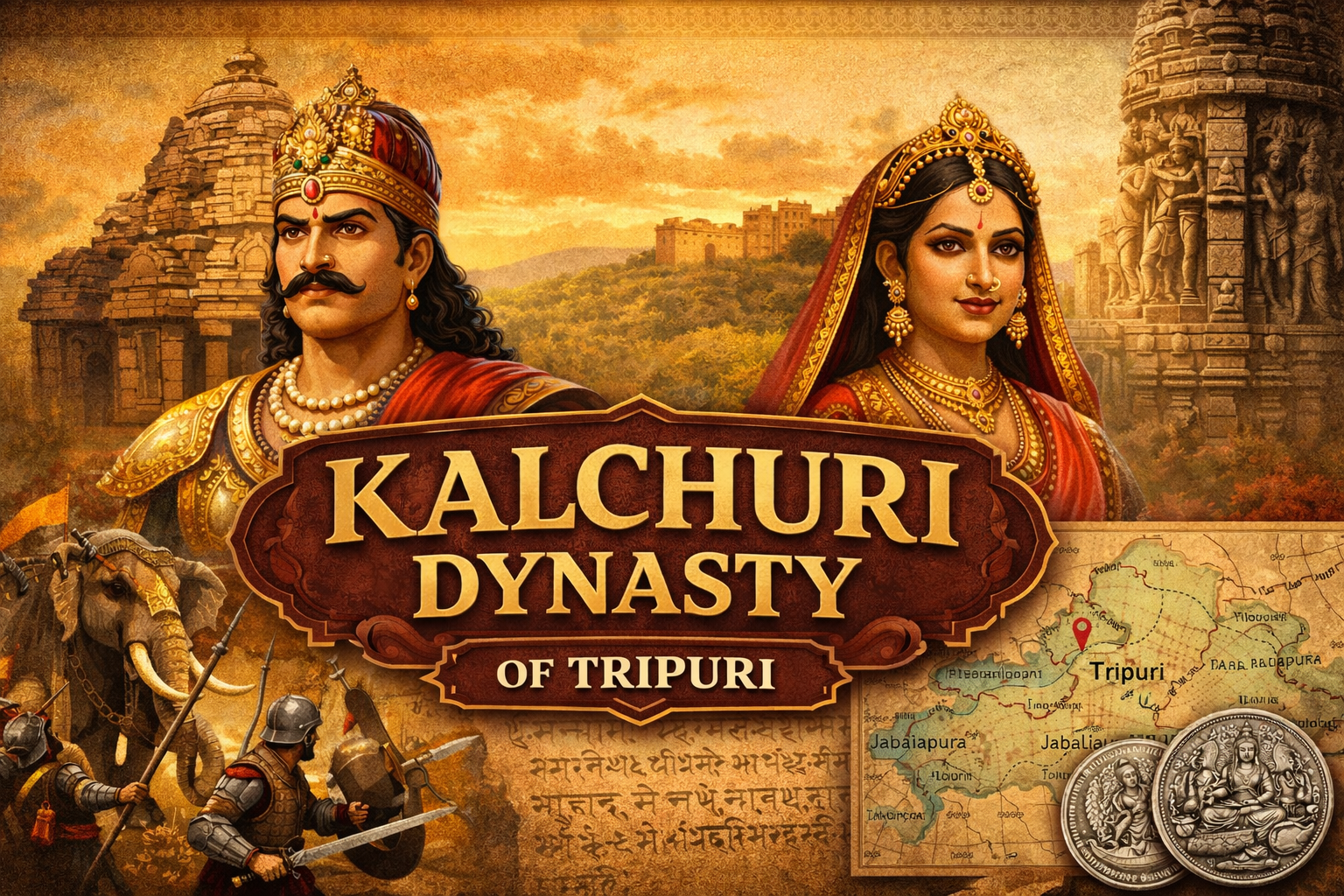
Table of Contents
Foundation of Kalchuri Dynasty
The foundation of the Kalchuri Dynasty is a complex historical process that transitioned from the Narmada Valley in the west to the Dahala-mandala (Jabalpur region) in the east. Historically, this foundation is divided into three distinct layers: the mythological claims, the Early Kalchuri phase, and the Imperial establishment at Tripuri.
1. Mythological Foundation (Haihaya Lineage)
To establish political legitimacy among the Rajput clans, the Kalchuri kings claimed a divine and ancient pedigree.
- Chandra Vamsa: They claimed descent from the Lunar Dynasty.
- The Haihaya Clan: Inscriptions such as the Bilhari and Karanbel records trace their origin to the legendary king Sahasrarjuna (Kartavirya Arjuna), who ruled from Mahishmati.
- Chedi Identity: They identified their territory as Chedi-desha, linking their medieval kingdom to the ancient Chedi Mahajanapada mentioned in the Mahabharata.
2. Early Kalchuri Foundation (c. 550 – 625 CE)
The first historically verifiable foundation occurred in Western India and the northern Deccan.
- Founder: Krishnaraja is the earliest known historical ruler.
- Capital: Mahishmati (modern-day Maheshwar, MP).
- Significance: This branch issued silver coins (featuring a bull) and controlled a vast area, including Malwa and parts of Maharashtra.
- The Displacement: Following a major defeat by the Chalukyas of Badami (Pulakeshin II) in the early 7th century, the Kalchuris were displaced from their western seat and migrated toward the Vindhyan ranges.
3. Migration and Vamaraja (c. 675 – 710 CE)
The “second foundation” or the transition to the east is credited to a ruler named Vamaraja.
- Occupation of Kalanjara: Vamaraja is credited in inscriptions as the king who conquered the strategic Kalanjara Fort and the Dahala region.
- The ‘Adi-Purusha’: While the dynasty later shifted its capital to Tripuri, Vamaraja is often referred to as the Vamadeva or the “First Ancestor” of the eastern branch in later copper-plate grants.
4. Imperial Foundation at Tripuri (c. 850 CE)
The foundation of the Kalchuris of Tripuri as a sovereign imperial power was finalised by Kokalla I, who is considered the “Real Founder.”
Important Kings of Kalchuri Dynasty
Kokalla I: The Architect of the Empire
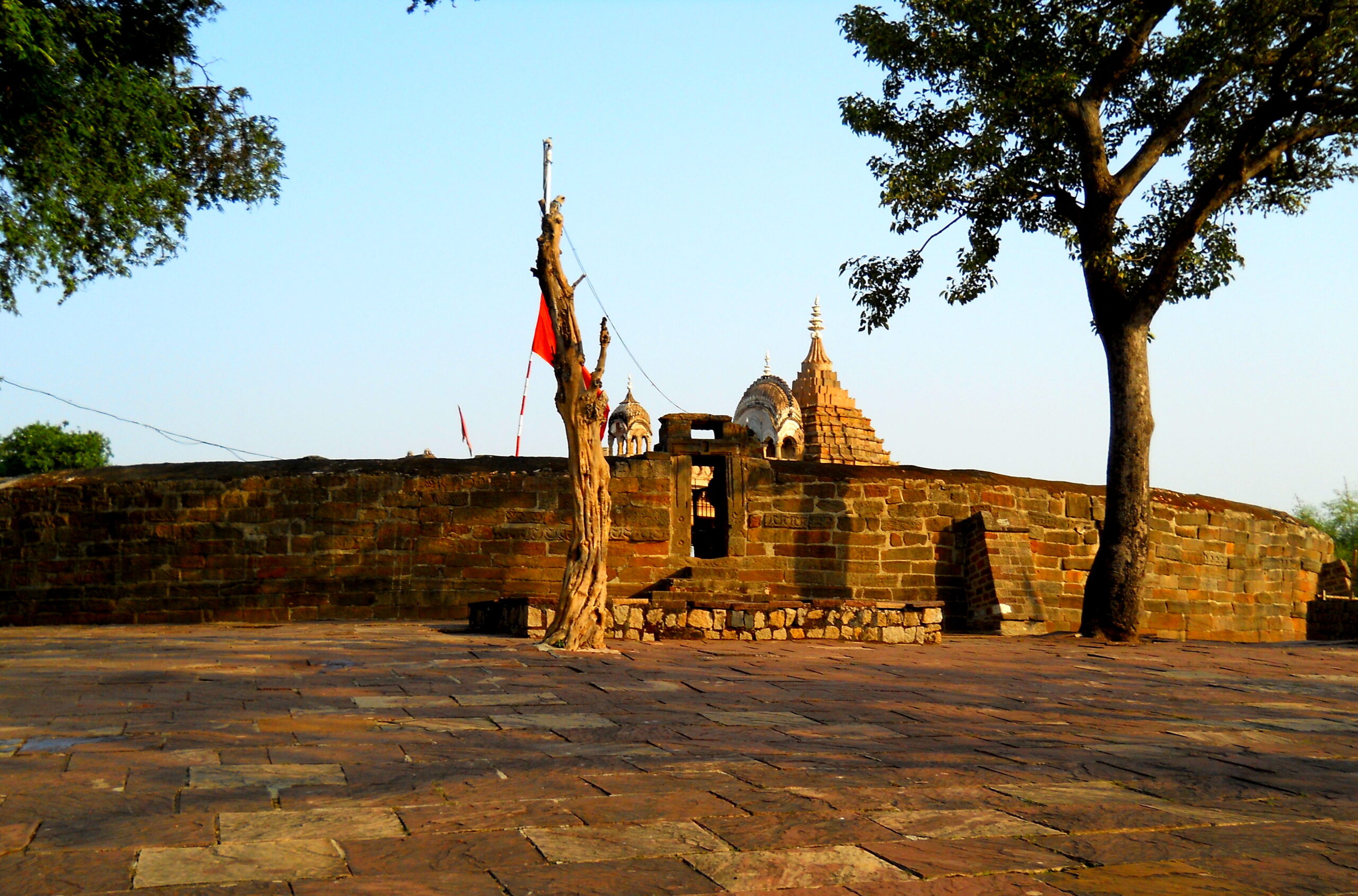
- Establishment of Tripuri: He made Tripuri (modern Tewar, near Jabalpur) the permanent political and military headquarters of the dynasty.
- Diplomatic Bedrock: Kokalla I founded the empire’s security on a system of matrimonial alliances. He married a Rashtrakuta princess and married his daughter to the Rashtrakuta King Krishna II.
- The ‘Kingmaker’ Status: He maintained a balance of power between the Gurjara-Pratiharas of the north and the Rashtrakutas of the south, ensuring the Kalchuri state remained an independent buffer.
Yuvaraja Dev I (Keyuravarsha)
- Military Title: Known as ‘Ujjaini Bhujanga‘ (The Serpent of Ujjain) after defeating the Paramara king.
- Cultural Patronage: His court was graced by the famous poet Rajasekhara, who wrote Viddhashalabhanjika and Kavyamimansa.
- Architecture: He is credited with building the Chausath Yogini Temple at Bhedaghat.
Gangeyadeva (c. 1015 – 1041 CE)
- Titles: Assumed the high-sounding title of ‘Vikramaditya‘.
- Coinage: He revived the North Indian economy by reintroducing gold coins featuring a seated Goddess Lakshmi.
- Historical Mention: The Persian scholar Al-Biruni mentions him and his capital, Tripuri, in Kitab-ul-Hind.
Lakshmikarna (c. 1041 – 1073 CE)
- The Napoleon of the Kalchuris: The most powerful military ruler of the dynasty.
- Conquests: He defeated the kings of Chola, Pandya, Pala, and Huna regions. He famously assumed the title ‘Trikalingadhipati‘ (Lord of the Three Kalingas).
- Architecture: Built the Karna Temple at Amarkantak and established the township of Karnavati (near Jabalpur).
Strategic Geography of Kalchuri Kingdom
The Kalchuri state was a masterful exercise in Environmental Determinism. By occupying the Dahala-mandala, the dynasty transitioned from displaced western refugees to the “Toll-Keepers of the Subcontinent,” turning a rugged frontier into a lucrative economic bottleneck.
1. The Jabalpur Corridor: The “Choke Point” of Empires
Tripuri (modern Tewar) was not a random settlement; it was a strategic mandate.
- Central Indian Bottleneck: At Jabalpur, the rugged Vindhyan and Satpura ranges converge, creating a natural funnel. This is the narrowest point of transit between the Indo-Gangetic plains and the Deccan plateau.
- Monopoly over trade route: By commanding this “Strategic Narrow,” the Kalchuris controlled the movement of all land-based power. Whether it was a merchant caravan or an imperial army moving from the Uttarapatha to the Dakshinapatha, Tripuri was the unavoidable gatekeeper. This geographical monopoly allowed the Kalchuris to maintain an independent buffer state, extracting political and financial concessions from both Northern and Southern superpowers.
2. Dakshinapatha Logistics: The “Dry Port” Economy
The Kalchuri economy was essentially a Transit State built upon the Sulkashala (Toll House).
- Inter-regional Hub: Tripuri functioned as a medieval “Dry Port,” where the high-value silks of the North were exchanged for the precious spices and gems of the South.
- Institutionalized Extraction: Managed by the Saulkika (Superintendent of Tolls), toll-stations were placed at every river ford and mountain pass. This system provided immediate liquidity—the Margadaya (transit duties)—required to fund the “Monetary Revolution.” This commercial flow made the Kalchuri treasury uniquely resilient to the seasonal failures of local agriculture.
3. The Geological Advantage: Wealth in the Stone
A masterly nuance of the Dahala-mandala is the specific mineral wealth of the Narmada metamorphic belt.
- Aesthetic-Economic Link: The presence of Green Schist (Chlorite) and limestone provided the raw material for the dynasty’s “Aesthetic Repute.” The Kalchuris built their magnificent temple complexes (like Bhedaghat) at the exact locations where their economic power was concentrated.
- Industrial Edge: Control over the iron-rich hematite deposits of the Jabalpur-Rewa belt allowed for a superior domestic armaments industry. The same geography that provided the stone for the temples provided the iron for the swords, ensuring the standing army was as well-equipped as it was well-paid.
4. Landscape as Destiny: The Narmada and the Maikal Shield
The Kalchuris utilised natural barriers as “Invisible Fortifications” to sustain their imperial longevity.
- Narmada Moat: The river served as a permanent southern defence line. Its deep gorges and the sheer marble cliffs at Bhedaghat acted as a natural barrier against the mobile cavalry of the Deccan powers (the Chalukyas and later the Yadavas).
- Maikal Hill Frontier: To the east, the Maikal range and the dense forests of Baghelkhand provided Strategic Depth. As documented in the Varanasi Copper Plate, these were the breeding grounds for the War Elephant, the dynasty’s primary military asset.
- Environmental Sovereignty: The Kalchuris were pioneers in “Sanskritizing the Frontier.” By turning “wild” forest tracts into organized administrative Pathakas (districts), they effectively brought independent forest tribes into the imperial tax net, expanding the state’s reach through a mix of agrarian expansion and religious land grants.
Fallacy of Choice: Geopolitical Fragility
Ultimately, the Kalchuri geography was both their strength and their doom. The dynasty’s power was contingent on holding the Maikal Hill Frontier. The “Fallacy of Choice” lies in the fact that without this eastern resource base, the centre could not hold. When this frontier was lost during the Ratanpur Secession, the “Economic Decapitation” was total. Tripuri was left without its grain, its iron, and its elephant breeding grounds—leaving the “brain” of the empire prestigious and intact, but its physical body paralysed and defenceless against the rising tides of the Gahadavalas and Yadavas.
Major Inscriptions of the Tripuri Branch
- Sagar Inscriptions of Sankaragana I: One of the earliest records, establishing the presence of the dynasty in the central regions of Madhya Pradesh.
- Bilhari Inscription (Jabalpur): This is a “biographical” stone record. It provides a detailed genealogy and records the military victories of Yuvaraja I (Ujjaini Bhujanga) and the religious activities of Lakshmanaraja II.
- Gurgi Inscription (Rewa): Essential for understanding the Mattamayura Shaiva sect. It describes the construction of massive monasteries and the spiritual influence of the Rajgurus (Royal Preceptors).
- Karanbel Inscription: Found near Jabalpur, this is the most complete “Vamshavali” (lineage list) of the Kalchuri rulers, from Kokalla I to the later kings.
- Amarkantak Inscription: Attributed to Lakshmikarna, it details his conquests and the construction of the temples at the source of the Narmada.
- Varanasi Copper Plate (1042 CE): It is the “State Paper” for Lakshmikarna’s coronation and serves as the primary evidence for his pan-Indian victories. It authenticates his title ‘Trikalingadhipati‘ and “Napoleon-like” conquests, while reflecting the dynasty’s administrative and Shaivite religious framework.
Administration of Kalchuris
- Administrative Units: The empire was divided into Bhuktis (provinces), Vishayas (districts), and Gramas (villages).
- Taxation: Revenue was collected through land taxes (Bhaga) and various tolls on trade.
- Trade: Tripuri was a major trade hub on the route connecting Northern India to the Deccan. The reintroduction of gold coins by Gangeyadeva indicates a period of high economic prosperity.
Revenue Administration of Kalchuri Dynasty
The Kalchuris managed a sophisticated, highly monetised, and measured land revenue system that transitioned from traditional feudalism to a more structured bureaucratic state.
1. Land Revenue of Kalchuris: Land tax, known as Bhaga, was the backbone of the treasury. It was generally set at one-sixth (Shadabhaga) of the produce, though this could vary based on the fertility of the soil.
- Measurement and Survey (Mahapramatara): Unlike many contemporary dynasties that relied on rough estimates, Kalchuris employed a high-ranking official called the Mahapramatara, who was the Chief Surveyor responsible for the accurate measurement of agricultural land. This ensures that taxation was “rational” and based on actual acreage.
- Categories of Land: Records distinguish between Khila (wasteland), Aprahata (uncultivated land), and Sita (crown lands). New settlements in the forest-heavy Narmada valley often received tax holidays to encourage “Sanskritization” and agricultural expansion.
- Pramatara: The officer responsible for Land Classification. They distinguished between fertile and wasteland to ensure Progressive Taxation (taxing based on soil capacity).
- Agrahara System: Kalchuri Kings frequently granted entire villages to Brahmanas or Temples (like the Golaraki Math). These were Sarva-namasya (tax-free) grants, where the state surrendered its right to revenue in exchange for religious merit and local stability.
2. Taxation (Beyond Agriculture): Kalchuris were unique in how heavily they taxed trade and specialized professions, reflecting the high commercial activity in the Dahala-mandala.
- Pravani and Vadari: These were specific taxes mentioned in inscriptions. Pravani was likely a tax on retail sellers, while Vadari was a cess on specific forest produce or items brought from the hills.
- Margadaya (Tolls): As Tripuri sat on the junction of the Uttarapatha (North) and Dakshinapatha (South) trade routes, Sulkashala (toll houses) were established at mountain passes and river crossings to collect transit duties.
- Saulkika: Superintendent of Tolls. They managed the Sulkashala (toll houses) at mountain passes and river crossings, ensuring that the “Margadaya” (transit duties) reached the central treasury.
- Salt and Mines: The state held a monopoly over salt production and mining (especially the iron mines of the Jabalpur-Rewa belt). Inscriptions often mention the grant of a village “along with its hidden treasures and deposits” (Sa-nidhi-so-panidhi).
High Status of Royal Women” or “Queenly Regency
While the Kalchuris were a patriarchal monarchy, the women of the royal household held unprecedented power in religious and civil administration.
- Queen Nohla Devi: The wife of Yuvaraja I, she was a princess of the Chalukya dynasty. She didn’t just influence the court; she independently commissioned the Nohleshwar Mahadev Temple at Nohta (Damoh).
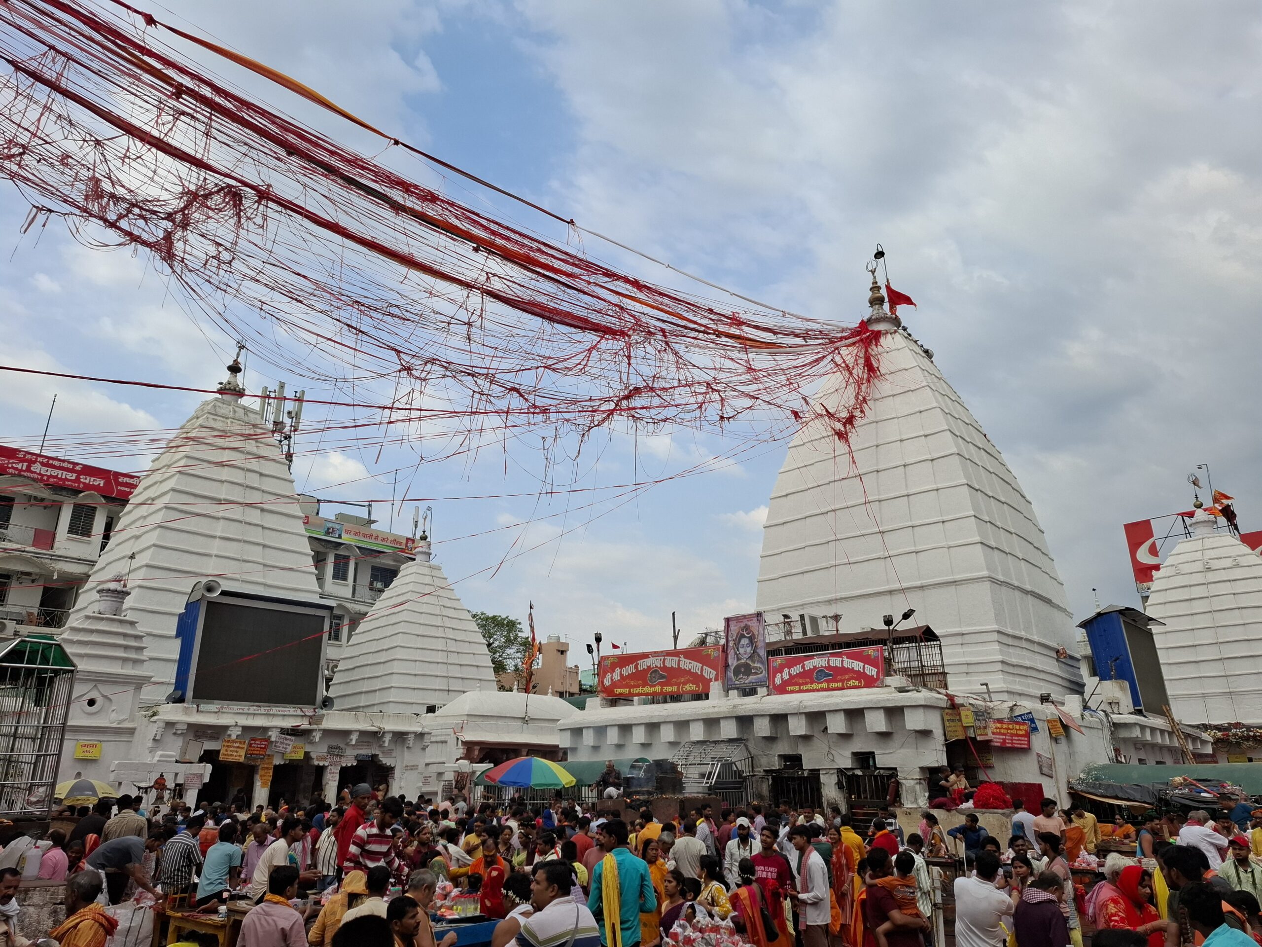
- Alhanadevi: The widow of Gayakarna, she acted as a powerful regent. She is credited with building the Vaidyanath Temple and a large matha, and she issued her own inscriptions detailing land grants.
- Significance: This indicates that Kalchuri queens had their own “Privy Purse” and administrative staff, allowing them to act as independent patrons of art and education.
“Panchakula” System (Local Governance)
- This was a committee of five representative elders (similar to the modern Panchayat) that managed village and town affairs.
- Responsibilities: They were responsible for collecting local taxes, maintaining temples, and acting as a local judiciary for civil disputes.
- Relevance: This shows that the Kalchuri state was decentralised. The King handled “War and Peace,” but the daily lives of the people in the Dahala-mandala were governed by this grassroots democratic body. It proves that the Kalchuri state was a “Decentralised Feudalism.”
Economy of Kalchuri Dynasty
The “Monetary Revolution” under the Kalchuris of Tripuri, specifically during the 11th century, ended a period of “monetary anaemia” in North India that had persisted since the decline of the Gupta Empire. From the 7th to the 10th centuries, gold coinage had almost entirely vanished from North Indian circulation, replaced by base metals or barter.
End of Gold Gap
- Gangeyadeva (c. 1015–1041 CE) broke this stagnation by reintroducing high-quality gold currency.
- “Seated Lakshmi” Motif: The coins featured a four-armed Goddess Lakshmi seated cross-legged on the reverse. This design was so iconic and trusted that it was later adopted by the Chandelas, Gahadavalas, and even the early Islamic rulers (the Ghurids), who kept the Hindu goddess on their initial coins to ensure market acceptance.
- Fractional Monetization: Gangeyadeva issued gold coins in 1/2, 1/4, and 1/8th Dramma sizes. This proves that the Kalchuri “Monetary Revolution” reached the retail level, enabling even small shopkeepers to trade in gold.
Military Administration of Kalchuris
Reasons for the Military Edge of the Kalchuri Dynasty
The military superiority of the Kalchuris, which allowed rulers like Lakshmikarna to earn the title “Napoleon of the Kalchuri Dynasty,” was not a result of sheer numbers alone. The reasons for the same are:
- Monopoly over Gajashakti (War Elephants)
- The single greatest tactical advantage of the Kalchuris was their massive Elephant Corps.
- Kalchuri heartland, Dahala-mandala, encompassed the dense forests of Amarkantak and Baghelkhand, which were primary breeding grounds for the finest wild elephants in India.
- Elephant’s Edge in Jungle Warfare: In the rugged, hilly terrain of Central India, elephants were superior to cavalry for breaking enemy lines and clearing forest paths.
- Standing Army vs. Feudal Levies: Because of the “Monetary Revolution,” the Kalchuris were among the few who could maintain a professional army paid in cash (Gold Drammas) rather than just land grants. This allowed for the long-distance “Napoleon-style” campaigns of Lakshmikarna.
Social History of Kalchuri Dynasty
Sanskritisation of Central India:
Kalchuris acted as the primary agents of “Sanskritization” in Central India.
- Integrating the Tribal Belt: The Narmada and Baghelkhand regions were originally inhabited by various forest tribes. Through the Agrahara system (land grants to Brahmanas), the Kalchuris established “islands” of Vedic culture in tribal areas.
- Linguistic Shift to Sanskrit: They shifted the administrative and courtly language from local Prakrits to High Sanskrit, as evidenced by the sophisticated poetry of Rajasekhara.
- Tribal Absorption: Local tribal chieftains were often absorbed into the lower rungs of the Rajput hierarchy, while tribal goddesses were “Sanskritized” into the Hindu pantheon (e.g., the Yoginis).
|
Important Notes |
| The Golaraki Matha (also known as the Golaki Matha) was the intellectual and spiritual nerve center of the Kalchuri Empire. Located in the capital city of Tripuri (modern-day Tewar, Jabalpur), it served as the headquarters of the Mattamayura sect.
Medieval Residential University: According to the Malkapuram Inscription, it attracted thousands of students from across the Indian subcontinent. It provided specialized education in the Four Vedas, Logic (Nyaya), Grammar (Vyakarana), and the Agamas (Shaiva scriptures). The Kalchuri kings granted several tax-free villages (Agraharas) to the Matha, ensuring it had the financial autonomy to support its vast academic population. Social safety net/Welfare Functions for Dahala Mandala:
Political and Religious Significance:Residence of the Royal Preceptors (Rajgurus): Rulers like Yuvaraja I and Lakshmikarna sought the guidance of the Golaraki Acharyas for statecraft and military rituals. Southern Expansion: As seen in the Malkapuram Inscription, the Mattamayura lineage moved into the Kakatiya Empire. They exported the “Tripuri Model” of welfare and education to the South, proving that their administrative system was a portable and highly effective engine of governance. |
Cultural Contribution of Kalchuri
Literature and Education
The Kalchuri court was a prestigious center for Sanskrit learning.
- Rajasekhara: The most celebrated figure of this era. Though he served the Pratiharas initially, his most mature works were composed under Yuvaraja Dev I.
- Viddhashalabhanjika: A play written specifically to be performed at the Kalchuri court to celebrate the King’s victory over the Rashtrakutas/Paramaras.
- Kavyamimansa: A practical guide for poets that provides immense geographical and cultural data of 10th-century India.
- Mattamayura Lineage: This was a powerful guild of Shaiva ascetics who acted as Rajgurus (Royal Preceptors). They established Mathas (monasteries) that served as medieval universities.
- The Golaraki Math (in Tripuri) was world-renowned. Inscriptions suggest it supported thousands of students and provided free food and medical care (Arogyashala).
- Kalchuri Era: Founded by Abhira King Ishwarsena (248–249 CE), this era was institutionalised by the Kalchuris over eight centuries. It followed the Amanata system (months ending on the New Moon), which was common in South and Central India. The year usually began in the month of Ashwin (September – October). It remains a vital “chronological anchor” for dating medieval Central Indian inscriptions and verifying dynastic migrations.
Architecture of Kalchuris
Kalchuri style is a sub-school of the Nagara tradition, characterized by heavy ornamentation and unique circular plans.
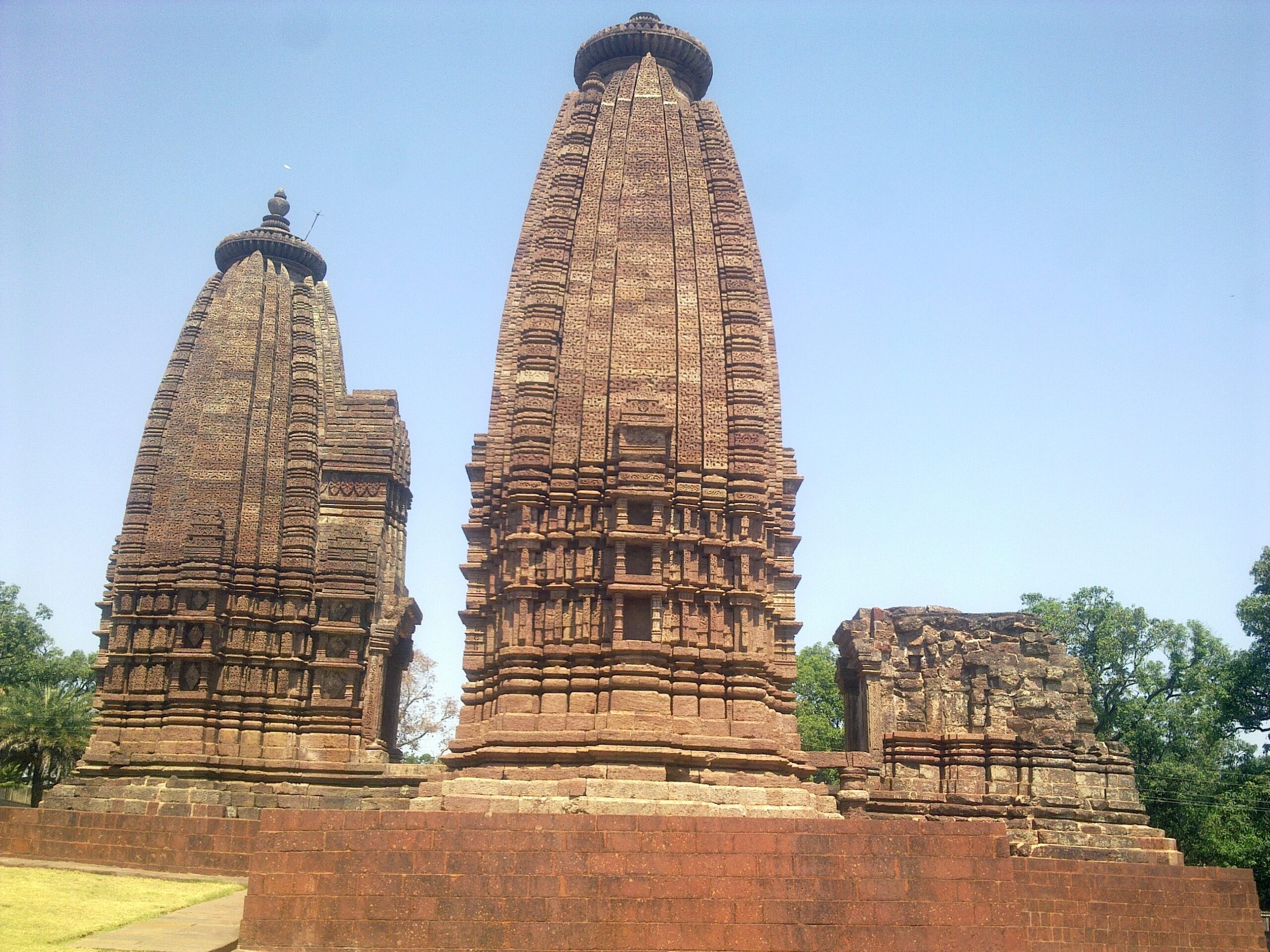
- Circular Temple Concept evident at Chausath Yogini Temple (Bhedaghat): Unlike the rectangular temples of the era, this is a massive circular enclosure. It houses 81 exquisite statues (Yoginis, Matrikas, and Shaktis). It is one of the few surviving Yogini temples in India and signifies the dominance of Tantric Shaivism.
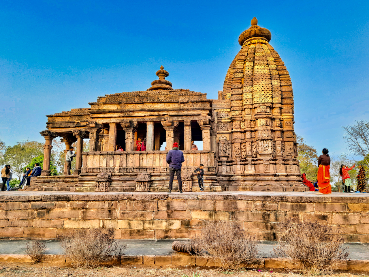
- Karna Temple at Amarkantak: Built by Lakshmikarna, it features a unique Trimukha (triple-shrine) design sharing a common mandapa. It is a precursor to the elaborate temple complexes seen later in Odisha and Khajuraho.
- Salient features of Kalchuri Architecture:
-
- Hypaethral Architecture: This is the specific architectural term for the Bhedaghat Temple. It means “roofless/open to the sky,” which was essential for the Tantric rituals it hosted.
Material Used: Green Schist
Kalchuri artisans of Tripuri specialised in Green Schist (also known as Chlorite). This stone was locally available in the metamorphic belts of the Narmada Valley (Jabalpur region).
- Green Schist is a “medium-hard” stone. When freshly quarried, it is relatively soft and easy to carve, but it hardens significantly upon exposure to air.
- “Jewellery-like” Detail: Because of the fine-grained nature of Chlorite, sculptors could achieve a level of filigree-like precision that is impossible on coarser sandstone. This allowed for the intricate depiction of:
- Exquisite ornaments and “Mekhalas” (waistbands).
- Detailed “Jatamukutas” (hair arrangements) of deities.
- Sharp, expressive facial features of the Yoginis at Bhedaghat.
Decline and Successor States of Kalchuris
Reasons for Decline of Kalchuries
1. Imperial Overstretch (The “Napoleon” Effect): The aggressive expansionism of Lakshmikarna (the “Napoleon of the Kalchuris”) was the primary catalyst for their downfall.
- Coalition of Enemies: His rapid conquests created a “coalition of enemies.” The Chandelas, Paramaras, Palas, and Chalukyas of the Deccan formed a strategic alliance to check Kalchuri dominance.
- Economic Exhaustion: Constant pan-Indian wars drained the treasury. The surplus gold generated by the “Monetary Revolution” was diverted from infrastructure and trade back into the high costs of maintaining a professional standing army across multiple fronts.
2. Internal Fragmentation (Rise of Branch Dynasties): The unified power of the “Chedi” state was broken by the independence of its own bloodline.
- Ratanpur Secession: The branch at Ratanpur (Chhattisgarh) declared independence under Jajalladeva I. This deprived Tripuri of the massive agricultural and mineral resources (iron/gold) of the eastern plains.
- Succession Disputes: Later rulers like Yashahkarna were unable to hold the central administrative units together, leading to a “feudal splintering” where local governors became independent chieftains.
3. External Invasions: By the 12th century, the Kalchuri heartland was surrounded by aggressive rising powers:
- North – Gahadavalas: Gahadavalas of Kanauj seized Varanasi, the second capital and religious heart of the Kalchuris. This was a fatal blow to their prestige and transit revenue.
- West – Chandelas: Chandela King Madanavarman decisively defeated Gayakarna, plundering Kalchuri territories and regaining control over the strategic Kalinjar region.
- South – Yadavas & Chalukyas: Yadavas of Devagiri and the Chalukyas of Kalyani plundered the Narmada valley and eventually sacked the capital, Tripuri, in the early 13th century.
4. Loss of Strategic Resources
- Elephant Monopoly: As they lost control over the forests of Baghelkhand and the Kalinga coast (Trikalinga), their “Gajashakti” (Elephant monopoly) vanished. Without their heavy-armour edge, their armies could no longer withstand the mobile cavalry of their rivals.
- Monetary Contraction: As trade routes were cut off by the Gahadavalas and Yadavas, the flow of gold stopped. The once-famous “Seated Lakshmi” coins were replaced by base-metal coinage, signalling a return to “monetary anaemia.“
Secession of Ratanpur Branch of Kalchuris
The secession of the Ratanpur branch under Jajalladeva I (c. 1114 CE) was not merely a dynastic quarrel; it was a Geopolitical Shift that fundamentally altered the power balance of Central India. By “cutting the anchor,” Ratanpur saved itself but doomed the parent empire at Tripuri to physical and fiscal exhaustion.
1. The “Rice and Iron” Geopolitics:
Chhattisgarh Plain (Dakshina Kosala) was the “Lungs” of the Kalchuri state.
- Strategic Grain Reserve: Unlike the rugged, hilly terrain of the Vindhyas around Tripuri, the Ratanpur region provided a massive agricultural surplus. This “Rice Bowl” fed the standing armies and sustained the empire during the long sieges that defined medieval warfare.
- Mineral Monopoly: Chhattisgarh was the source of high-grade iron ore and alluvial gold. By breaking away, Ratanpur took the raw materials of war with them, leaving Tripuri with the prestige of the throne but no steel for its swords.
2. Tax Revolt and Regional Identity:
The secession was driven by a deep-seated resentment against the “Imperial Overstretch” of the main branch, particularly the legacy of Lakshmikarna.
- Imperial Hubris: The Ratanpur elites grew tired of their local wealth being drained to fund failed pan-Indian campaigns in the North. The secession was essentially an Economic Tax Revolt.
- Social “Brain Drain”: As Ratanpur became more stable and prosperous, there was a migration of administrative talent. Talented Kayasthas (scribes) and Brahmanas moved east, choosing the fresh opportunities of the Ratanpur court over the aging, war-torn bureaucracy of Tripuri.
- “Kosala” Identity: A distinct regional consciousness emerged. The people of Ratanpur began to identify more with the cultural heartland of Dakshina Kosala than with the “Chedi” identity of the Narmada valley.
3. Jajalladeva I: The Master of Symbolic Defiance
Jajalladeva I executed the split with surgical political precision. He utilised Symbolic Independence to make the break irreversible:
- Coinage Declaration: He minted his own gold coins featuring the Lion-Elephant (Gajashardula) motif. This was a direct strike at the “Seated Lakshmi” brand of Tripuri, signalling that the “Bank of the Kalchuris” had moved its headquarters.
- Neutralizing the Gajashakti: By refusing to send forest levies to Tripuri, he deprived the central throne of its Elephant Corps, effectively disarming the empire’s heavy cavalry.
4. The Domino Effect: Structural Collapse
The secession triggered a “Feudal Splintering“ that left Tripuri isolated:
- Loss of the Eastern Corridor: Without Ratanpur as a land bridge, Tripuri lost access to the maritime tolls and “Gajashakti” of Trikalinga (Odisha).
- Security Vacuum: Tripuri lost its “Safe Zone.” When the Chandelas and later the Yadavas invaded, there was no longer a loyal eastern flank to retreat to. The empire became a “brain without a body”—prestigious and intelligent, but physically unable to survive.
 Partition of India and Pakistan 1947: Ca...
 Nalanda University in Bihar: History, Re...
 Chandela Dynasty: History, Rulers, Archi...