StudyIQ is India’s Best Website for UPSC, State PSC, and Judiciary exam preparation. We offer a wide array of resources designed to help aspirants succeed in these highly competitive exams. Our platform provides UPSC Online Coaching, Daily Current Affairs, Government Schemes Updates, General Knowledge Updates, and State PSC Updates, ensuring that you stay well-informed and prepared at all times.
We cover a diverse range of subjects, including History Updates, Geography Updates, Indian Polity Updates, Environment Updates, Science Tech Updates, Economy Updates, and Art and Culture Updates. Our Biography Updates help you learn about influential figures that are often tested in various exams.
Trending Posts
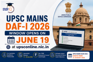 UPSC Mains DAF-I 2026 Window Opens on June 19 at upsconline.nic.in, Check Application ProcessJune 17, 2026The next step in the process of conducting the UPSC Civil Services Examination 2026 is being commenced ...
 G7 Summit 2026: Countries, Leaders, Key Issues and Global ImpactJune 17, 2026G7 Summit 2026: The 52nd G7 Summit is taking place from 15 to 17 June 2026 in ...
 World Crocodile Day 2026: Date, Theme, Importance, Threats and Conservation EffortsJune 17, 2026World Crocodile Day is observed every year on 17 June to raise awareness about crocodiles and the ...
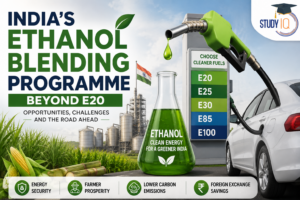 India’s Ethanol Blending Programme Beyond E20: Opportunities, Challenges, and the Road AheadJune 16, 2026Context The government has exempted higher ethanol blends (E22-E30) from central excise duty and proposed recognising E85 and ...
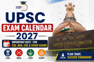 UPSC Exam Calendar 2027 Out: UPSC CSE Prelims on May 23, Check Complete ScheduleJune 16, 2026The Union Public Service Commission (UPSC) has officially released the UPSC Calendar 2027, providing aspirants with the ...
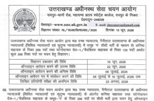 UKSSSC High Court Recruitment 2026 Apply Online – 398 Posts AvailableJune 16, 2026The Uttarakhand Subordinate Service Selection Commission (UKSSSC) has officially released the UKSSSC High Court Recruitment 2026 Notification ...
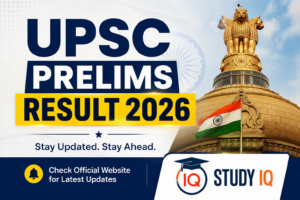 UPSC Prelims Result 2026 LIVE: Result PDF, Roll Number List, Expected Cut Off, Merit ListJune 16, 2026UPSC Prelims Result 2026 Out: The Union Public Service Commission (UPSC) announced the CSE Prelims 2026 Result ...
 UPSC Prelims Result 2026 Out: Check Roll Number PDF, 13,343 Candidates Qualify for MainsJune 16, 2026The Union Public Service Commission (UPSC) has officially declared the Civil Services Preliminary Examination (CSE) 2026 Result ...
 APSC CCE Admit Card 2026 Out, Download Assam PSC Prelims Hall Ticket PDF @ apsc.nic.inJune 16, 2026The Assam Public Service Commission (APSC) has officially released the APSC CCE Admit Card 2026 for the ...
 MPSC Group B Answer Key 2026 Out (Official), Download PDF at mpsc.gov.inJune 15, 2026MPSC Group B Answer Key 2026 Released: The Maharashtra Public Service Commission (MPSC) has officially released the ...
UPSC CSE Prelims PYQs
- Consider the following countries Through which of the above does the Tropic of Capricorn pass?
- Variations in the length of daytime and night times from season to season are due to
- On 21st June, the Sun:
- In the northern hemisphere, the longest day of the year normally occurs in the
- On June 21 every year, which of the following latitude(s) experience(s) a sunlight of more than 12 hours?
- Consider the following statements: DNA Barcoding can be a tool to:
Government Schemes
- NAMASTE Scheme: Objectives, Features and Impact on Sanitation Workers
- River Basin Management (RBM) Scheme: Objectives, Features and Importance
- Skills Outcomes Fund: Purpose, Benefits and Implementation
- Multi-Hazard Early Warning Decision Support System (MHEW-DSS)
- Rebate of State and Central Taxes and Levies (RoSCTL) Scheme
- Reform Express Initiative: Objectives and Key Features
- Immigration, Visa, Foreigners Registration and Tracking (IVFRT) Scheme
- Regional Connectivity Scheme – Modified UDAN
- Credit Guarantee Scheme for Microfinance Institutions-2.0
- Self Help Groups (SHGs) in India: Functions, Benefits and Role
- Atmanirbhar Bharat Abhiyaan, Objective, Features, Pillars and Benefits
- Approved List of Models and Manufacturers (ALMM) Framework
History
- Influence of Indian Ideas on Southeast Asia: Religion, Culture, Architecture & Political Impact
- Birsa Munda Death Anniversary 2026: Life Story, Ulgulan Movement and Key Achievements
- Oor Pare Prehistoric Site: Location, Rock Art and Archaeological Significance
- Kshatriyaisation in Contemporary India: Meaning, Process and Social Impact
- Khooni Bhandara – Mughal Water Harvesting System in Burhanpur
- Statesmanship of Ain-ul-Mulk Multani in Malwa (Late 13th – Mid-14th Century)
Geography
- Astronomy in the Atacama Desert: Telescopes, Conditions and Discoveries
- Why Below-Average Rains Don’t Rule Out Flood Threat: Causes and Risks
- Mahanadi River: Location, Major Tributaries, Course and Map
- Wind Energy in India: Potential, Advantages, Disadvantages, and Future Prospects
- Global Warming and Sea-Land Breeze: Causes, Changes and Climate Impact
- Coastlines of India: Length, States, Features and Importance
Indian Polity
- Anti-Defection Law: Origin, Provisions of 10th Schedule, Importance and Challenges
- Central Information Commission (CIC): Appointment, Composition, Power and Functions
- Defection vs Merger: The Raghav Chadha Controversy and India’s Anti-Defection
- Panchayati Raj Institutions (PRI): Evolution, Significance and Challenges
- National Panchayati Raj Day 2026: Theme, History and Significance
- Government of India Act 1935: Complete Notes for UPSC and Other Competitive Exams
Environment
- Great Indian Bustard (GIB): Features, Threats and Conservation Status
- Seshachalam Forest: Topography, Vegetation, Flora and Fauna
- NGT Mandates Mitigation of Arsenic & Fluoride: Key Directions and Impact
- Climate Adaptation and Resilience: Pathways for India’s NDCs (2031–35)
- Sekha Jheel Bird Sanctuary: Location, Biodiversity and Importance
- Dependence of Grazing Communities on Forests in National Parks: Issues and Solutions
Economy
- Index of Service Production (ISP): Need, Methodology, Sectors and Importance
- Rise of Orange Economy in India: Key Sectors, Impact and Challenges
- Payments Bank Regulation – Paytm Payments Bank Licence Cancelled by RBI
- Informal Sector in India: Economic Significance, Key Issues and Challenges
- Tobacco Use and Poverty in India: Economic Burden, Health Impact and Policy Measures
- Strengthening India’s Food Processing Ecosystem: Policies, Challenges and Growth
Biography
- Birsa Munda Death Anniversary 2026: Life Story, Ulgulan Movement and Key Achievements
- Birth Anniversary of Dhanna Bhagat: Philosophical Contributions and Significance
- BR Ambedkar: Biography, Contributions and Ambedkar Jayanti 2026
- Veer Savarkar Biography: Ideology, Legacy and Contribution
- Jyotiba Phule Biography: Social Reforms, Contributions and Legacy
- Prithviraj Chauhan History: Biography, Battles, Legacy and Facts
Best UPSC IAS Preparation Website 2026
The objective of StudyIQ is to provide every student across the country with affordable resources that can help them in their preparation for UPSC, State PSC, and Judiciary exams.
StudyIQ covers all the recruitment information from the start to the end. After the release of the notification of the exam, we cover the detailed information that a candidate wants to know about a particular recruitment, such as the notification, important exam dates, vacancy details, eligibility criteria, exam pattern, syllabus, and educational qualifications. We also provide you with a direct link to download the notification PDF directly and steps to download or apply for the particular examination from the respective official website.
StudyIQ provided appropriate study material with the test series, book kit, mock test, previous years’ question papers with solutions, cut off, and daily MCQs. We provide you with vast knowledge of all subjects required for examination, section-wise knowledge, and also videos on the daily relevant current affairs topics on our StudyIQ YouTube platform.
Our test series, daily study notes/PDF, and mock tests help candidates prepare themselves on a daily basis for the UPSC, State PSC, and Judiciary examinations. This will help candidates increase their speed and Accuracy without going to any of the big cities for preparation.
Candidates can attempt proper section-wise mock tests for all topics from home. We also provide daily MCQs for a particular topic in the subject.
As we see, there are ample amounts of study materials available in the market that sometimes dilute the focus of the candidates from the focused area. So, the StudyIQ team provides you with all relevant information in one place in a systematic way that can help you figure out the strategy and planning to complete their syllabus promptly.
Best Website for UPSC Preparation 2026
The Union Public Service Commission conducts the UPSC CSE exam every year for the recruitment of various vacancies for the various posts of Group A and Group B under the central government. UPSC Civil Service 2026 is the biggest and most prestigious government examination. StudyIQ provides you with detailed information regarding the notification, exam pattern, eligibility criteria, important dates, syllabus, and Results.
Best UPSC Civil Service Preparation Website FAQs
Q. How do I start my UPSC preparation?
Ans. Candidates can start their UPSC preparation from the StudyIQ platform in a systematic way, where they can find Daily Current Affairs, Burning Issues, Hindu Analysis, PIB Analysis, and many more.
Q. How to cover current affairs when the IAS preparation syllabus is so vast?
Ans. Current Affairs for the IAS preparation is a very important part, for which you can referto the StudyIQ’s Daily Current Affairs news Analysis and monthly magazine.
Q. Is self-preparation for the IAS exam enough to clear it?
Ans. Self-preparation for the IAS exam is a good choice, but you need to start preparation in an organized manner with relevant study materials and a proper strategy, for which the StudyIQ platform can play an important role in providing all the UPSC-related materials and guidance at a place.
Q. Where to download UPSC study materials/IAS study material PDF?
Ans. Candidates can easily download UPSC study materials/IAS study material PDFs from India’s best UPSC platform, StudyIQ.
Q. What are the Study Materials for GS preparation for IAS?
Ans. The Study Materials for GS preparation for the IAS exam include mainly NCERT from classes 6th to 12th, Daily Current Affairs & News analysis integrated with the static part, and also refer to StudyIQ’s reference books such as Indian Geography, Indian Polity, Indian Economy, Indian Art & Culture and Fundamentals of Geography.
Q. Which website is best for the UPSC IAS exam preparation?
Ans. StudyIQ is the best platform for every aspect of the UPSC IAS exam preparation from scratch.