Table of Contents
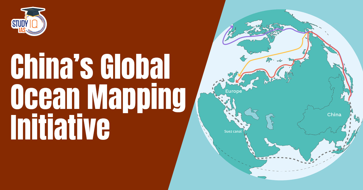
Context: A recent newspaper investigation reveals that China is conducting a massive undersea mapping and monitoring operation across the Pacific, Indian, and Arctic Oceans.
China’s Global Ocean Mapping Initiative
China’s Global Ocean Mapping Initiative represents a large-scale effort to systematically map the world’s seabed across major oceans. While officially framed as a scientific and resource exploration program, the initiative has gained global attention due to its strategic, economic, and military implications.
The initiative involves deploying dozens of research vessels, underwater sensors, and advanced technologies to collect detailed data on ocean floors, including seabed terrain, temperature, salinity, and currents. These activities span the Pacific Ocean, Indian Ocean, and Arctic regions, covering several strategically important maritime zones.
About “Transparent Ocean” Strategy
- Objective: To create a real-time network of sensors, buoys, and subsea arrays.
- Data Points: Capturing detailed information on seabed topography, water temperature, salinity, and ocean currents.
- Because sound waves travel differently depending on temperature and salinity, this data allows Chinese sonars to detect enemy submarines more accurately while helping their own subs stay hidden in “acoustic shadows.”
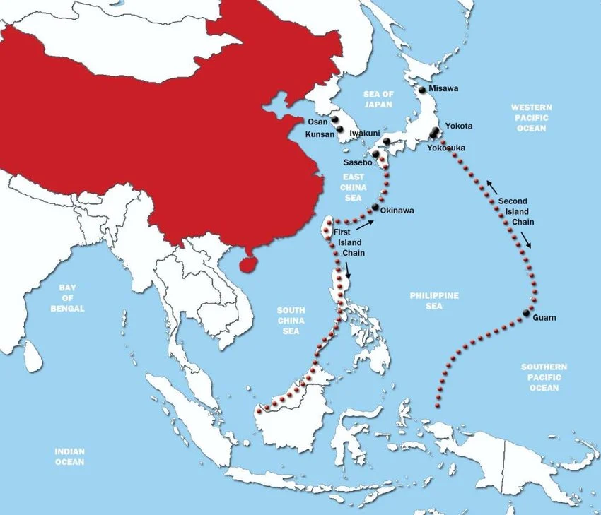
Strategic Geography and Mapping Significance
| Strategic Zone | Mapping Focus | Military Significance |
| First Island Chain
(Kuril Islands, Japanese Archipelago, Ryukyu Islands, Taiwan, the northern Philippines, and Borneo) |
Critical straits (Taiwan Strait, Luzon Strait) & deep-sea trenches | Enables breakout from perceived maritime “encirclement” by adversaries and facilitates access to the wider Pacific Ocean for blue-water naval operations. |
| Second Island Chain
(anchored in the north by Japan’s Bonin and Volcano Islands, centers on the U.S. territory of Guam, and runs south toward Palau and the Federated States of Micronesia (FSM)) |
Port approaches, seabed topography & communication routes | Vital for surveillance of U.S. military bases (especially nuclear assets) and ensuring operational reach into the Central Pacific while countering U.S. power projection. |
| Ninety East Ridge (Indian Ocean; volcanic, aseismic ridge primarily formed by the Kerguelen hotspot) | Undersea canyons, ridges & seabed infrastructure routes | Crucial for safeguarding Sea Lines of Communication (SLOCs), particularly energy imports (“oil lifeline”), and enhancing submarine detection and deployment capabilities. |
| Arctic/Alaska Region | Continental shelf mapping, ice thickness & under-ice routes-
Mapping north of Alaska and across the Chukchi Sea |
Supports emerging “Polar Silk Road,” enables under-ice submarine stealth operations, and provides strategic advantage in future Arctic resource and military competition. |
 Great Atlantic Sargassum Belt (GASB): Gr...
 Ancient Marine Snail Discoveries in Guja...
 Biologics and Non-Animal Methodologies (...