Table of Contents
Context
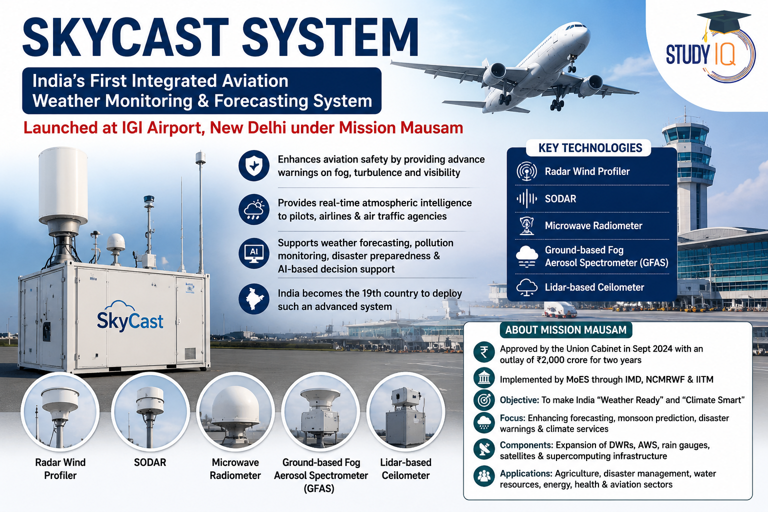
India inaugurated its first SkyCast System at Indira Gandhi International Airport (IGI), New Delhi, under Mission Mausam to improve aviation weather forecasting.
Read Also: UPSC Daily Current Affairs 2026
About SkyCast
- What is it? An integrated aviation weather monitoring and forecasting system that provides real-time atmospheric intelligence to pilots, airlines and air traffic management agencies.
- Purpose: Improves safety of take-offs and landings by providing advance warnings on fog, turbulence and visibility
- Key Technologies: Integrates Radar Wind Profiler, SODAR, Microwave Radiometer, Ground-based Fog Aerosol Spectrometer (GFAS) and Lidar-based Ceilometer.
- Radar Wind Profiler: Measures wind speed, wind direction, turbulence and vertical air movement up to about 3 km altitude.
- SODAR (Sonic Detection and Ranging): Uses sound waves to monitor lower-atmosphere wind patterns and turbulence.
- Microwave Radiometer: Measures atmospheric temperature, humidity and water vapour profiles.
- Ground-based Fog Aerosol Spectrometer (GFAS): Analyses fog droplets and aerosols to improve fog forecasting and visibility assessment.
- Lidar-based Ceilometer: Uses laser pulses to monitor cloud base height, fog layers and vertical atmospheric structure.
- Additional Uses: Supports weather forecasting, pollution monitoring, disaster preparedness, urban weather services and AI-based decision support systems.
- Global Status: India became the 19th country to deploy such an advanced integrated aviation weather monitoring system.
- Scientific Basis: Developed using findings from the Winter Fog Experiment (WiFEX) launched jointly by IITM and IMD in 2015.

About Mission Mausam
- Launch: Approved by the Union Cabinet in September 2024 with an outlay of ₹2,000 crore for two years.
- Nodal Ministry: Implemented by the Ministry of Earth Sciences (MoES) through IMD, NCMRWF and IITM.
- Objective: To make India “Weather Ready” and “Climate Smart” through improved weather forecasting and climate services.
- Key Focus Areas: Enhancing weather forecasting, monsoon prediction, disaster warnings and climate services using advanced observation systems and high-resolution models.
- Major Components: Expansion of Doppler Weather Radars (DWRs), Automatic Weather Stations (AWS), rain gauges, satellites and supercomputing infrastructure.
- Applications: Supports agriculture, disaster management, water resources, energy, health and aviation sectors.
|
Read More Notes |
|
| Environment Notes | Art and Culture Notes |
| Science and Tech | History Notes |
| Geography Notes | Indian Polity Notes |
| General Knowledge | International Relation |
|
Explore StudyIQ Courses |
|
 Digital Empowerment of Women in India: C...
 India’s First Hydrogen Train Explained...
 EPFO VISHWAS 2026: One-Time Dispute Reso...