Table of Contents
The Kamchatka Peninsula, located in Russia’s Far East, is known not just for its stunning volcanic landscapes and pristine wilderness but also for its high seismic activity. The region has recently made headlines due to a powerful 8.8 magnitude earthquake on July 30, 2025, which triggered tsunami warnings across the Pacific. But what makes this remote area so geologically volatile? This article breaks down the location, plate tectonics, and earthquake-tsunami risks of the Kamchatka Peninsula in a simple and accessible way.
Where Is the Kamchatka Peninsula Located?
-
The Kamchatka Peninsula extends about 1,250 km into the North Pacific Ocean, in Russia’s Far East.
-
It is bordered by:
-
The Pacific Ocean to the east
-
The Sea of Okhotsk to the west
-
-
Petropavlovsk-Kamchatsky is the largest city and administrative center.
-
The region is sparsely populated, remote, and largely untouched by industrial development.
Quick Facts:
| Feature | Description |
|---|---|
| Continent | Asia |
| Country | Russia |
| Latitude | ~56° N |
| Climate | Subarctic: cold winters, cool summers |
| Terrain | Volcanic mountains, forests, tundra |
Why Is Kamchatka Prone to Earthquakes and Tsunamis?
Tectonic Setting
Kamchatka sits on a subduction zone, where the Pacific Plate is moving beneath the Okhotsk microplate at a rate of about 86 mm/year.
-
This process forms the Kuril-Kamchatka Trench, an oceanic trench almost 10 km deep.
-
Subduction zones are responsible for the world’s strongest earthquakes and tsunamis.
Part of the Pacific Ring of Fire
Kamchatka is located on the Pacific Ring of Fire, a 40,000 km horseshoe-shaped zone known for:
-
90% of the world’s earthquakes
-
75% of active volcanoes
-
Other nations on the Ring include Japan, Indonesia, Chile, USA, and the Philippines.
History of Earthquakes and Tsunamis in Kamchatka
Kamchatka has experienced several mega-earthquakes, many followed by tsunamis:
| Year | Magnitude | Impact |
|---|---|---|
| 1737 | ~9.0 | Massive tsunami, limited records |
| 1841 | ~8.7 | Tsunami waves recorded |
| 1923 | 8.5 | Widespread seismic activity |
| 1952 | 9.0 | Pacific-wide tsunami, few casualties |
| 2025 | 8.8 | Tsunami alerts in Japan, Hawaii, US West Coast |
These events demonstrate the global reach of Kamchatka’s seismic activity.
How Tsunamis Form in Kamchatka
When a massive undersea earthquake occurs, it displaces large volumes of seawater vertically. This energy spreads out in waves—tsunamis—that can travel across oceans.
-
Tsunami alerts are common after Kamchatka quakes.
-
Coastal areas in the US, Japan, Chile, and other Pacific nations are often affected.
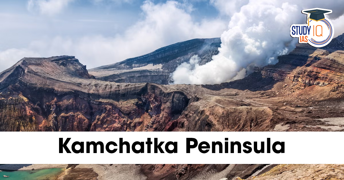
Volcanic Activity Adds to the Risk
Kamchatka is also home to over 300 volcanoes, with at least 30 active at any time. Key volcanoes include:
-
Klyuchevskaya Sopka (highest in Eurasia)
-
Shiveluch
-
Karymsky
Volcanic eruptions can:
-
Trigger earthquakes
-
Cause lahars (mudflows)
-
Disrupt air travel due to ash clouds
Impact of the 2025 Kamchatka Earthquake
-
Magnitude: 8.8 – classified as a “great” earthquake
-
Tsunami warnings issued for:
-
Japan
-
Hawaii
-
California
-
Alaska
-
South American coast
-
-
Though few casualties were reported due to Kamchatka’s low population, the economic and environmental risks were significant.
Conclusion
The Kamchatka Peninsula is one of the world’s most seismically active regions due to its location on the Pacific Ring of Fire and the ongoing subduction of the Pacific Plate beneath the Okhotsk microplate. Earthquakes, tsunamis, and volcanic eruptions are part of its natural landscape. Understanding Kamchatka’s geological setting is vital not just for Russia but for the entire Pacific region, which can feel the effects of its powerful seismic events.
 Removal of the Chief Election Commission...
 Artemis II Launch 2026 LIVE: Crew Begins...
 Utkal Divas 2026: Date, History, Signifi...