Table of Contents
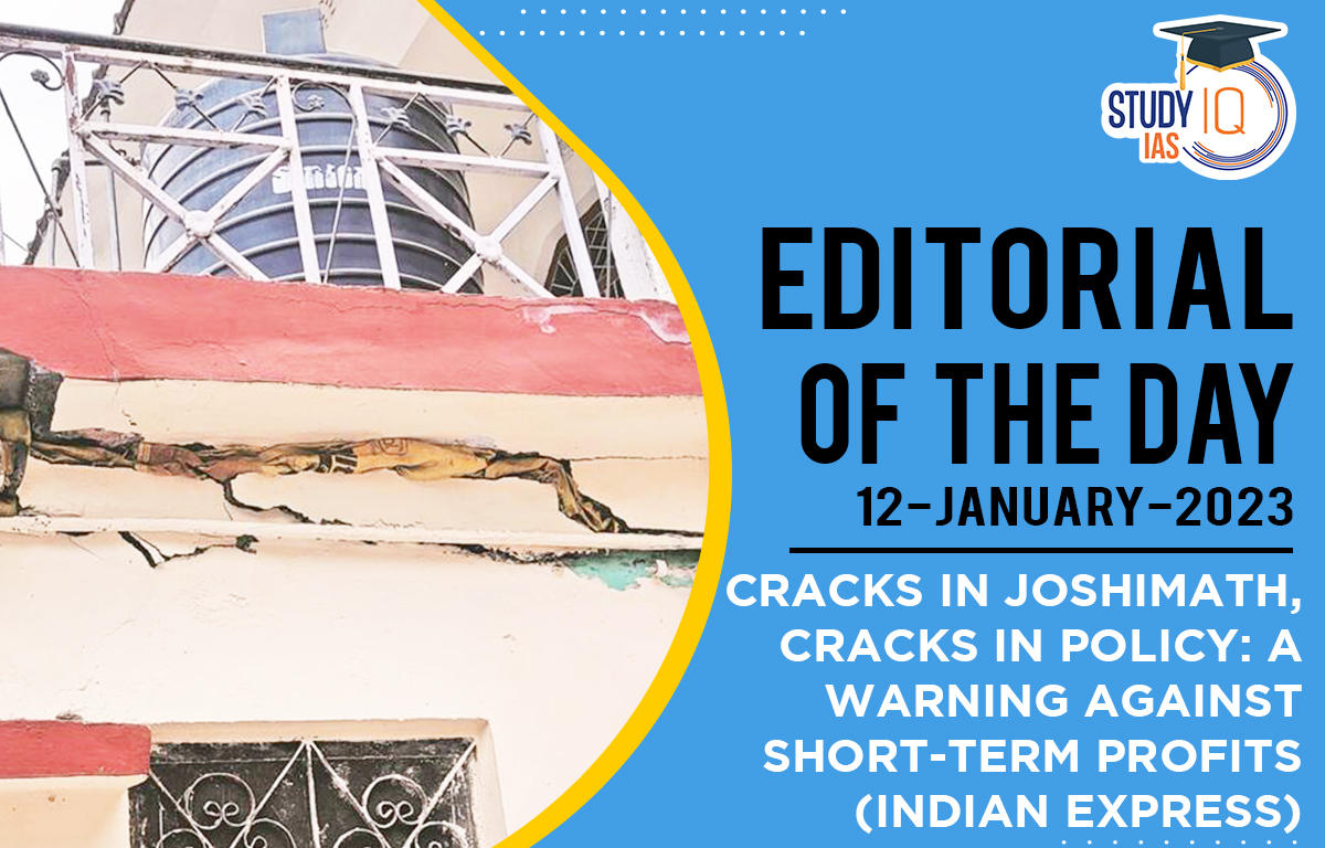
In News: Due to land subsidence, Joshimath – a key transit point for tourists travelling to Badrinath and Hemkund Sahib – developed cracks, causing panic and protests among the local population.
- Joshimath also known as Jyotirmath, is a town in the Garhwal Himalayas in Chamoli District in Uttarakhand, located on the NH-7 (Rishikesh-Badrinath).
- It is situated on the middle slopes of a hill bounded by the Karmanasa and Dhaknala streams on the west and the east and the Dhauliganga and Alaknanda rivers on the south and the north.
- The town (fall in high-risk seismic Zone-V) is traversed by running streams with a high gradient from Vishnuprayag, a confluence of the Dhauliganga and the Alaknanda rivers.
- Joshimath is also of great strategic importance to the Indian armed forces and is home to one of the Army’s most important cantonments.
- It is home to one of the four cardinal maths or monasteries established by Adi Shankara – Sringeri in Karnataka, Dwarka in Gujarat, Puri in Odisha, and Joshimath near Badrinath in Uttarakhand.
Reasons for Joshimath Sinking
- Mishra Committee report: According to the 1976 Mishra Committee report,
- Joshimath lies on a deposit of sand and stone, it’s not on the main rock. It lies on an ancient landslide. The report added that undercutting by river currents of Alaknanda and Dhauliganga is also playing their part in bringing landslides.
- Geographical Location: The town area is prone to landslides and highly vulnerable to sinking due to scattered and highly weathered gneissic rocks with a low bearing capacity and loose soil due to seepage from streams uphill.
- According to the Uttarakhand State Disaster Management Authority (USDMA), Joshimath falls in Zone V of the Seismic Zonation Map and has witnessed several earthquakes of a magnitude of less than 5 on the Richter scale.
- Joshimath being on a fault line makes it highly vulnerable to sinking because of tectonic activity.
- Extreme weather events: Flood events of June 2013 and February 2021 (flooding of Rishi Ganga) had an adverse impact on the landslide zone as a result of extreme erosion.
- According to the latest satellite data, mountain streams have expanded their channels and changed course, thereby inducing more slope instability in an already fragile belt.
- Construction Activities: Increased construction, hydroelectric projects, and the widening of the NH have made the slopes highly unstable in the last couple of decades.
- The Border Roads Organisation (BRO) is building the Helang bypass that will reduce the distance to Badrinath shrine by about 30 km, using heavy machinery.
- Improper water drainage: According to the USDMA, this could be the reason for an increase in ground seepage of water from the surface, which is a probable cause for subsidence.

Measures to be taken to save Joshimath
- Mishra Committee had recommended that restrictions be placed on heavy construction work, blasting or digging to remove boulders for road repairs and other construction, and felling of trees.
- Experts recommend a complete shutdown of development and hydroelectric projects in the region. But the urgent need is to relocate the residents to a safer place and then reimagine the town’s planning to accommodate the new variables and the changing geographical factors.
- One of the most important factors that need to be studied and redeveloped is drainage and sewer planning. The irrigation department has been asked by the state government to look into the issue and create a new plan for the drainage system.
- Experts have also suggested replanting in the region, particularly in vulnerable areas, to retain soil capacity.
- While the state already has weather forecasting technology that can warn people of local events, its coverage needs to be improved. Weather forecasting in Uttarakhand is done through satellites and Doppler weather radars.
There is a need for a coordinated effort between the government and civil bodies with the aid of military organizations like the Border Roads Organisation (BRO) to save Joshimath. The state government also needs to take scientific studies more seriously, which clearly spells out the reasons for the current crisis. Only then will the state put an end to its development frenzy.
 Editorial of the day (18th Apr): Great I...
 Expansion of Universe, Speed, Reasons, I...
 Current Affairs 18th April 2024 for UPSC...